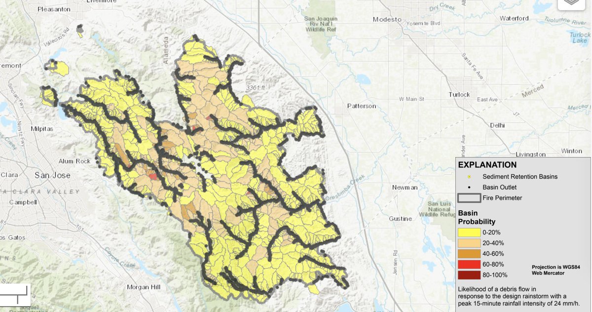
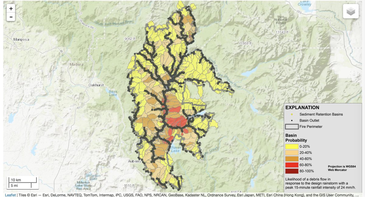
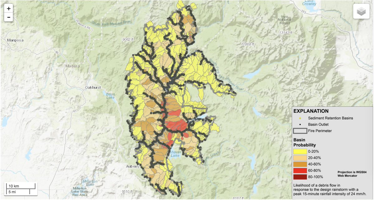
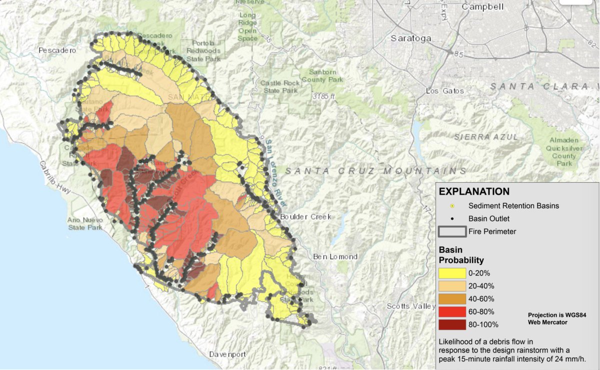
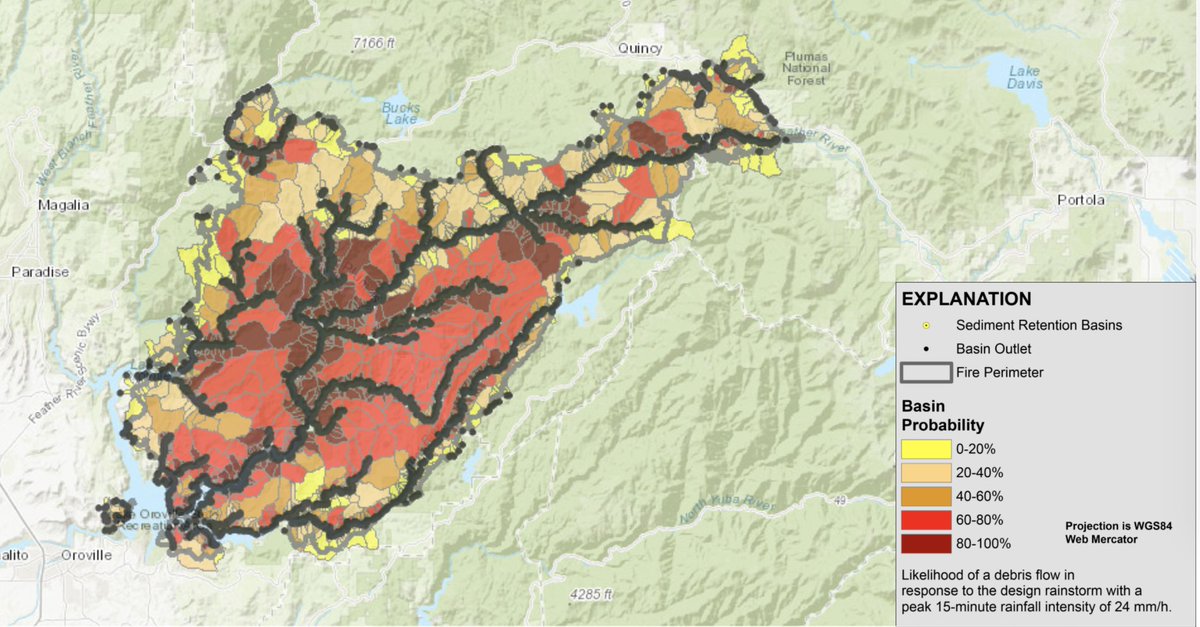
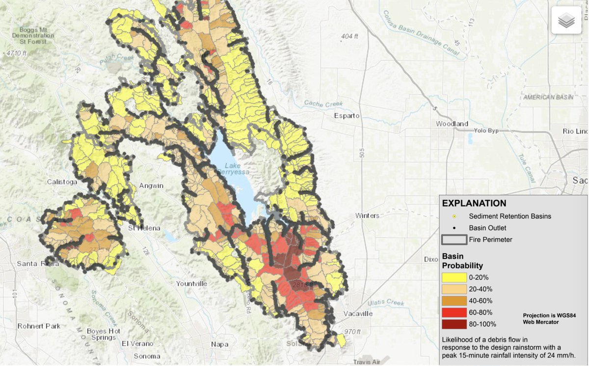
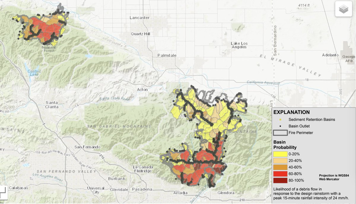
CA fire season is finally winding down. But >4 million acres have burned in 2020--a substantial portion of which at a high intensity and/or on steep slopes, which raises risk of post-fire debris flows/flash flooding. (Thread) #CAwx #CAfire https://landslides.usgs.gov/hazards/postfire_debrisflow/detail.php?objectid=299
Not all recent burn scars face same level of risk. Large areas burned at low-mod intensity, where risk will be pretty low. Good examples of lower risk zones include nearly all of #SCUComplex, majority of enormous #AugustComplex, & wide swaths of #CreekFire. (H/T @geodirtdude)
However, there are several areas of high concern. #CZUComplex in Santa Cruz mountains tops the list, given very high burn intensity in some areas, steep slopes & small, "flashy" watersheds, & susceptibility to very high precipitation rates during winter storm events.
Other areas of concern include #NorthComplex/Bear Fire, which burned at high intensity and is also topographically/climatologically susceptible to high runoff events. Southern portions of #LNUComplex may also be at considerable risk.
Risk of debris flows in/near the SoCal burn areas, as one might expect given the background geology/geography of the Transverse Ranges, is also high. But geographic extent of burn scars down south is less than in NorCal this year.
Debris flows and post-fire floods are nothing new in California. But the geographic scope of high intensity fire in 2020 is essentially unprecedented in modern CA history. There are numerous areas potentially at risk given a heavy enough precipitation event this year.
A few caveats: these maps come from USGS Emergency Post-Fire Debris Flow Hazard Assessment, available via: https://landslides.usgs.gov/hazards/postfire_debrisflow/detail.php?objectid=299. These are preliminary & not fully inclusive of all possible risks (they are targeted toward debris flows,not flash floods or deep-seated landslides).
Also: these risks will only be realized if there is a sufficiently intense rainfall event locally. But even though seasonal outlooks suggest a tilt toward a drier-than-average winter, that does not preclude the occurrence of individual strong storm/heavy rain events.
Finally: I don't see any weather events of particular concern on the horizon as of mid-Nov. Upcoming rainfall in Norcal looks relatively modest and not especially intense--good news in the short term.

 Read on Twitter