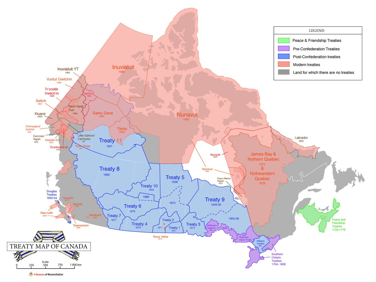
Just a nerdy history/political economy observation: unsurprising that major Pacific and Atlantic ports are on unceded lands.
Like, you can see the history of colonization/capitalism in this map (i.e. Canada signs treaties to build/protect railway routes to get resources to industrial hub in great lakes, then out to international markets).
Also, one final point, just learned that "Ottawa" (Canada's capital, which is on unceded Algonquin lands) is an appropriated Algonquin word, adawa, meaning "trade." Building your capital on unceded land from which to govern + control trade is pretty emblematic of Canada's project
Another final, final point. Treaty land does not mean 'ceded, forever'. We need to challenge the simplistic understanding of unceded vs. ceded = unsettled/settled. See the new book, No Surrender, for an explanation of this on the Prairies: https://uofrpress.ca/Books/N/No-Surrender
Final, final, final point - the image in the bottom left hand corner of this map, used for the logo, is a two row wampum belt. For more on the symbolism of the two row wampum belt as the foundation of nation-to-nation relations, see: https://briarpatchmagazine.com/articles/view/a-short-introduction-to-the-two-row-wampum

 Read on Twitter


