I am teaching a month-long course with @AurozOgra offered via the University of Johannesburg. This course is the result of months of work developing 100+ scenarios where GIS - particularly #QGIS can be applied in Urban and Regional Planning. A thread 

The entire course is developed using Open Datasets from cities across the world. This course uses a hybrid-learning model with 24 hours of live online lectures + 26 hours of videos with hands-on #QGIS labs. I'll post new materials here every week so you can follow along.
Week1 kicks off with Intro to GIS and #QGIS. Lab 0 focuses on getting familiar with QGIS interface, loading and exploring raster, vector, CSV, and WMS layers, Measurements of lengths and areas. Data comes from City of Cape Town Open Data Portal https://web1.capetown.gov.za/web1/opendataportal/Default
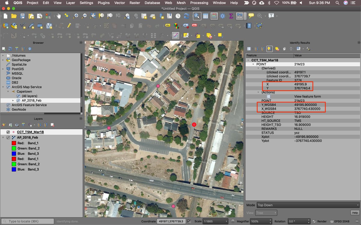
Lab0 also covers working with projections and Custom CRSs - particularly south-oriented CRSs such as Hartebeesthoek94 / Lo19 - which can be a source of much confusion. QGIS handles these CRSs very well. We look at survey markers data to understand how coordinates are represented
We then start on our first theme. 'Land Use Planning and Management'. Lab 1 uses data from South African National Land-Cover (SANLC). Very impressive open landcover data covering classified data with changes in epochs 1990 <> 2014 <> 2018 https://www.environment.gov.za/projectsprogrammes/egis_landcover_datasets
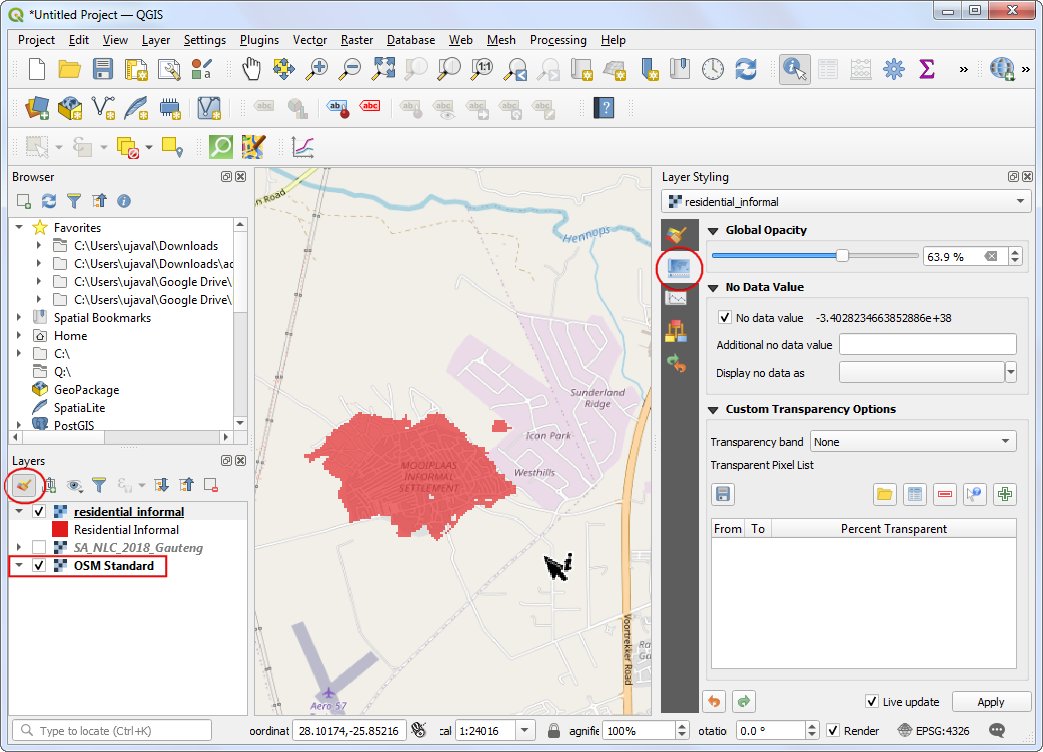
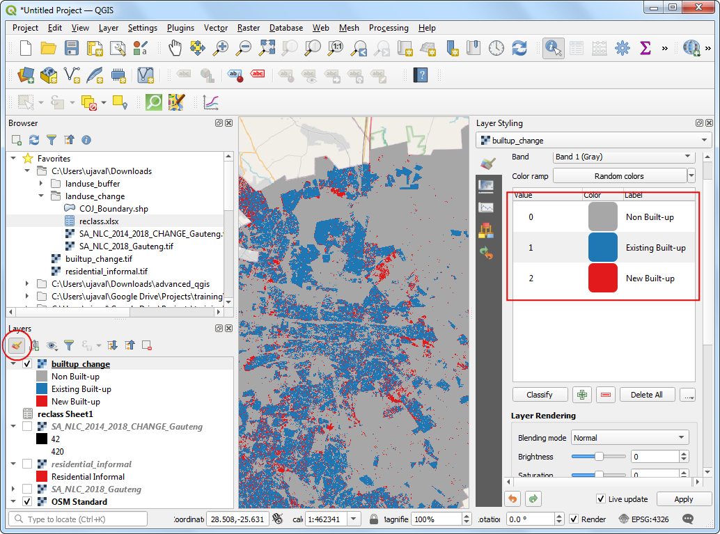
Lab1 shows how to apply #QGIS Raster Calculator and Reclassify by Layer tools to a) Find all areas under Informal Settlement land use and b) Identify urban growth pattern from 2014-2018 in the Gauteng region.
Lab2 takes Parcels data from the City of San Francisco Open Data Portal https://data.sfgov.org/Housing-and-Buildings/Land-Use/us3s-fp9q and shows how one can use 'Select by Attributes' tool identify parcels of 'Institutional Land Use' and use 'Buffer' and 'Join Attribute by Location' tools to establish restricted zone.
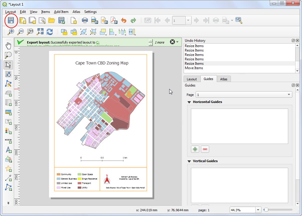
Lab3 takes Zoning data from the City of Cape Town and uses #QGIS Categorized Symbology and Print Layout to create a zoning map of the Cape Town CBD area. Students are encouraged to go beyond the lab instructions and use their creativity and research ideas to improve the map.
Week 1 concludes with office hours and reading materials to prepare for Week 2 - which covers 'Crime Prevention and Safety' and 'Solid Waste Management' themes. Hope you found the thread useful. Feedback/ ideas/ suggestion welcome. Look out new materials on this thread every week

 Read on Twitter


