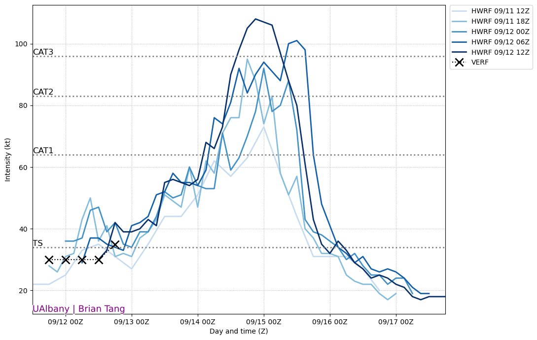
The last several runs of the HWRF have had a pretty consistent signal for Sally undergoing RI beginning late Sunday into Monday. There are some signals that support this possibility. (1/5)
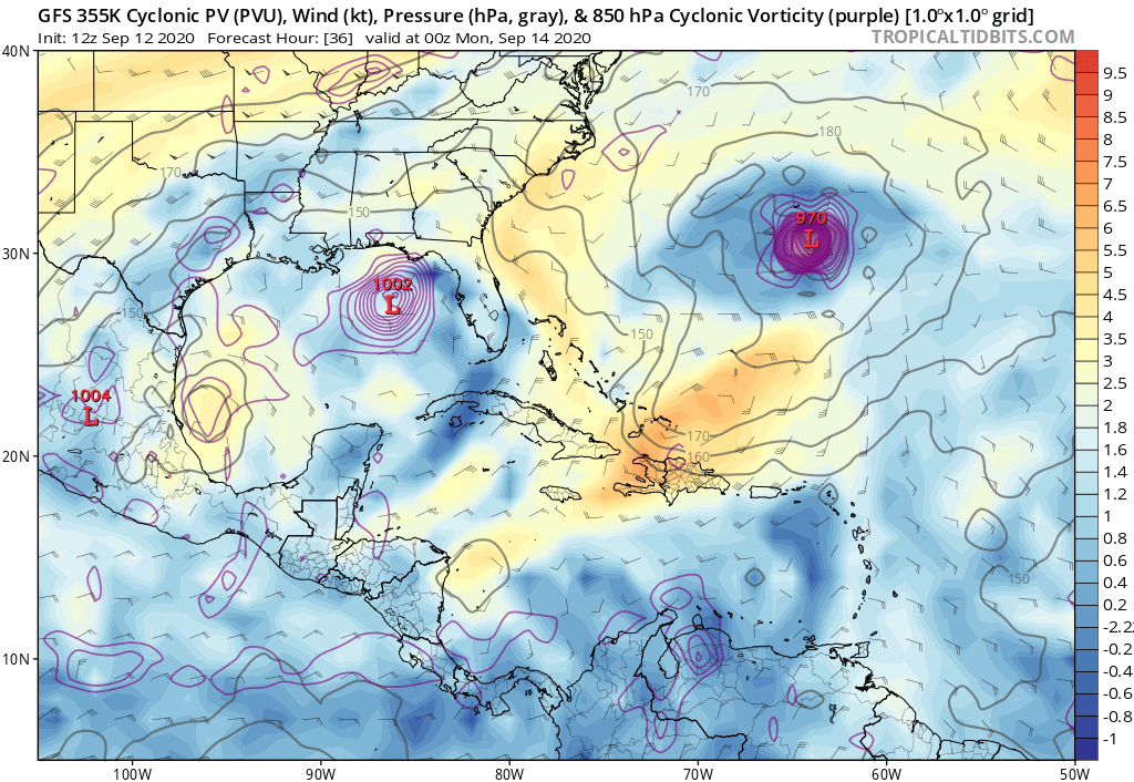
First, the upper-level flow looks to become favorable for intensification. There will be a cutoff low to the SW of Sally, an upper-level trough to the NE of Sally, and an anticyclone over Sally. This flow pattern will result in low wind shear. (2/5)
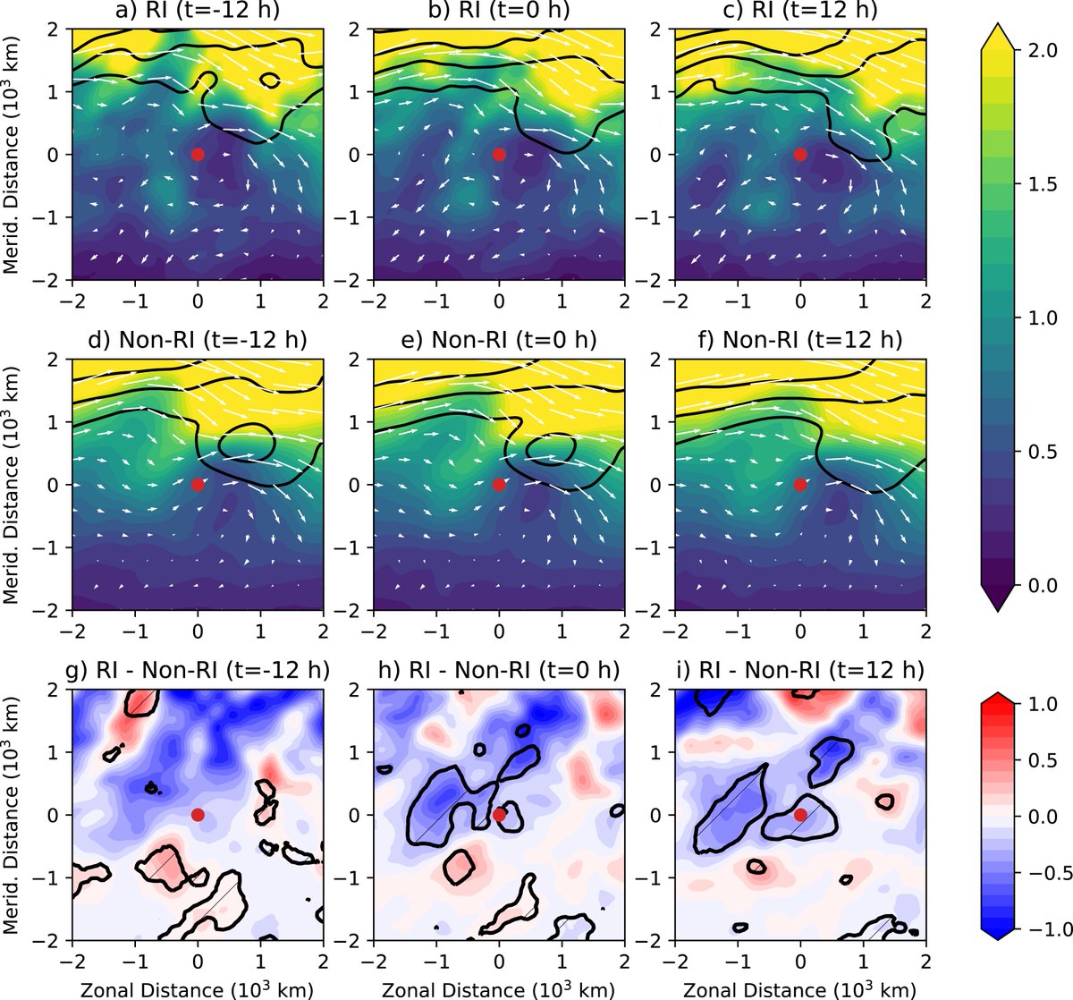
Additionally, this cutoff-trough pattern is reminiscent of the RI composite for the NE-trough cluster from @MikeFischerWx et al. (2019), so we know this kind of upper-level pattern has been associated with past TCs that have undergone RI in similar environ. (3/5)
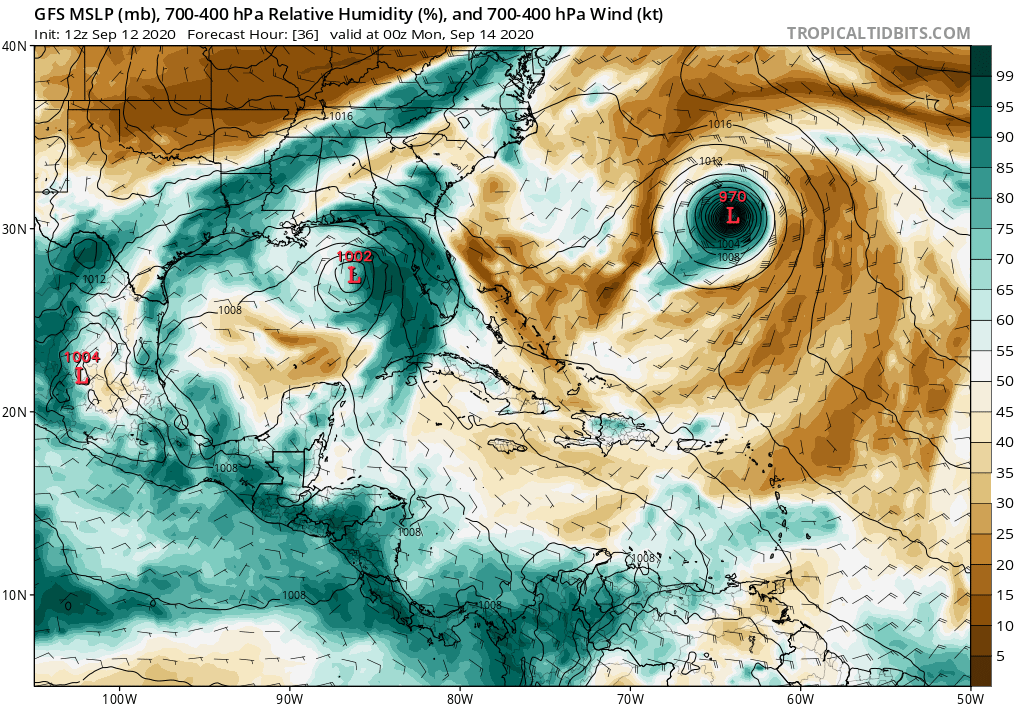
Second, the midlevel environment around Sally looks to be fairly moist. The tropical wave in the central Gulf of Mexico is helping to moisten the environment to the west of Sally. Greater moisture upshear is associated with a higher probability of RI. (4/5)
Like with Laura, we are again faced with the possibility of a tropical cyclone undergoing RI as it approaches the coast  . Hopefully Sally doesn't. Regardless, the forecasted slow movement will be problematic for surge and flood hazards. (5/5)
 . Hopefully Sally doesn't. Regardless, the forecasted slow movement will be problematic for surge and flood hazards. (5/5)

 Read on Twitter


