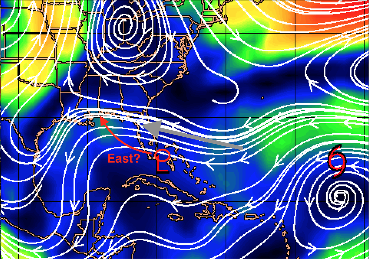
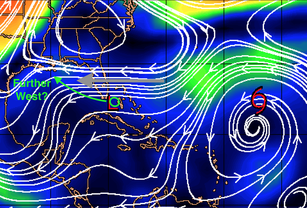
With the LLC and MLC of #TD10 currently displaced about 100 miles away from each other, I thought to show the differences in the steering for each potential outcome. One where the MLC becomes dominant (top -> down) and vice-versa with the LLC becoming dominant (bottom -> up). 1/
This frame shows the likely path if the LLC becomes the dominant circulation and develops to closer to Florida. This path would lead to more time over land and in turn, less time over water as the steering for a *weaker* storm has more WNW forcing it towards the LA/MS border. 2/
I put the term weaker in quotation marks because the 18z HWRF model run showed the storm taking the shorter path with less time over water and yet strengthened the storm from a TD to potent category 2 hurricane in 3 days. 3/
Usually, the HWRF tends to over intensify storms, however this year it has nailed a fair few storms in this area. It nailed Laura becoming a cat 4 a few days before other models came along, it also had Hanna intensifying prior to landfall before the other models as well. 4/
Onto the other frame. We see what would happen if the MLC built an LLC and the other one dissipated. This would lead to less land interaction with Florida and more time over the GOM which as we saw with Laura earlier this year is quite potent. 5/
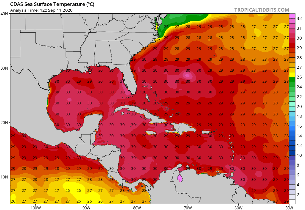
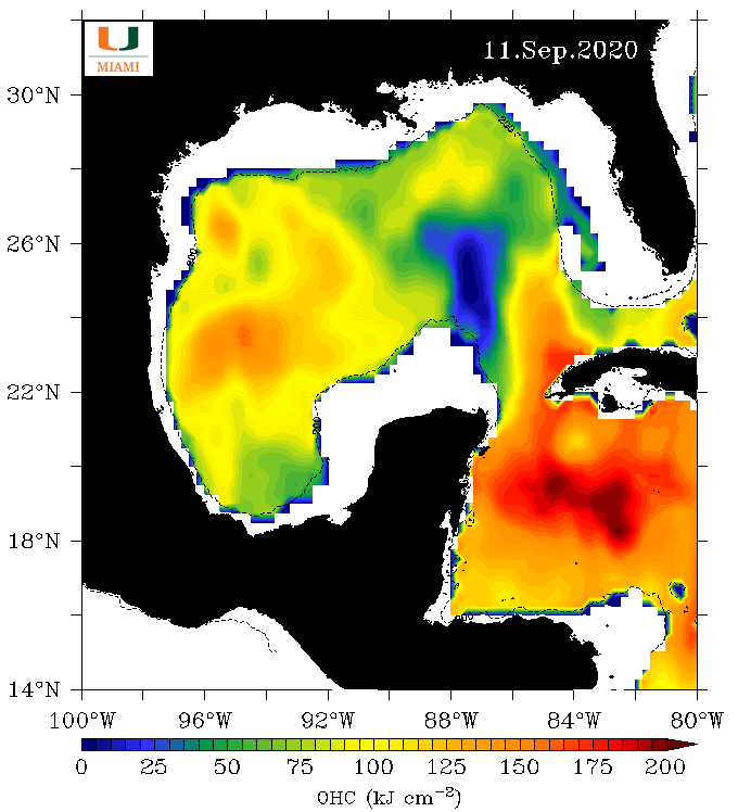
This is a double edged sword as while the GOM harbours SSTs > 30C which is about 1C above average this time of year, the OHC is meagre in the CGOM from Laura + Marco's cold wake in addition to the cold eddy that has been there all year. 6/
It's likely that TD19 will pass too far to the north and too fast to really feel the low OHC values to be detrimentally hurt by it. It's one of many components that will determine where this storm will go and how strong it may get. 7/
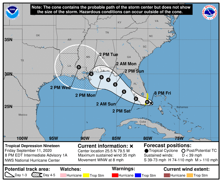
The NHC is already a borderline hurricane at landfall but mentioned that there is increased uncertainty regarding it. As they mentioned below the intensity may be revised upwards in subsequent advisories so a hurricane in the GOM is most definitely not out of the picture. 8/
The NHC currently splits the difference with the cone of uncertainty. As has been the theme throughout the season, a ton of storms with a ton of uncertainty on intensity and direction. Trust the @NHC_Atlantic for the latest information and data. 9/9
*TD19*... wouldn't be a thread without mistakes :)

 Read on Twitter