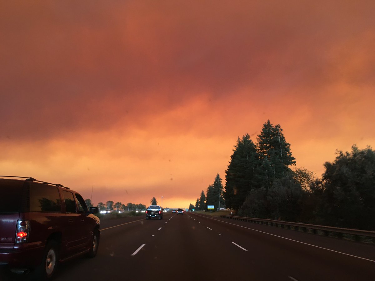
Much of the Western United States is cloaked in wildfire smoke at the moment. Some air quality indicators are "off the charts" with air that's the worst in the world and hazardous to breathe.
(This is an eerie shot from our reporter @jrdscience from Oregon on Tuesday.)
(This is an eerie shot from our reporter @jrdscience from Oregon on Tuesday.)
In times like this, many people are looking for answers.
How do we know how bad the smoke is, where it's going, or what it's made of?
(NASA Earth Observatory image by Lauren Dauphin)
How do we know how bad the smoke is, where it's going, or what it's made of?
(NASA Earth Observatory image by Lauren Dauphin)
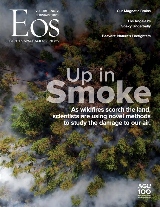
At Eos, we dedicated a special magazine issue earlier this year to this topic. https://eos.org/wp-content/uploads/2020/01/Feb-20_magazine.pdf
Here are some salient points from the issue.
Here are some salient points from the issue.
First, how do we know what's in smoke?
All fires emit CO2, CO, and particulate matter, including white (organic) carbon and black carbon. But largely because of biomass and other inputs, the exact makeup of smoke varies for every fire on Earth, writes @MeganSever4. https://eos.org/features/what-is-left-in-the-air-after-a-wildfire-depends-on-exactly-what-burned
Each fire’s exact emissions cocktail is partially “determined by the way the fire is burning,” @cwiedinm
said.
Fires can be smoldering, flaming, or both. They can burn at the very crown of a forest, at the ground surface, or even belowground.
said.
Fires can be smoldering, flaming, or both. They can burn at the very crown of a forest, at the ground surface, or even belowground.
If you have a flaming fire, you get more complete combustion and more black smoke. (California's fires are often like this).
If something is smoldering, you get less complete combustion, and more white organic carbon or white smoke, like from a charcoal grill.
If something is smoldering, you get less complete combustion, and more white organic carbon or white smoke, like from a charcoal grill.
Of course, 


 matter too.
In the Amazon, fresh, green canopies of the tropical forest release nitrogen-rich compounds when they burn.
In comparison, the brown grasses of California hillsides emit far less nitrogen but are more likely to emit such compounds as black carbon


 matter too.
In the Amazon, fresh, green canopies of the tropical forest release nitrogen-rich compounds when they burn.
In comparison, the brown grasses of California hillsides emit far less nitrogen but are more likely to emit such compounds as black carbon
Next, how do we know where wildfire smoke goes?
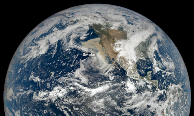
Satellites are a huge boon for this. Fires are visible from space—see the brown smoke along the West Coast on 9 September in this image?
(NASA Earth Observatory images by Lauren Dauphin)
Satellites are a huge boon for this. Fires are visible from space—see the brown smoke along the West Coast on 9 September in this image?
(NASA Earth Observatory images by Lauren Dauphin)
Satellites offer frequent, broad coverage at no risk to observers. Also, they can measure critical parameters representing aerosol sources in climate and air quality models, like the smoke injection height and source strength, writes Ralph Kahn of NASA. https://eos.org/science-updates/a-global-perspective-on-wildfires
At the same time, models must step in where satellites fall short.
Chemical transport models play a central role in mapping the downwind evolution of smoke plumes when there are gaps in satellite coverage and ambiguities in determining aerosol type.
Chemical transport models play a central role in mapping the downwind evolution of smoke plumes when there are gaps in satellite coverage and ambiguities in determining aerosol type.
Lastly, how do we know how 'bad' it is, both in the short- and long-term?
In terms of climate change, it's very hard to tell how fires affect the climate, because many computer models don't include wildfires in them. https://eos.org/features/firing-up-climate-models
One of the biggest challenges in incorporating fires into climate models is the two-way nature of the relationship between climate and wildfires. Fires affect climate, but weather and climate also influence fires.
But we can see the short-term consequences around us.
Black carbon particles in smoke from biomass that burned in the Amazon fell on glaciers in the Andes, causing them to melt faster. https://eos.org/articles/amazon-fires-contribute-to-andean-glacier-melting
Black carbon particles in smoke from biomass that burned in the Amazon fell on glaciers in the Andes, causing them to melt faster. https://eos.org/articles/amazon-fires-contribute-to-andean-glacier-melting
In another case, black carbon lofted so high into the atmosphere from Canadian wildfires that it stayed aloft for 8 months.
The smoke plume was so enormous that researchers used it as a model of nuclear war. https://eos.org/articles/what-wildfire-smoke-tells-us-about-nuclear-winter
The smoke plume was so enormous that researchers used it as a model of nuclear war. https://eos.org/articles/what-wildfire-smoke-tells-us-about-nuclear-winter
You can read more about our special issue and this burgeoning field of wildfire emissions research on Eos. https://eos.org/agu-news/finding-wildfires-fingerprint-in-the-atmosphere
Stay safe out there everyone, and if you need a smile,
check out this tale (and delightful stop motion animation video) about a little-known firefighter, the beaver. https://eos.org/articles/are-beavers-natures-little-firefighters
check out this tale (and delightful stop motion animation video) about a little-known firefighter, the beaver. https://eos.org/articles/are-beavers-natures-little-firefighters

 Read on Twitter


