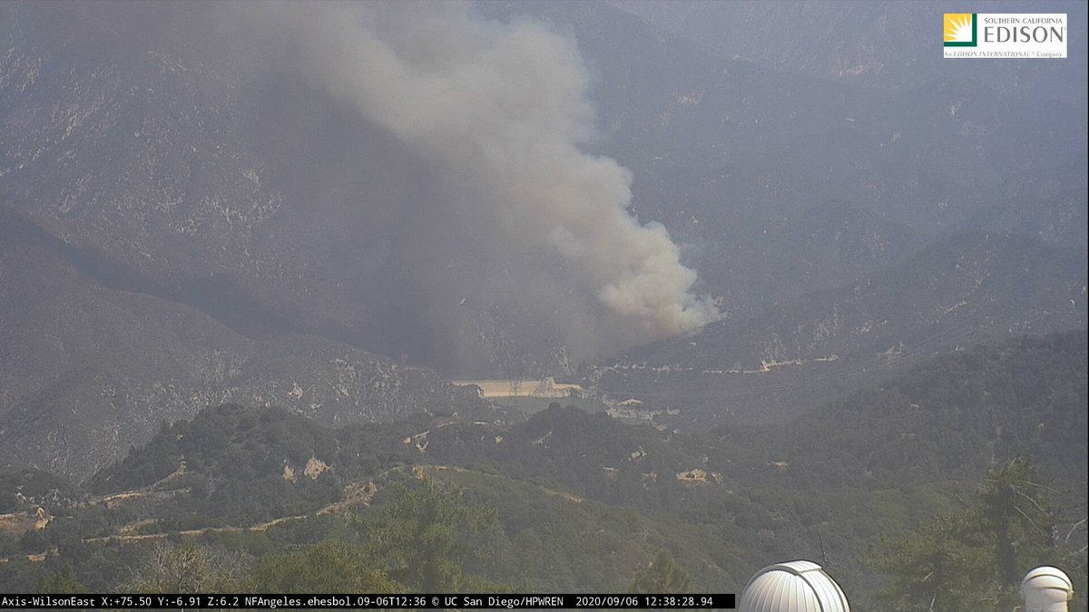
Per @CAFireScanner, a second alarm. Unit on the ground says the fire is at least five acres.
Per WildCAD, this is the #BobcatFire.
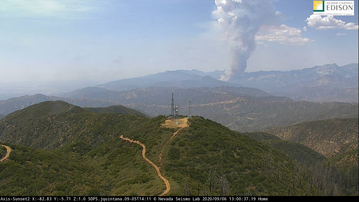
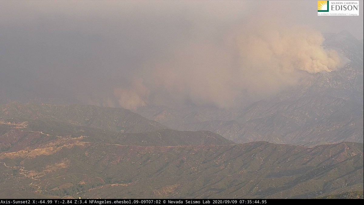
New pic of the #BobcatFire from the Sunset Peak camera:
IC says the fire 100+ acres in medium-to-heavy brush with a rapid ROS. both sides of the canyon. High growth potential. The fire is pushing toward Angeles Crest Highway.
#BobcatFire
#BobcatFire
Local picture from @ghosthoffa of the #BobcatFire https://twitter.com/ghosthoffa/status/1302699679222607874?s=20
#LACoFD sending various resources. Will be requesting #Quebec1 + #Quebec2 super scoopers to the #BobcatFire. #ANF IC also asking for three Type 1 helicopters and six Type 1 crews.
There is a "mass amount of [people recreating]" in the area of North Fork and West Fork, creating a life safety threat in addition to a structure threat in the immediate area.
#BobcatFire
#BobcatFire
Same resident sending an updated pic of the #BobcatFire: https://twitter.com/ghosthoffa/status/1302701495431753728?s=20
I will check on this but per scanner, the Quebecs have been diverted to a fire in the Topanga area.
@Angeles_NF now says the #BobcatFire is 200 acres. https://twitter.com/Angeles_NF/status/1302707147348742146?s=20
Quebec scoopers are now heading to the #BobcatFire. There is a possibility that this fire could push toward Mount Wilson.
- Spotting of at least a quarter-mile
- Extreme fire behavior
- FFs now going into a defensive mode
#BobcatFire
- Extreme fire behavior
- FFs now going into a defensive mode
#BobcatFire
The fire is now 400-500 acres in medium fuels with dangerous/critical ROS. It will go extended if not become a major fire, according to the IC.
#BobcatFire
#BobcatFire
Pic of the #BobcatFire from Monrovia: https://twitter.com/tjkn/status/1302715383523106817?s=20
The fire is now 500 acres. One head of it is heading into the Ranch Fire burn area. Unsure on evacs at the moment.
#BobcatFire
#BobcatFire
Last I checked, the #RedFlagWarning was still in effect for the L.A./Ventura county mountains, beginning at 6 p.m. Pacific.
#BobcatFire
#BobcatFire
Per scanner, the #BobcatFire is now 1,800 to 2,000 acres. Trying to paint a ridge ahead with retardant to impede progression.
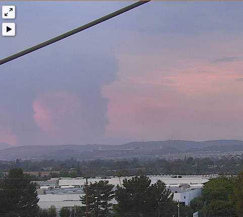
A view of the #BobcatFire from Anaheim:
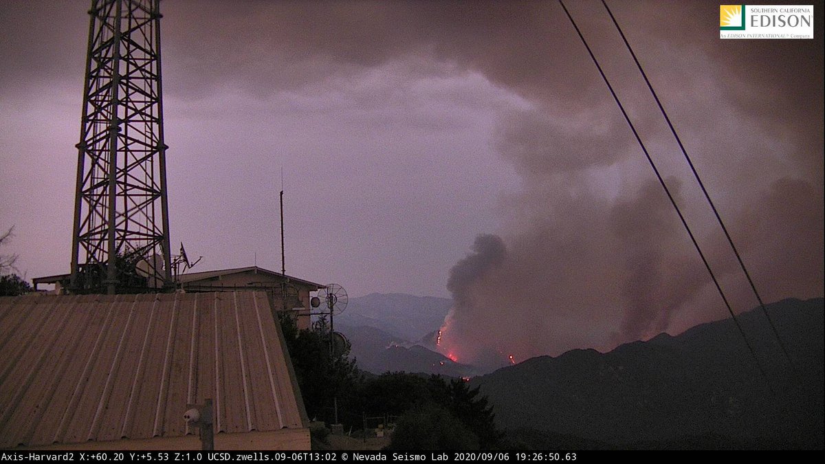
Some active flame on the #BobcatFire from the Mount Harvard camera:
From @jaclyncosgrove re: #BobcatFire:
Wind shift could present problems
https://twitter.com/jaclyncosgrove/status/1302812801145028609?s=20
Wind shift could present problems
https://twitter.com/jaclyncosgrove/status/1302812801145028609?s=20
Per CHP CAD, Highway 39 will be closed at the base of the mountain except for residents.
#BobcatFire
#BobcatFire
Angeles Crest Highway will also be closed from Mount Wilson Red Box Road to Islip Saddle.
#BobcatFire
#BobcatFire
Overnight update on the #BobcatFire: https://twitter.com/CAFireScanner/status/1302889954586976257?s=19
We should have information on the "day plan" soon. Per scanner, the #BobcatFire has begun to pick up steam in places with "pretty good flame lengths." There is again concern that the fire could also impact Angeles Crest Highway.
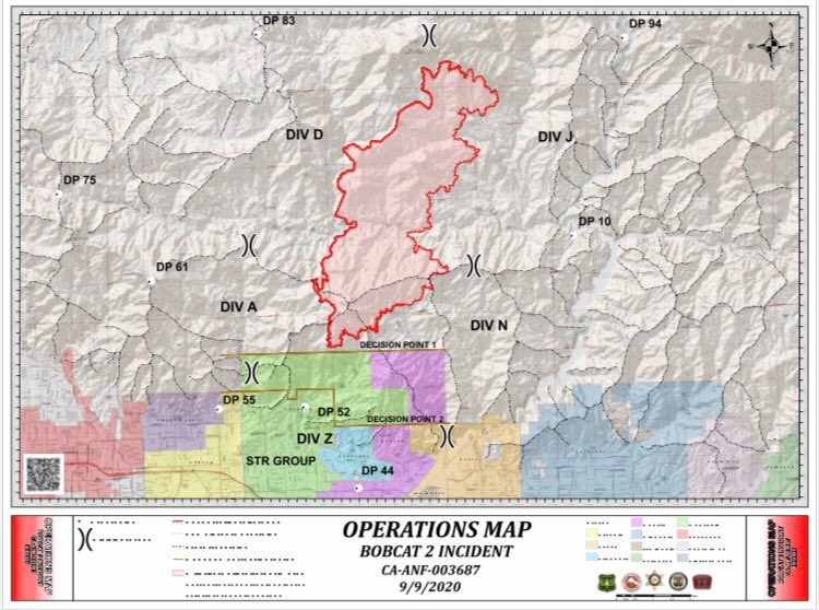
@Angeles_NF says the #BobcatFire is now 4,871 acres and is still 0% contained. Here is today's perimeter map. I realize it doesn't really show anything specific. https://twitter.com/Angeles_NF/status/1302983748145700866?s=20
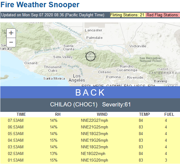
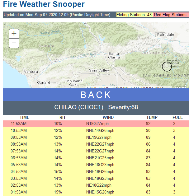
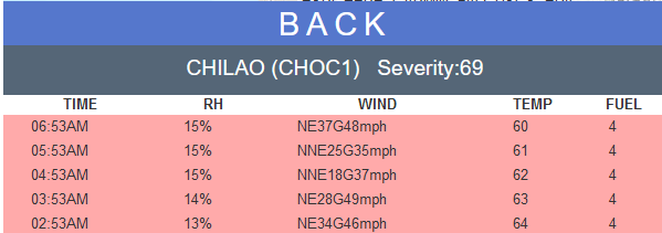
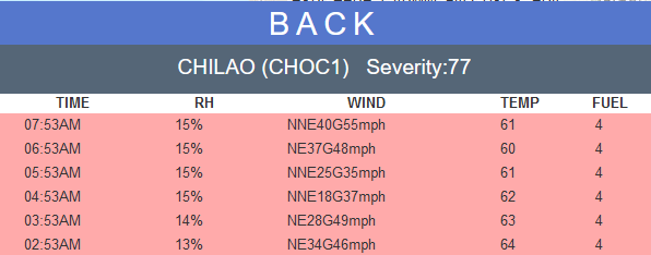
Recent readings on the snooper for the Chilao station (relatively nearby) for the #BobcatFire:
The Quebec scoopers + one copter are returning back to Van Nuys base due to poor visibility. It's not clear which aircraft will be launching once it improves.
#BobcatFire
#BobcatFire
Fifteen hours ago, the #BobcatFire was 1,800 to 2,000 acres. This morning it had ballooned to 4,800. For perspective.
Here is what I was looking for re: Mount Wilson Observatory. They did have to evacuate due to the #BobcatFire. https://twitter.com/MtWilsonObs/status/1302987228788875265?s=20
A press conference for the #BobcatFire will happen at 3 p.m. Pacific at the Santa Fe Dam. https://twitter.com/Angeles_NF/status/1303046612319526912?s=20
Chilao station now marked red on the snooper: winds at 18 mph - gusts to 27; RH 10%; temp of 95 F.
- As of 11:53 a.m. Pacific
#BobcatFire
- As of 11:53 a.m. Pacific
#BobcatFire
Let's all hope it survives the #BobcatFire. https://twitter.com/DrLucyJones/status/1303036355832815616?s=20
** Press conference ** #BobcatFire
Sheriff's department is working with Monrovia PD to position units ahead of time should the fire advance into communities. If you don't live in the area, stay out. If you do, make plans now (line up plans for pets and large animals).
Sheriff's department is working with Monrovia PD to position units ahead of time should the fire advance into communities. If you don't live in the area, stay out. If you do, make plans now (line up plans for pets and large animals).
The IC says the fire is likely to move south toward six communities below the mountains. Slopes are steep, fuels are dry. Pay attention to official instructions. Don't wait to get things ready.
- Concern is for Duarte and Monrovia but Santa Ana winds could impact Sierra Madre, Bradbury, etc. All could be in a warning or order. To the east is the Ranch Fire burn scar. But directly below the mountains, fuels have not burned for decades.
Trying to avoid everyone leaving at once. FD apparatus need to get in and out of the area and they can't if all streets are clogged. Pack your car up now and be ready if you might be in affected zone.
Law enforcement is on the fire now so they can figure out how to best place people to protect homes while residents are evacuated. Once the area is locked down, no one comes back in.
#BobcatFire
#BobcatFire
This Santa Ana event is not typical of what we see in the late fall in terms of how it will behave. There isn't as much cold air aloft now. The wind right now would push the fire away from Mount Wilson. The north end is burning into the Station Fire scar.
*** Much thanks to @sciencewrighter
for the press conference link!! ***
for the press conference link!! ***
A friend forwarded me this Nixle link for the city of Duarte. The city emergency operations center is open and preparing response plans just in case. A temporary evac site has been set up at Santa Anita Race Track.
(1/×)
(1/×)
The county fairgrounds in Pomona are being set up to take large animals (up to 200 horses).
(2/×)
(2/×)
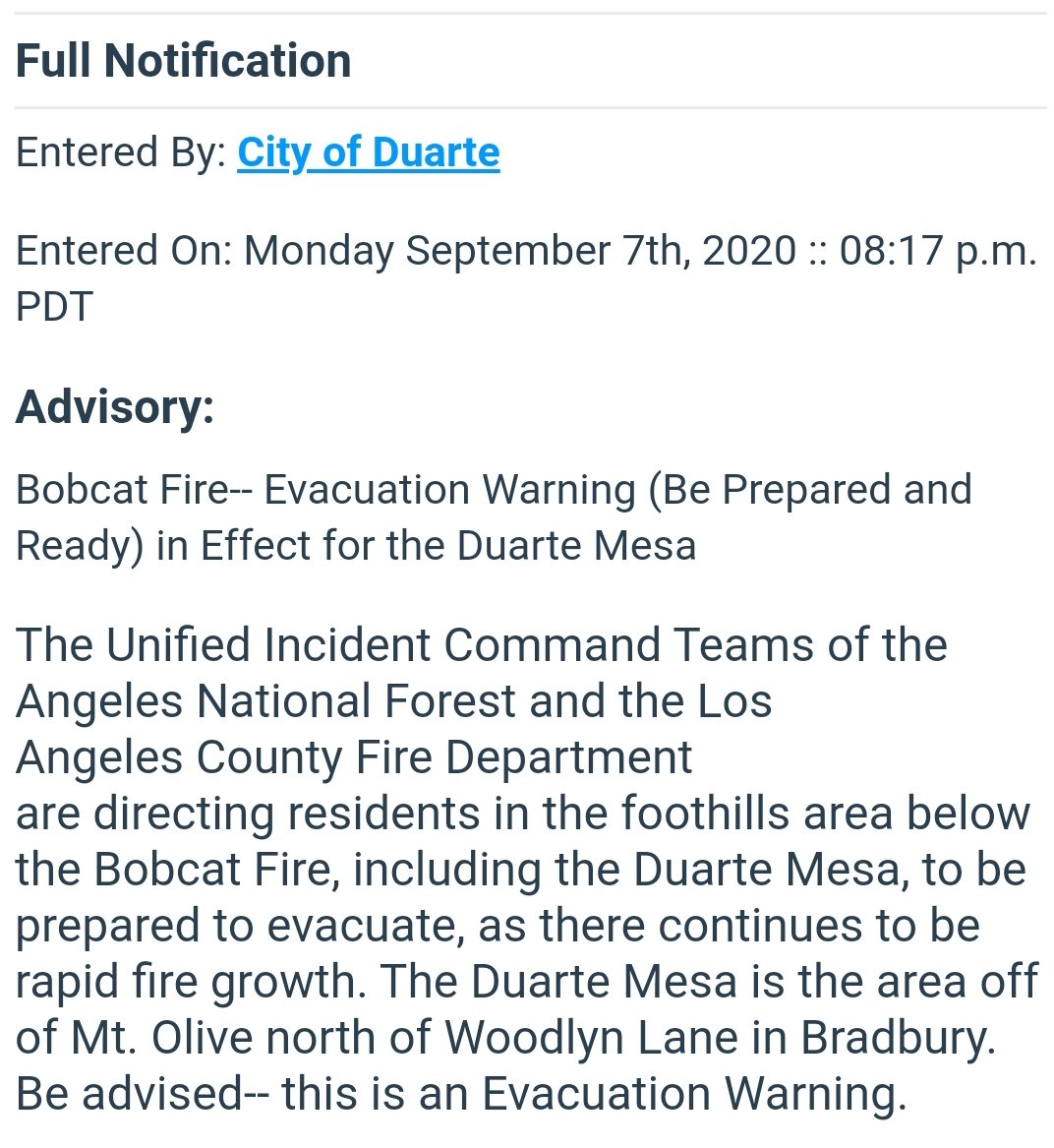
There could be possible *voluntary" evacuations for everyone north of Deodar Lane in the city of Bradbury and Duarte, including Duarte Mesa. Officials are asking for everyone in the Duarte Mesa prepare now.
(3/3)
(3/3)
(I have verified this alert on the official Nixle site -- http://local.nixle.com/alert/8229728 )
New maps on Inciweb for the #BobcatFire (California): https://twitter.com/inciweb/status/1303134623061377030?s=20
From the foothills of Monrovia -- blackened leaves from the #BobcatFire: https://twitter.com/fluffyfeline24/status/1303133109118889984?s=20
-- @ProtectArcadia for specific information on the #BobcatFire for that area -- https://twitter.com/ArcadiaFireDept/status/1303125876075188224?s=20
View from Duarte of the #BobcatFire: https://twitter.com/SoCalFirePhoto/status/1303122370543063043?s=20
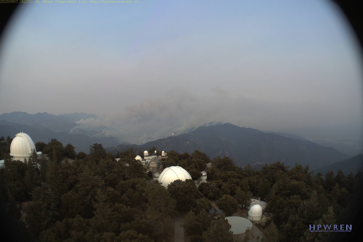
Here is a pic of the #BobcatFire from the HPWREN camera at Mount Wilson:
Monrovia, more preparations happening for the #BobcatFire https://twitter.com/MTravanti208/status/1303089004527534081?s=19
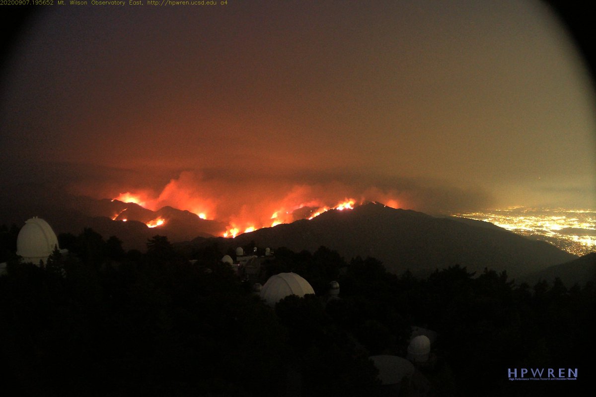
Latest shot from the HPWREN camera at Mount Wilson as night falls on the #BobcatFire
Graphic here on the #BobcatFire going forward: https://twitter.com/jaqbennett/status/1303165403540205568?s=20
A thread here on the #BobcatFire and Mount Wilson from someone who knows: https://twitter.com/DestaG/status/1303186023011115008?s=19
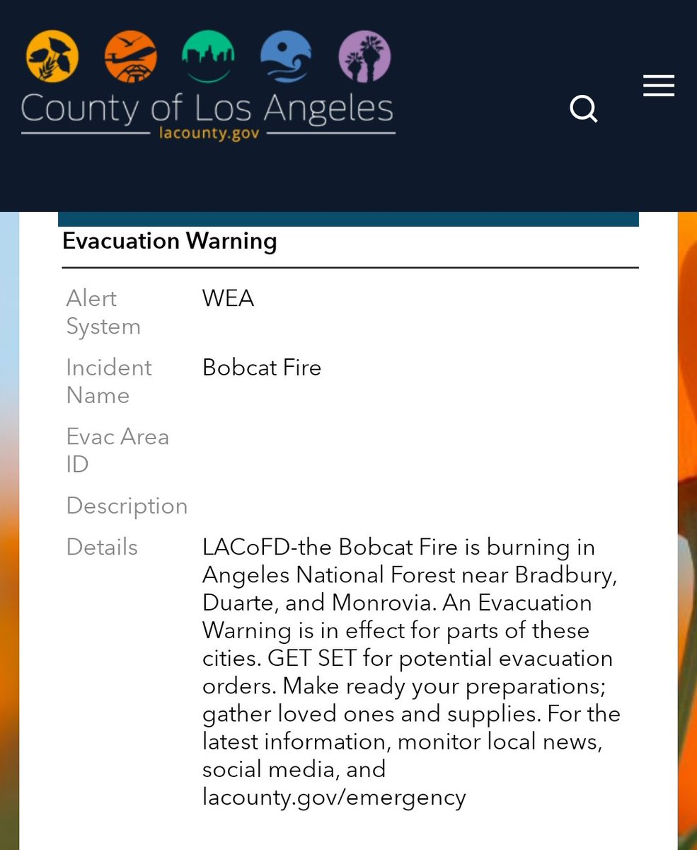
L.A. County posting here about an evacuation warning. I will try to post details shortly.
#BobcatFire https://twitter.com/CountyofLA/status/1303175507425464320?s=19
#BobcatFire https://twitter.com/CountyofLA/status/1303175507425464320?s=19
It isn't specific to neighborhoods or streets at this time. I imagine they will update this.
#BobcatFire
#BobcatFire
Here is the two-phased evac plan for the city of Monrovia:
#BobcatFire https://twitter.com/MonroviaCA/status/1303190859559567365?s=19
#BobcatFire https://twitter.com/MonroviaCA/status/1303190859559567365?s=19
Note: This will take place *if* an order is issued for Monrovia. Plan now and follow your official sources: @MonroviaCA @Angeles_NF @LACoFDPIO
#BobcatFire
#BobcatFire
For Arcadia on the #BobcatFire: https://twitter.com/ProtectArcadia/status/1303190620178014208?s=19
This was a couple of hours ago from the city of Duarte:
#BobcatFire
https://local.nixle.com/alert/8230396/
#BobcatFire
https://local.nixle.com/alert/8230396/
More on the forecast for today at the #BobcatFire
https://twitter.com/Fallingheight/status/1303330093599567872?s=20
https://twitter.com/Fallingheight/status/1303330093599567872?s=20
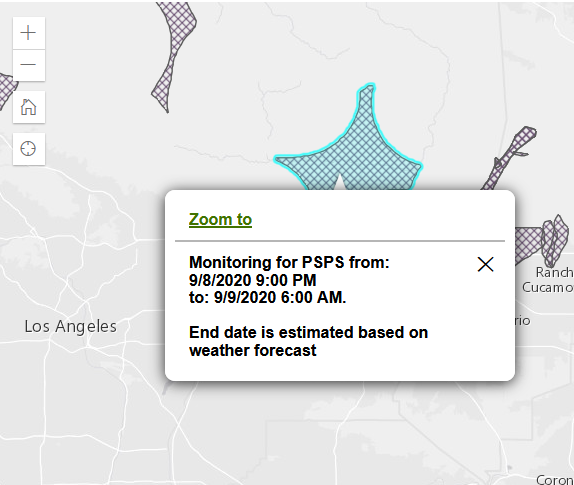
The @SCE #PSPS is being considered for 9 p.m. tonight to 6 a.m. tomorrow in the #BobcatFire area.
http://sce.com/wildfire/psps
http://sce.com/wildfire/psps
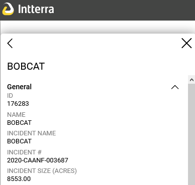
As of about 5 a.m. today, the NWCG page shows the #BobcatFire at 8,553 acres and 0% contained. This is *unofficial* until @Angeles_NF or another agency confirms.
Based on the Initial Action Plan for today for the #BobcatFire:
- Objective is to keep the fire north of Sierra Madre, Duarte, Monrovia, Arcadia, and Azusa; west of 39; east of Mt. Wilson; and south of Angeles Crest Highway.
- Objective is to keep the fire north of Sierra Madre, Duarte, Monrovia, Arcadia, and Azusa; west of 39; east of Mt. Wilson; and south of Angeles Crest Highway.
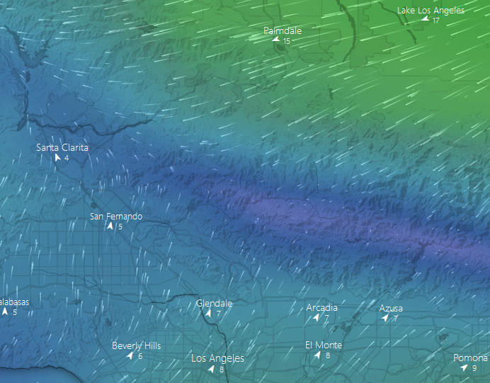
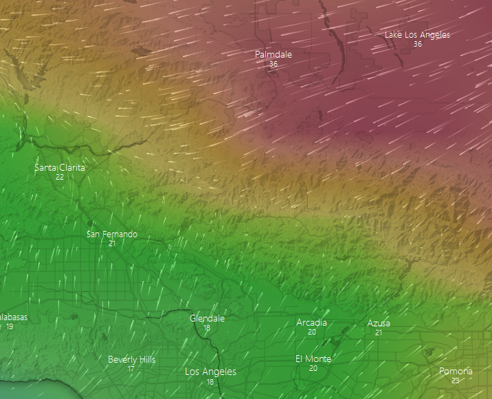
- Winds are forecast on the slope/valley north from 15-25 mph with gusts to 35 mph, becoming NE from 15-30 with gusts to 40 mph this afternoon.
- Active fire behavior expected today. Potential for rapid ROS, spotting, and torching.
- Active fire behavior expected today. Potential for rapid ROS, spotting, and torching.
- Spotting could reach from one-half mile to two miles.
- Downslope winds will cause the fire to impact foothill communities.
- Downslope winds will cause the fire to impact foothill communities.
The Inciweb page for the #BobcatFire also shows 8,553 acres.
https://twitter.com/san_surname/status/1303368114923474944?s=20
Thanks ( @san_surname)
https://twitter.com/san_surname/status/1303368114923474944?s=20
Thanks ( @san_surname)
Official post: 8,553 acres for the #BobcatFire https://twitter.com/Angeles_NF/status/1303374647224721408?s=20
Update from @CityofDuarte on the #BobcatFire
https://twitter.com/CityofDuarte/status/1303463665597927430?s=20
https://twitter.com/CityofDuarte/status/1303463665597927430?s=20


#Arcadia residents north of Foothill and east of Santa Anita are warned to prepare for evacuation
#BobcatFire
https://www.arcadiaca.gov/news_detail_T41_R167.php
Information from the city of Monrovia. FFs are on structure defense just in case.
#BobcatFire https://twitter.com/MonroviaCA/status/1303450714048466944?s=20
#BobcatFire https://twitter.com/MonroviaCA/status/1303450714048466944?s=20
@CitySierraMadre update on the #BobcatFire:
https://twitter.com/CitySierraMadre/status/1303474473140588544?s=20
https://twitter.com/CitySierraMadre/status/1303474473140588544?s=20
Update: The #BobcatFire is now over 10,000 acres. Still 0% contained. https://twitter.com/Angeles_NF/status/1303508821126471680?s=19


County supervisor says that more communities are now included in the evac warning for the #BobcatFire. No other posts seen.
- Bradbury
- Pasadena
- Altadena https://twitter.com/kathrynbarger/status/1303511408873676800?s=20
Voluntary evacuation notice for Arcadia (latest update)
#BobcatFire https://twitter.com/ProtectArcadia/status/1303530798310539264?s=20
#BobcatFire https://twitter.com/ProtectArcadia/status/1303530798310539264?s=20
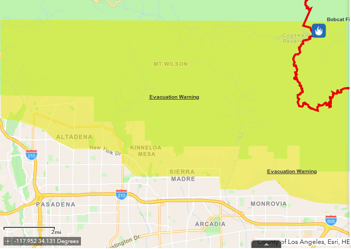
Here is the current evac warning map from the county emergency services on the #BobcatFire:
NOTE: Individual cities may have their own orders/notices, etc. not on this map. Refer to those cities' social media accounts.
@CityofDuarte
@ProtectArcadia
@MonroviaCA
@PasadenaGov
@CityofDuarte
@ProtectArcadia
@MonroviaCA
@PasadenaGov
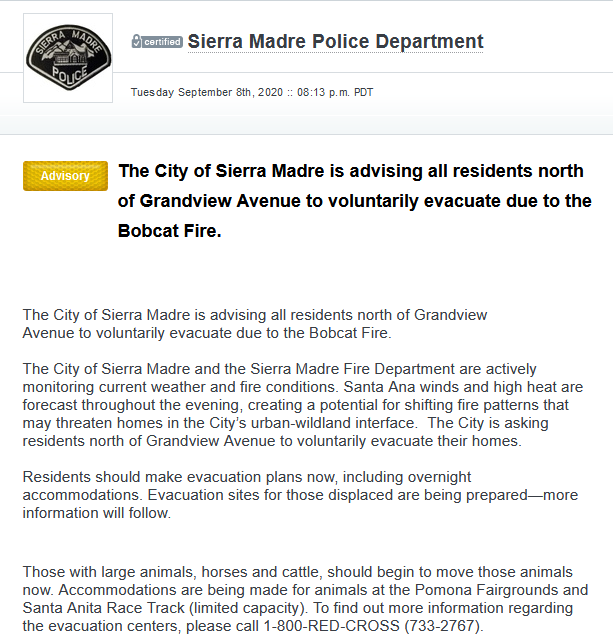
The city of Sierra Madre also has issued a voluntary evacuation notice for all residents north of Grandview Avenue.
#BobcatFire
https://local.nixle.com/alert/8232472/
#BobcatFire
https://local.nixle.com/alert/8232472/
Evac point info for the #BobcatFire: https://twitter.com/RedCrossLA/status/1303538229283414016?s=20
Animal evac info from @CityofDuarte:
#BobcatFire
https://twitter.com/CityofDuarte/status/1303562688652627969?s=19
#BobcatFire
https://twitter.com/CityofDuarte/status/1303562688652627969?s=19
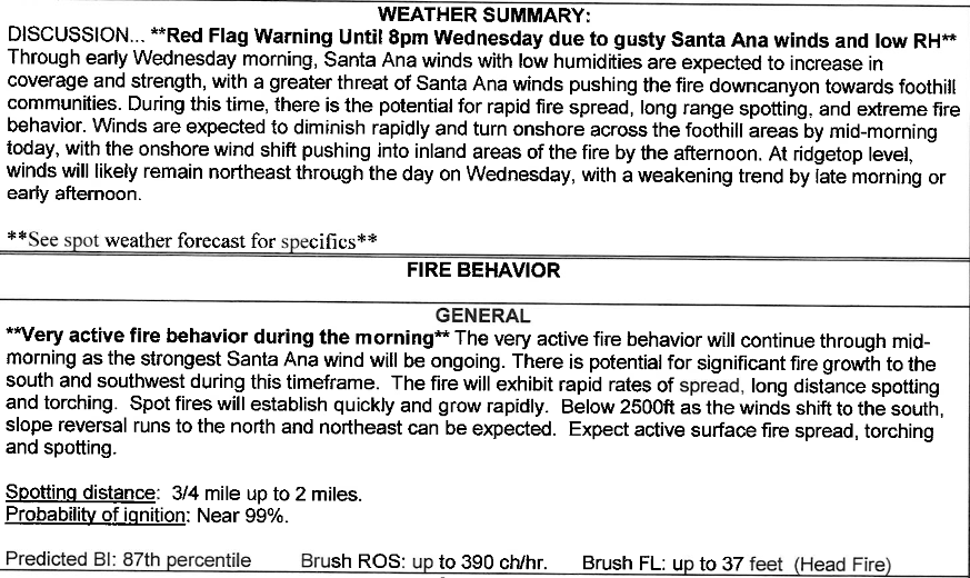
Fire behavior analyst says per scanner that relative humidity has dropped significantly in zones above 2,500 feet. Expected increase in northeast winds.
#BobcatFire
#BobcatFire
** Evac message update **
#BobcatFire https://twitter.com/ProtectArcadia/status/1303566888627179520?s=19
#BobcatFire https://twitter.com/ProtectArcadia/status/1303566888627179520?s=19
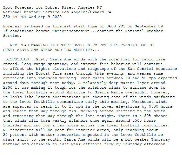
Spot forecast just now for the #BobcatFire from @NWSLosAngeles:
- Winds with potential for long-range spotting will continue for higher elevations through this evening but will weaken overnight
- Peak gusts between 40-50 mph will linger through about noon today
- Winds with potential for long-range spotting will continue for higher elevations through this evening but will weaken overnight
- Peak gusts between 40-50 mph will linger through about noon today
- Marine layer at ~ 2,200 feet kept offshore winds from reaching the surface in foothills around Sierra Madre/Monrovia, but some may early this morning
- NE Winds are expected to reach 15-25 mph in lower elevations through mid-morning, then from the south through tonight
- NE Winds are expected to reach 15-25 mph in lower elevations through mid-morning, then from the south through tonight
- About a 30% chance of more offshore winds for foothills this morning
- RH will recover with wind shift to the south
- Santa Anas will be weaker Thursday and diminishing to weak offshore by Thursday afternoon
- RH will recover with wind shift to the south
- Santa Anas will be weaker Thursday and diminishing to weak offshore by Thursday afternoon
- Evacuations will likely be coming for a portion of East Fork Road. **Unconfirmed**. I had heard chatter about Camp Williams
- Requesting fixed-wing and copters, immediate need
-
- Requesting fixed-wing and copters, immediate need
-
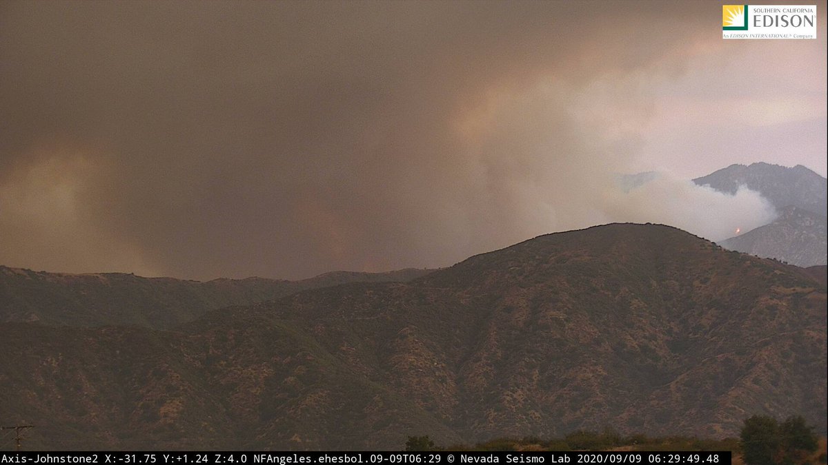
Here is a look at the #BobcatFire from Johnstone Peak, above San Dimas:
Hearing chatter now that most people have been evacuated from Crystal Lake, north of Falling Springs.
#BobcatFire
#BobcatFire
NWCG page this morning -- as of about 6 a.m. -- has the #BobcatFire at 11,456 acres and 0% contained.
Units may be coordinating structure defense near the Rincon Fire Station on Highway 39 just west of the San Gabriel Reservoir.
#BobcatFire
#BobcatFire
Activity seems to have picked up in the past couple of hours on the Johnstone Peak camera:
#BobcatFire
#BobcatFire
Some families placed in hotels due to the #BobcatFire: https://twitter.com/tina_patel/status/1303701018723512322?s=20
Someone will be heading up to Newman Point, east of Highway 39 along Glendora Mountain Road, to check for any spotting.
#BobcatFire
#BobcatFire
For reference, Newman Point is about 6.5 miles above the Dalton Camp Fire Station in Glendora. They are only using it as a lookout; this does not mean the fire is at that point.
#BobcatFire
#BobcatFire
The #BobcatFire is having a flare-up over Monrovia Canyon https://twitter.com/webeburnin305/status/1303732445196374016?s=20
More orientation on the fire and previous pics:
#BobcatFire https://twitter.com/webeburnin305/status/1303745769334165505?s=20
#BobcatFire https://twitter.com/webeburnin305/status/1303745769334165505?s=20
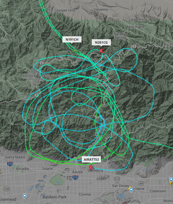
AA 52 was just released. I don't see any other aircraft over the #BobcatFire right now.
#LACoFD COPT21 is still around, though, over the #BobcatFire.
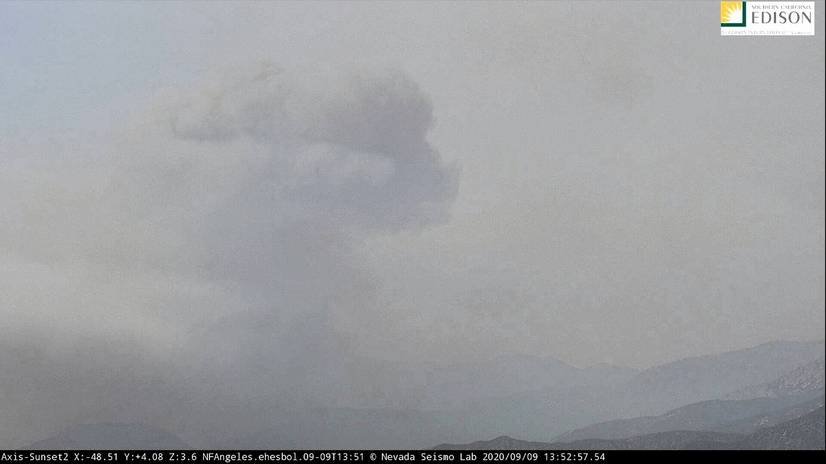
This activity just began on the Sunset Peak camera really got going about 30 minutes ago on the #BobcatFire:
** Evacuation update on Nixle **
#BobcatFire
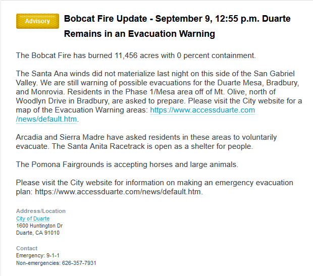
Still evac warnings for the Duarte Mesa, Bradbury, and Monrovia. If you're in the Phase 1/ Mesa area off Mount Olive, north of Woodlyn Drive in Bradbury, you should still prepare to leave.
#BobcatFire
Still evac warnings for the Duarte Mesa, Bradbury, and Monrovia. If you're in the Phase 1/ Mesa area off Mount Olive, north of Woodlyn Drive in Bradbury, you should still prepare to leave.
*** This does not cancel any other warnings previously issued by various agencies. Consult official sources for information. ***
@CityofDuarte
@MonroviaCA
@CitySierraMadre
@LACoFDPIO
@ProtectArcadia
@CityofDuarte
@MonroviaCA
@CitySierraMadre
@LACoFDPIO
@ProtectArcadia
Per scanner, the #BobcatFire is making a "significant run" from the Bear Creek drainage up to Smith Mountain. "We're getting smoked in up here."
Update per @NWSLosAngeles re: fire activity https://twitter.com/NWSLosAngeles/status/1303806823070269440?s=20
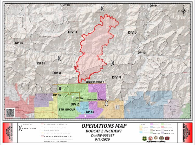
One #LACoFD is on its way to Division Zulu. Here is the map again:
Ordering three LATs (large air tankers) or better, preferably not 747s due to conditions. And hoping for one #VLAT.
#BobcatFire
#BobcatFire
There is some spotting near Smith Mountain. Some units have shifted to Crystal Lake as the fire picked up.
#BobcatFire
#BobcatFire
TNKR914 -- a #VLAT -- is heading to the #BobcatFire from San Bernardino.
The fire has spotted across Highway 39 but crews figure they can pick that up with hose lay.
#BobcatFire
#BobcatFire
This is good news, of course: https://twitter.com/LaPorteVintage/status/1303835379607371776?s=20

 Read on Twitter