Some rapid fire thoughts this morning. These thoughts are my own and for the Houston area.
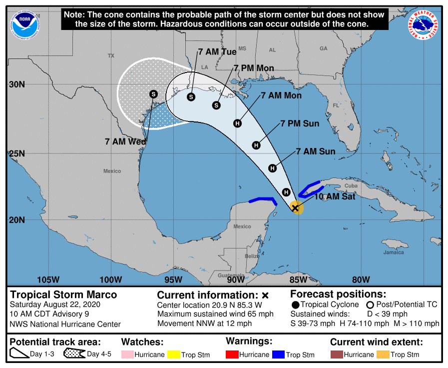
1.) Marco being stronger likely means it’s destined to go east of us. We should continue to monitor, but I expect more track shifts east today.
1.) Marco being stronger likely means it’s destined to go east of us. We should continue to monitor, but I expect more track shifts east today.
2.) As far as rain, that likely will be primarily directed east with Marco. But there are still enough questions that we should continue to monitor. But while a slowdown is possible, a stall (very bad) is not.
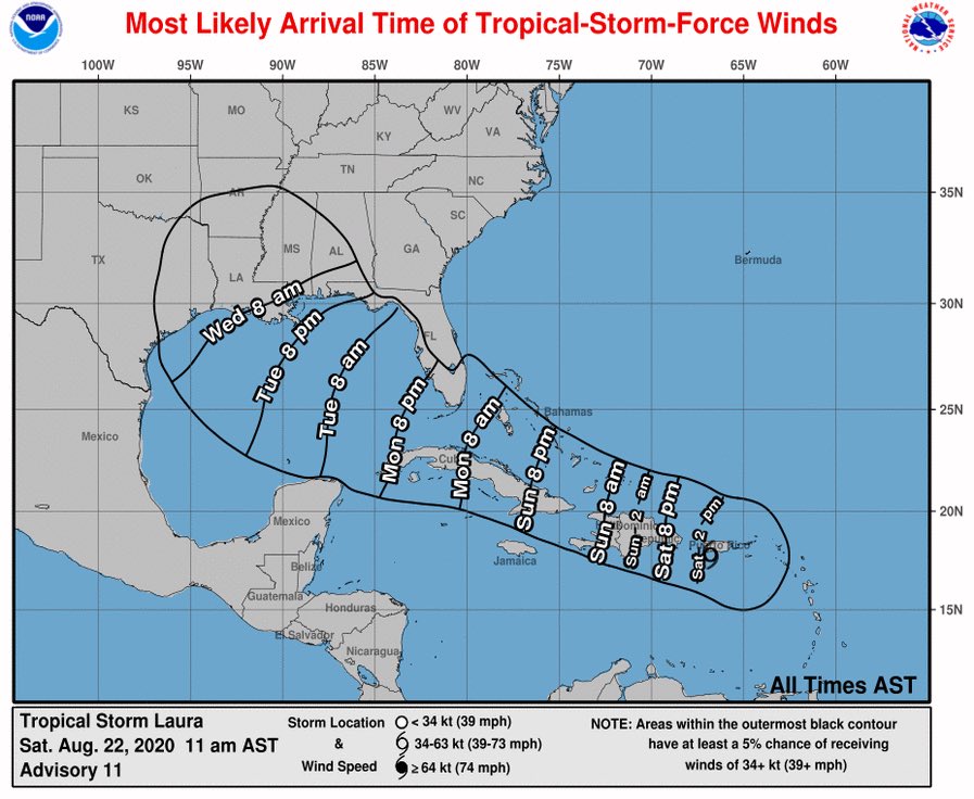
3.) It’s not really wise to speculate on Laura’s future right now. It’s disorganized and likely to undergo some initial track changes that could impact Laura’s future in the Gulf. Realistically, the cone on day 5 is from northern Mexico to the FL Panhandle.
Broadly, Laura will come west across the Gulf. Depending on any number of factors (storm positioning the next 2 days, storm intensity, ridge strength), Laura’s track could shift farther west or more to the east. You will need to have vigilance and check in a couple times per day.
4.) IF Laura impacts Houston, it would likely be from PM Wednesday through PM Thursday.
5.) No need to panic by any means. Just a good idea to have some preps done and ready this weekend to help you next week, should you need to implement them.
5.) No need to panic by any means. Just a good idea to have some preps done and ready this weekend to help you next week, should you need to implement them.
Folks elsewhere on the central & western Gulf Coast should monitor the progress of both storms very closely. Significant impacts are possible for some or multiple areas from Monday through Thursday.

 Read on Twitter


