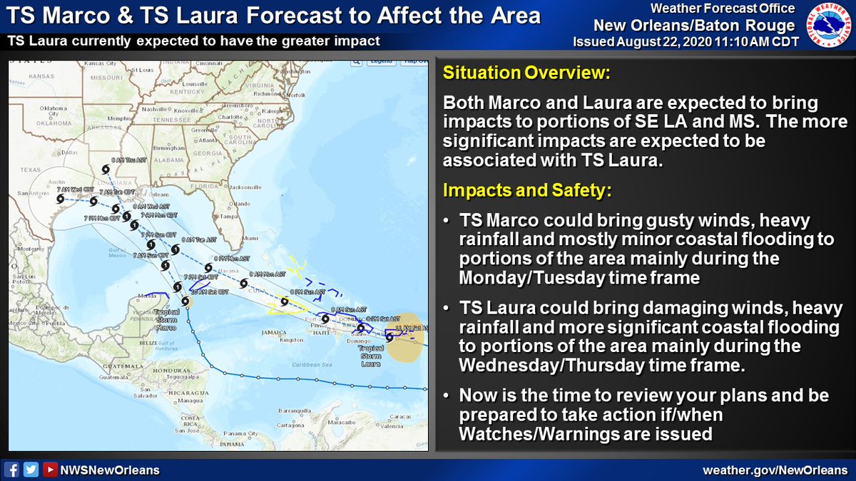
Short thread: Latest on TS #Marco & TS #Laura, both of which could bring impacts to portions of SE LA and MS. The more significant impacts are currently expected to be associated with TS Laura.
Coastal flooding , heavy rain
  , and strong winds
  all possible. (1/4)
Coastal flooding
 , heavy rain
  , and strong winds
  all possible. (1/4)
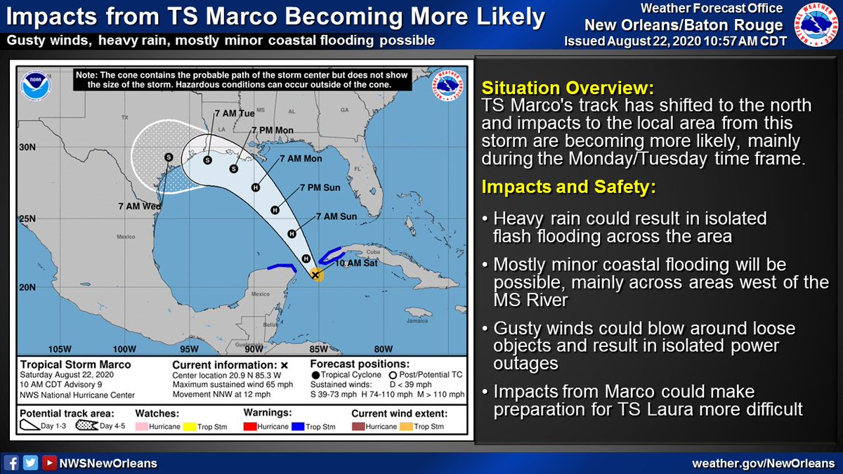
TS #Marco's track has shifted northward and likelihood of local impacts has increased. Impacts would be primarily during the Mon/Tues time frame and would include:
 Mostly minor coastal flooding
 Heavy rain
 Gusty winds
(2/4)
 Mostly minor coastal flooding
 Heavy rain
  Gusty winds
 (2/4)
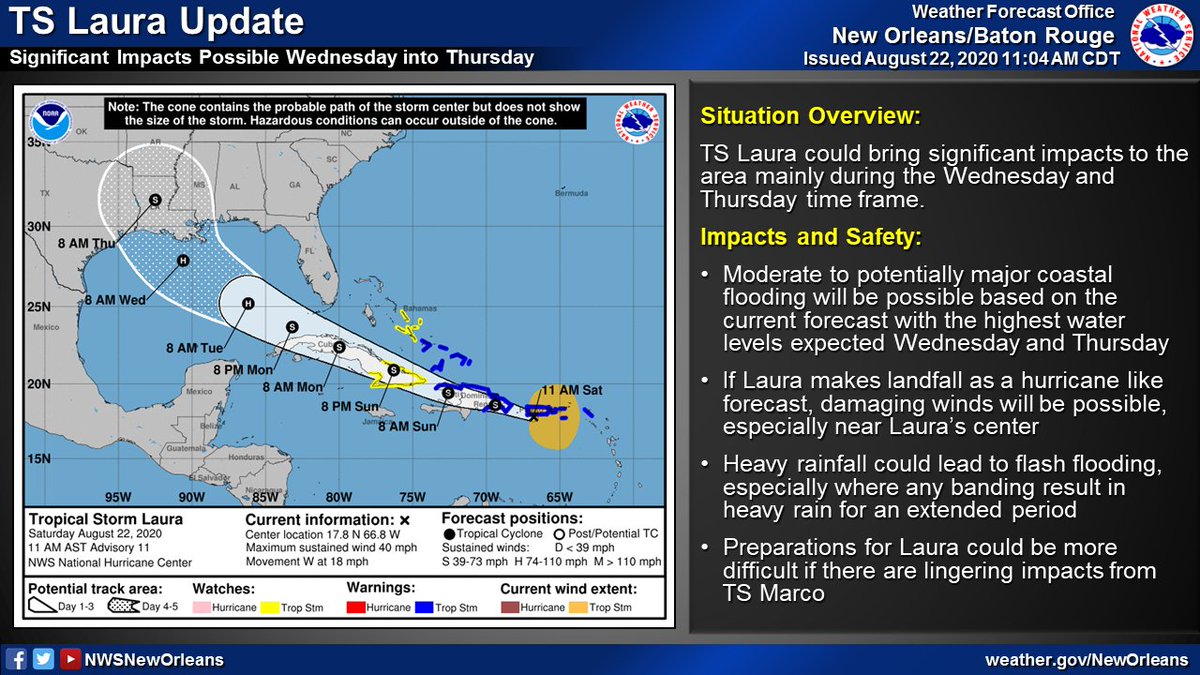
TS #Laura is currently forecast to bring more significant impacts to the area mainly during the Wed/Thurs time frame. Impacts could include:
 Moderate to major coastal flooding
 Heavy rain with flash flooding possible
 Strong/Damaging winds
(3/4)
 Moderate to major coastal flooding
 Heavy rain with flash flooding possible
 Strong/Damaging winds
(3/4)

 Read on Twitter


