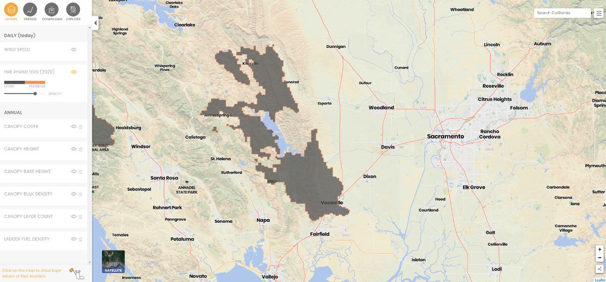
Quick thread on the ecological footprints of the current #CaliforniaWildfires. While only ~120 km apart, the #CZUAugustLightning fire in the Santa Cruz Mountains and the #HennesseyFire (part of #LNULightningComplex) in Berryessa/Vacaville are dramatically different fire systems.
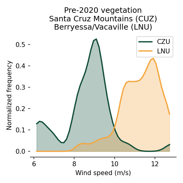
The #CZULightningComplex is fuels-dominated fire, where large volumes of biomass burn intensely but typically spread slower. The #LNULightningComplex is a wind-dominated fire, where shrubs and grasses burn quickly, fanned by hot and fast winds.
The average wind speeds and temperatures in these regions demonstrate that distinction nicely. I might not trust the absolute wind speed numbers too much—gusts are much higher—but the patterns illustrate the relative shifts.
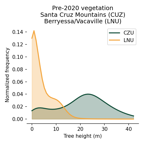
With the #CZUAugustLightningComplex burning through coastal redwood forests, we can see the signature of just what burns. The trees there are so massive, and tree density is so much higher than the inland oak chaparral of the #LNULightningComplex.
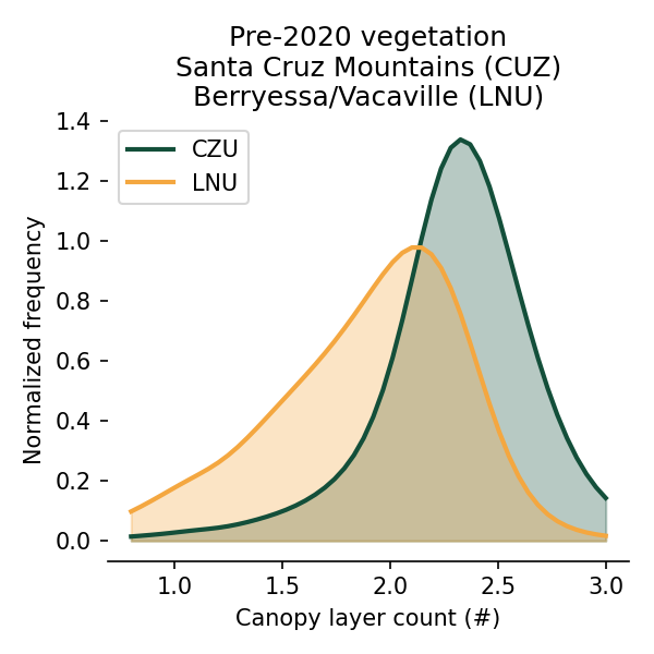
These coastal forests are also more structurally complex. Because they're so tall they tend to have a lot of vertical habitat (like, branches and shit). This is great for wildlife. It's great for everything: tall forests host their own canopy ecosystems! https://www.savetheredwoods.org/grant/what-is-growing-in-the-canopies-of-the-tallest-trees-in-the-world/
This isn't to take anything away from Oak woodlands! They're tremendously beautiful and productive and support an amazing array of species. This was mostly to say that these systems are structurally—and measurably—very different. (Also, consider supporting @savetheredwoods!)
Everything we've seen here has been pretty straightforward. Big trees burning in the forest, hot and fast winds burning through grasslands and chaparral. But the next plot caught me by surprise.
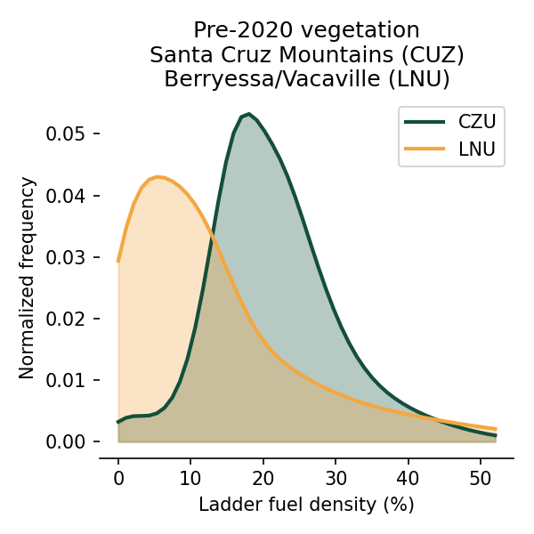
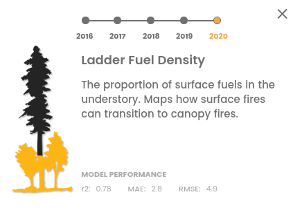
Ladder fuel density—which measures the amount of low-growing (<4 m) vegetation—was much higher on average in the area burned by #CZUAugustComplex. Ladder fuels are often dense in oak/chaparral/grassland systems. But the understory vegetation was much denser in the coastal forest.
This is critical. Ladder fuel density drives the probability that a surface fire will transition—or ladder—into a crown fire. When communities perform fuels treatments they typically remove ladder fuels by thinning or by starting low-intensity fires, decreasing future hazards
Communities across California have been working hard to increase the pace and scale of forest management to reduce the probability that small forest fires ladder into the canopy. The consequences of runaway fires—as we're seeing today—are so costly. But we need to do more.
One way to do this is with more information—to use data to identify where treatments are necessary. There are few datasets on ladder fuel density, and fewer available statewide. So we created a high res. statewide ladder fuel dataset with the @forestobs https://tinyurl.com/yxj6gy7v
The @forestobs is providing these data—and more—for free to researchers, government agencies, NGOs & communities to support the good work they do. Open collaboration will be key to reduce future community wildfire risks and improve forest health. We're here for it. 


 Read on Twitter
