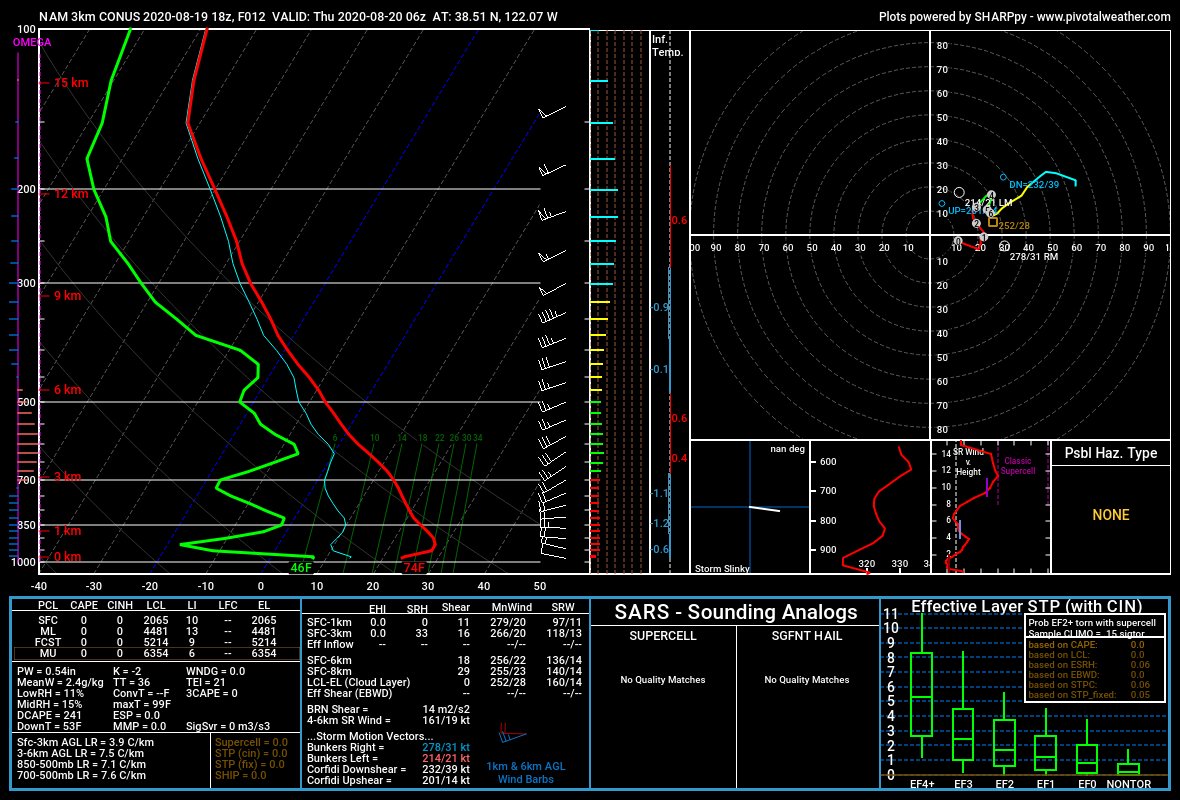
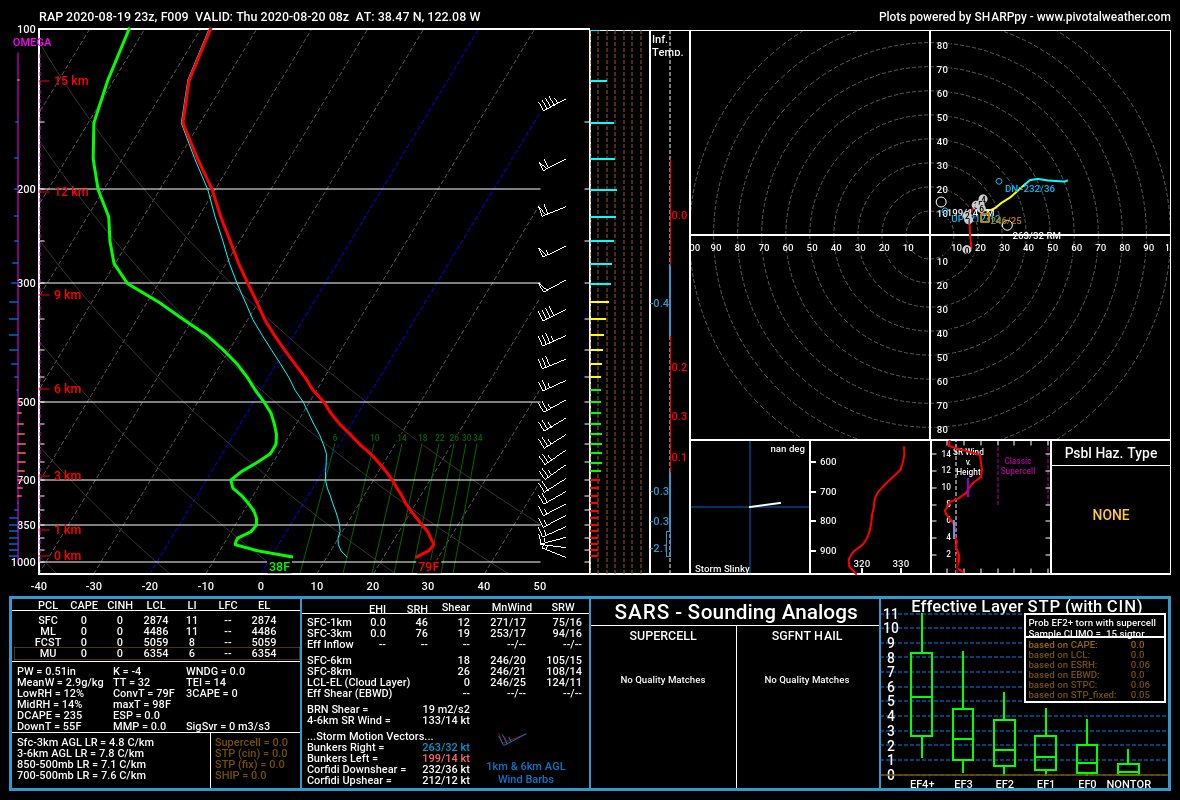
Unfortunately, we could see a repeat of last night in central/northern CA. Very dry air above the marine layer with likely subsidence from a passing shortwave trough to enhance drying overnight. West-northwest winds of 15-25 mph coupled with minimum RH of 7-20%
#CAfire #CAwx
The feature in these atmospheric soundings to key on is the large space between the temperature (red line) and dewpoint (green line) just above the surface. Terrain rises into this region and the fires experience the warmer, drier air not to mention stronger winds.
#CAwx #CAfire
This leads to rapid rates of fire spread and extreme fire behavior in the very dry fuels of the Coast Ranges in central/northern CA. A lot of heat/moisture is released which along with steep lapse rates just above helps pyrocumulus development that we've seen
#CAwx #CAfire
Tip: mention @twtextapp on a Twitter thread with the keyword “unroll” to get a link to it.