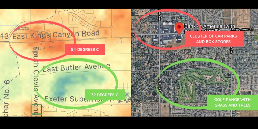
Been nerding out with @NASAJPL surface temp data. Here's a morsel of Fresno's urban heat island just 2 weeks ago. The red area is a cluster of car parks and box stores - maybe a type of urban design that needs to go or be reinvented?
Props to @mariner2100 who ironically worked though the heat wave to make these images happen!
The full Fresno heat island 2020.07.27, 4:30pm PT. Data from the EcoStress sensor by @NASAJPL. Look how hot the airport is!

 Read on Twitter


