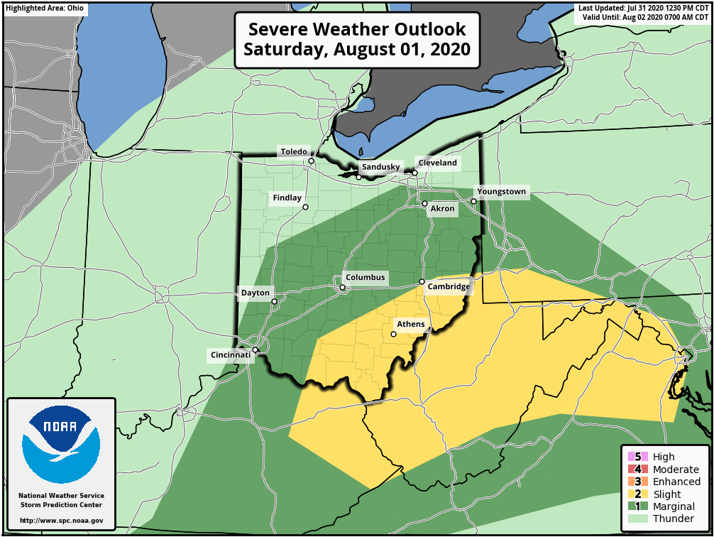
A slight risk of severe weather has been issued by the SPC for tomorrow across central and southern OH. The main threats with this will be Damaging straight line winds, and a few tornadoes...storms initiate in the late morning in N KY, and spread NE through the day (1/10) #ohwx
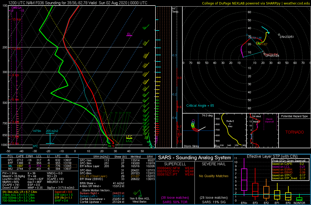
The most favorable parameters will be kinematic. All guidance agrees on 0-6 km bulk shear values nearing 35 kt, creating just enough mid-level spin for updraft rotation. 0-3 km SRH values of at least the upper 100s m^2/s^2 will allow storms to acquire this spin #ohwx (2/10)
0-1 km SRH values over a broad area greater than 120 m^2/s^2 will allow storms to acquire low level spin as well. However, with 0-6 km bulk shear values less than 40, rotation should be moderately sporadic and short-lived #ohwx (3/10)
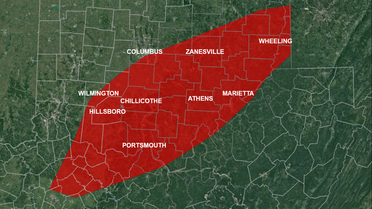
A few short-lived tornadoes will be possible tomorrow in the slight risk. The area of highest tornado probability (my thinking) will be mainly S of I-70, & E of I-71 & US-62 (red area). This doesn't mean tornadoes WILL happen, but best parameters are in place there #ohwx (4/10)
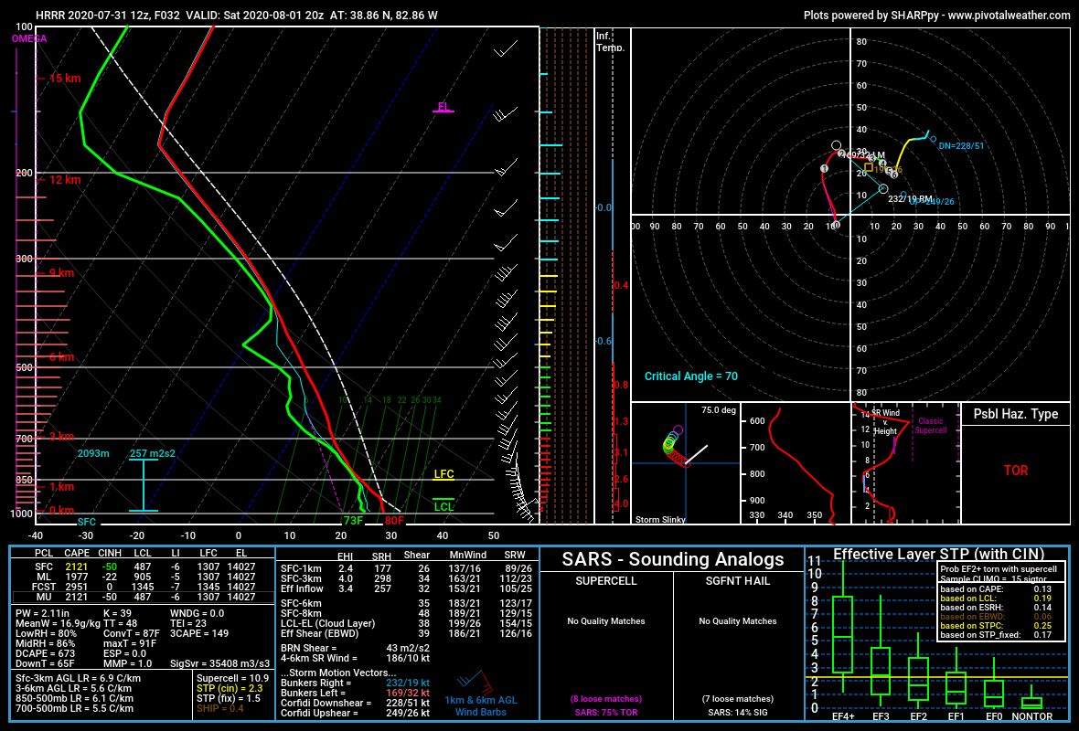
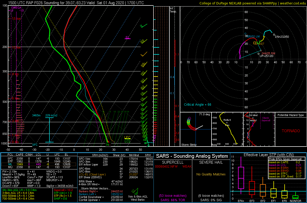
There are still questions on the thermodynamics of the environment tomorrow. As seen an a lot of the forecast soundings, mid level air will be warm, inhibiting CAPE throughout the mixed layer. (5/10) #ohwx
While I do think MLCAPE and SBCAPE will be sufficient to support strong updrafts, mainly due to the moistness of the near SFC, Fairly marginal MLCAPE and ML lapse rates will inhibit cloud tops from reaching extremely high. This will also inhibit hail growth. #ohwx (6/10)
A big question regarding tomorrow is the amount of downdraft entrainment and DCAPE. There will be at least modest DCAPE potential, allowing a slight damaging wind threat. As far as hail, the greatest threat will exist in updrafts that acquire rotation. #ohwx (7/10)
The two ares to watch for the strongest storm development will be 1.) just south of the warm front (near I-70 and US-33), and along a very subtle moisture boundary a few miles east of the cold front. #ohwx (8/10)
Storms should remain discrete through about OH-327. After this, cold pools should begin combining, and clusters will form. The environment will likely favor bowing storms with a few spin ups east of I-77. Any supercell that forms will likely be HP. #ohwx (9/10)
The threat should end around 12 AM. Please be weather aware, and have multiple ways to receive warnings tomorrow #ohwx (10/10)

 Read on Twitter