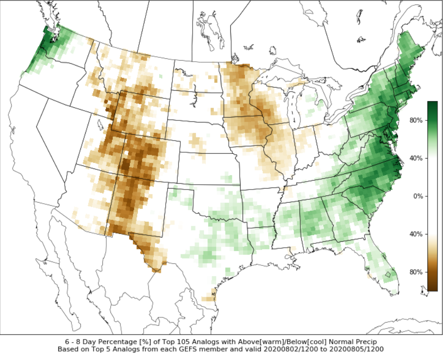
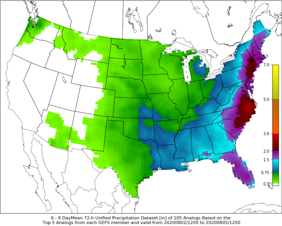
Lots of discussion on #92L but how about the synoptic evolution over North America? There will be a handful of heavy rain areas on today's Day 3-7 Hazards Chart but the East Coast towards Days 6-7 will be key.
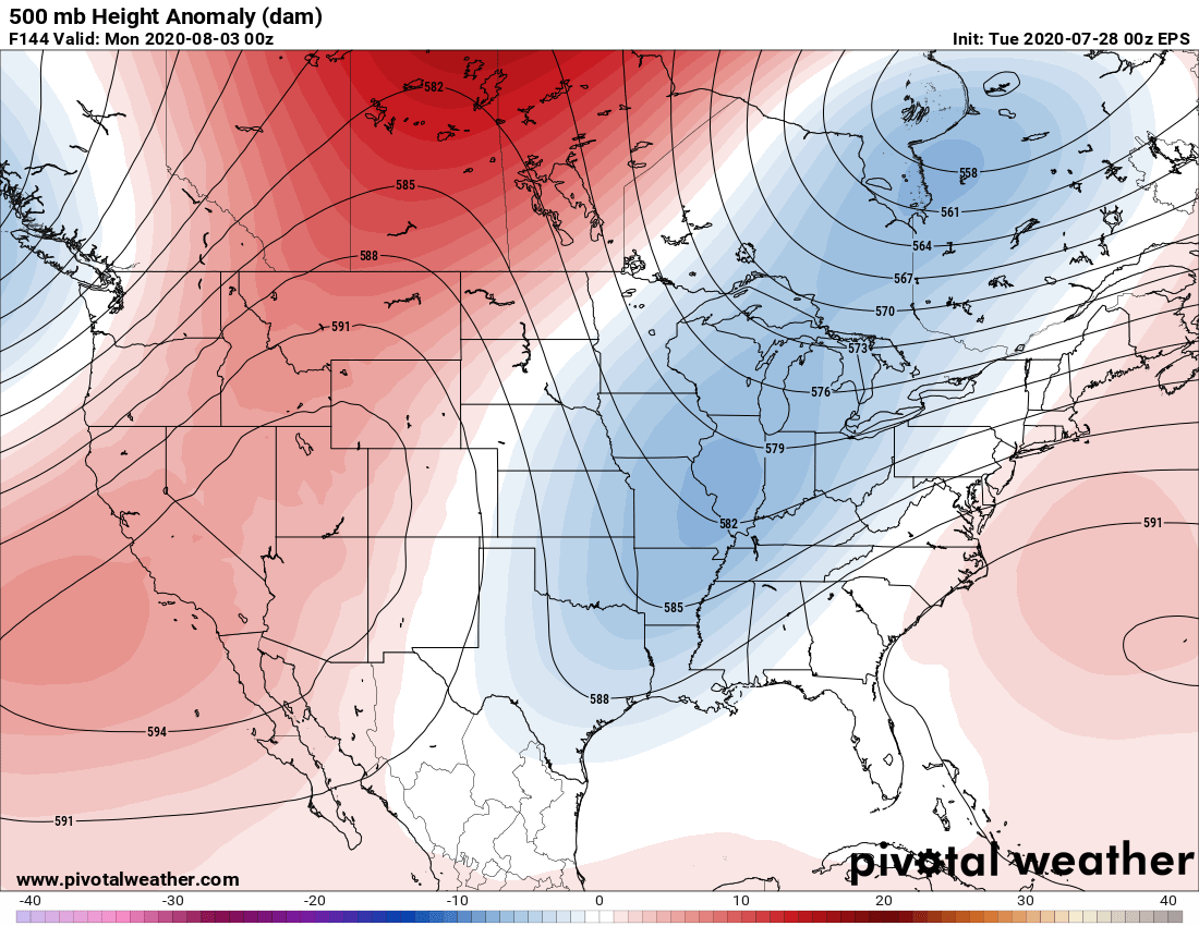
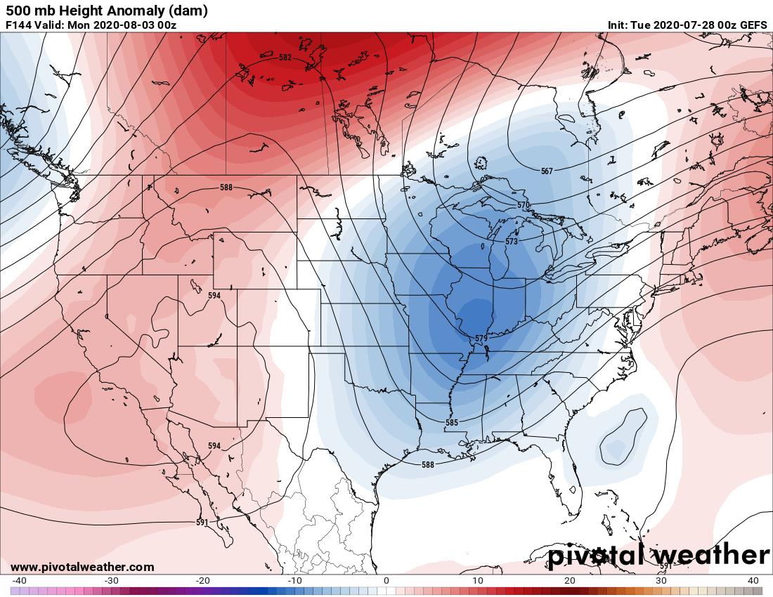
This 500mb pattern isn't exactly one you want to see with a tropical feature near the Bahamas/FL. The thightening gradient between the developing trough over the E-C US & two dueling ridges makes for a surge of tropical moisture up the East Coast a real possibility.
Sorry, *tightening
The 250mb jet positions shown on the latest GEFS highlight at least a pair of scenarios where jet streaks provide ample divergence aloft. First late this weekend over southern Ontario into New England, then second early next week along the East Coast.
It's important to note this is still far out, and 92L's uncertain future plays a big role. The strength/position of the Bermuda high is key. It could slow the trough's east progression more, putting areas slightly further west at risk.

 Read on Twitter


