It's dangerously hot out. Here's a quick THREAD on how overbuilding our

 infrastructure makes our hot days hotter...and harmful for our most vulnerable residents. It's been on my mind since seeing this tweet by @WxManAJB of @WCVB: https://twitter.com/WxManAJB/status/1287334256117723137?s=20 #mapoli (1/x)
 on how overbuilding our

 infrastructure makes our hot days hotter...and harmful for our most vulnerable residents. It's been on my mind since seeing this tweet by @WxManAJB of @WCVB: https://twitter.com/WxManAJB/status/1287334256117723137?s=20 #mapoli (1/x)
Asphalt roads soak-in and retain heat, reaching temperatures that are 25°+ hotter than they would otherwise be. These thermometer-busting temps can be deadly for seniors or those with pre-existing conditions like asthma or heart disease. (2/x) https://www.wbur.org/commonhealth/2017/07/05/greater-boston-heat-islands
Narrow roads and shade from trees can mitigate temps, but in too many neighborhoods in MA we spent decades making roads wider (sometimes sacrificing trees in the process) to accommodate more cars. Now many of these n'hoods are "heat island" hotspots. (3/x) https://www.wbur.org/earthwhile/2019/11/25/heat-mapping-boston-museum-of-science
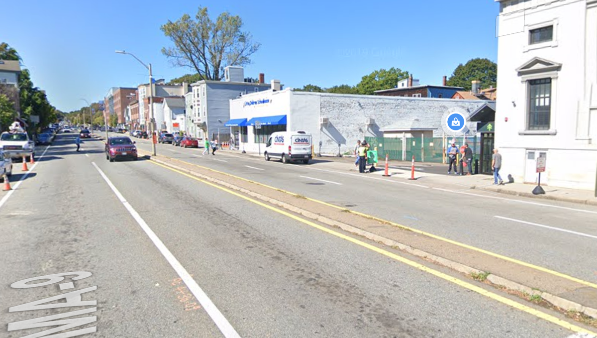
Brookline Village is a telling example. Researchers from the @museumofscience used mobile sensors to record temps and found that Rt. 9 in Brookline Village was the hottest place in the entire town. It looks like this -- a wide ribbon of asphalt. (4/x)
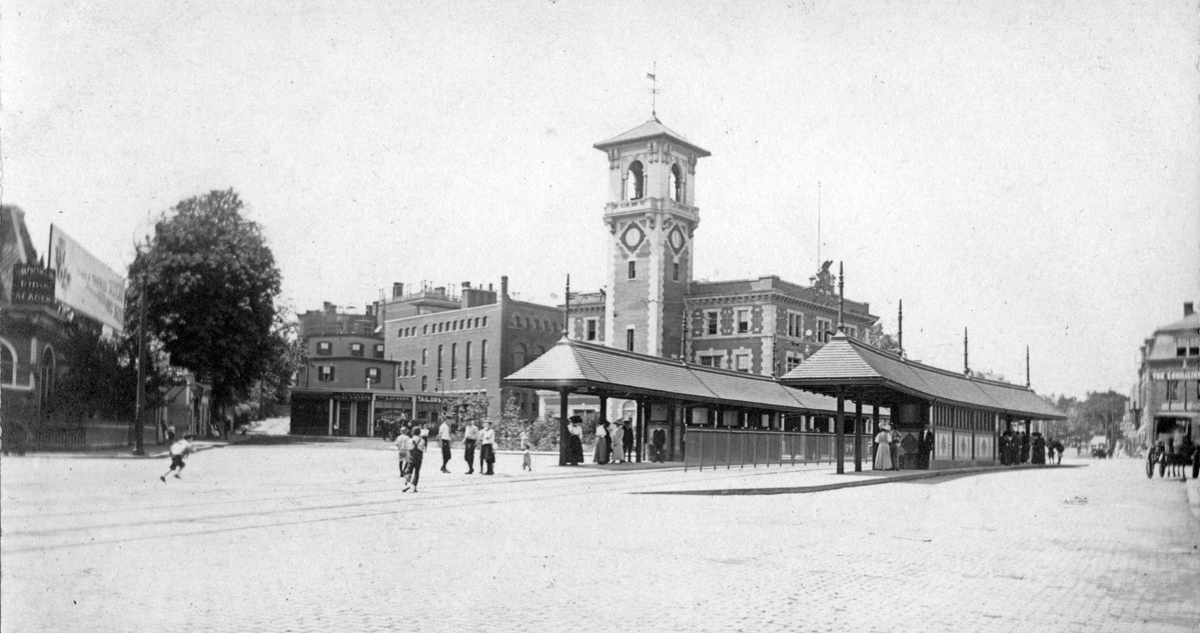
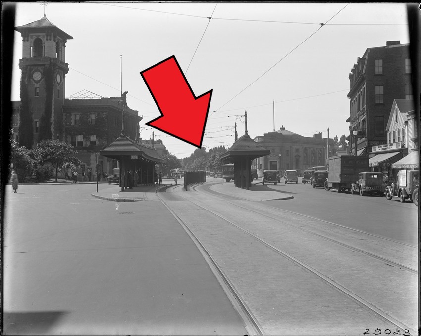
It wasn't always this way. Here's an image from when this corridor was still served by streetcars (this route is now the MBTA 66 bus). Still too much cobblestone, but at least transit riders got to wait in some shade, and the shops had awnings. (5/x)
The street trees you see in the background of this image must have been chopped down for a widening of Route 9. This more recent image is that same stretch of road today. The only "trees" you find there now are the ones they sell at @netacaremass. (6/x)
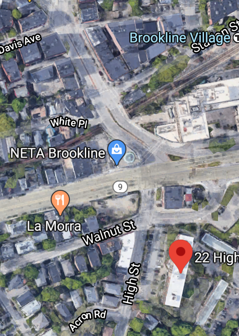
Widening roads and cutting down trees hurts property values, perhaps a factor in this location being chosen for some of Brookline's limited public housing. 22 High Street is the development in the bottom of this image. It houses families + seniors at affordable rents. (7/x)
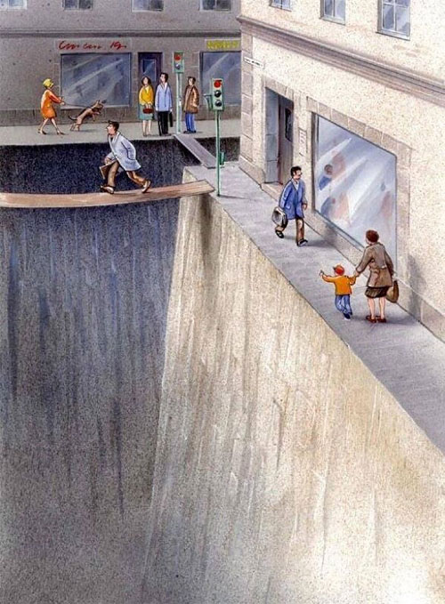
It is a short walk from 22 High Street to the Town Hall and the wonderful Brookline Library ( @brklib), but six lanes of 120° asphalt doesn't feel short to a kid with asthma or a senior with a heart condition. It feels like a wall -- or a chasm. (8/x).
This is what people mean when they talk about how inequities *compound*. The residents of 22 High Street are at higher risk of asthma because they live near a busy road. On a hot day like today, that asthma is exacerbated by the heat-island effect caused by that wide road. (9/x)
And that chasm/wall of baking Route 9 asphalt might mean they do not get to make that trip to the public library, while their peers on the other side of the road do. Decades of auto-oriented policy decisions helped contribute to this compounding, inequitable status quo. (10/x)
If you're thinking "But this is Brookline -- a town that benefited from many privileges and advantages for the last two centuries". That's the point! Many communities with less power or resources to fight road widenings + tree removal faced much worse. (11/x)
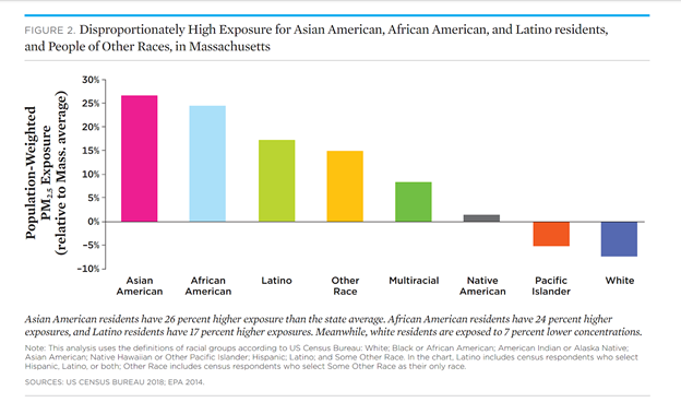
Many have pointed out that these auto-oriented decisions were inseparable from race. @UCSUSA has shown that in Massachusetts, people of color are disproportionately exposed to air pollution from roads. This is what structural racism in transportation looks like. (12/x)
Massachusetts needs policies + politicians that put


 (and
(and 

 !) first, not

 . It will help us stay cooler, improve the health of our most vulnerable residents, and make our communities more equitable places to live. (13/x) #mapoli


 (and
(and 

 !) first, not

 . It will help us stay cooler, improve the health of our most vulnerable residents, and make our communities more equitable places to live. (13/x) #mapoli

 Read on Twitter
