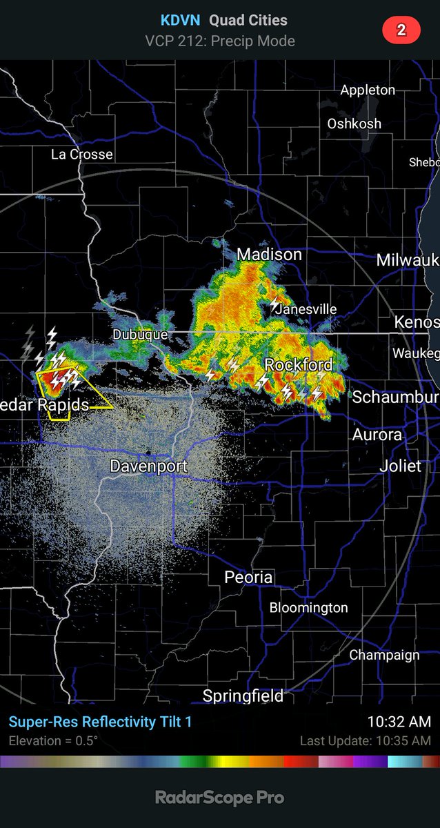
The evolution of storms, likely becoming surface based, including a supercell over eastern Iowa and a multicellular cluster over northern Illinois, and their attendant outflow boundary are key in the storm threat later today across central Illinois. There are several scenarios
1. The current storms continue and grow into a line. This would yield mainly a wind threat later this afternoon.
2. The current storms eventually break into discrete storms. This evolution is unusual, but has happened here before, most recently on 5/16/19. This would yield mainly a wind and hail threat, although a tornado can't be ruled out depending on boundary interactions.
3. The current storms dissipate but their outflow boundary continues southward and serves as the focus of new storm development. If the new storms can remain discrete and interact with the outflow boundary, this would maximize chasing potential.
4. Same as 3) except that the new storms quickly grow into lines/clusters. Initial wind/hail risk, transitioning more to wind with time.
5. Same as 3) except that new storms do not form over Illinois this afternoon. Most model guidance suggests that storms may also redevelop over Iowa later today, and these could grow into a line that would move through the region after dark bringing mainly wind.
6. Same as 5) except the line dissipates or weakens considerably before reaching Champaign-Urbana.

 Read on Twitter


