New to 3D GIS with @esri and @ArcGISPro?
I’ve put together a printable 2-page cheat-sheet of the concepts and terms you need to get started, so you won’t need 20 yrs of trial-and-error (like I did)!
Download the PDF here:
https://maps.arcgis.com/sharing/rest/content/items/d8ddd38812324c7d9457f30bdd8f13bf/data
More info in thread.
-1/12
I’ve put together a printable 2-page cheat-sheet of the concepts and terms you need to get started, so you won’t need 20 yrs of trial-and-error (like I did)!

Download the PDF here:
https://maps.arcgis.com/sharing/rest/content/items/d8ddd38812324c7d9457f30bdd8f13bf/data
More info in thread.
-1/12
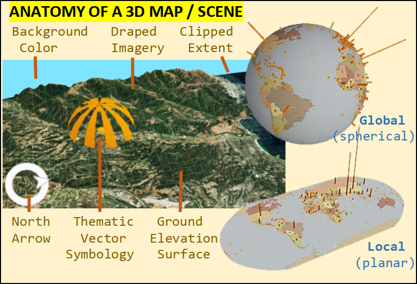
First, take a quick anatomy lesson to learn about the elements that make up a 3D scene. Not every scene has every element, but you need to know your options.
-2/12
-2/12
Perhaps most importantly, think about HOW you intend to share your 3D map BEFORE you spend hours (or days) making it.
Tip: If it’s an image or a video, you can spend more time on areas you know the camera will visit, and less on the rest.
-3/12
Tip: If it’s an image or a video, you can spend more time on areas you know the camera will visit, and less on the rest.
-3/12
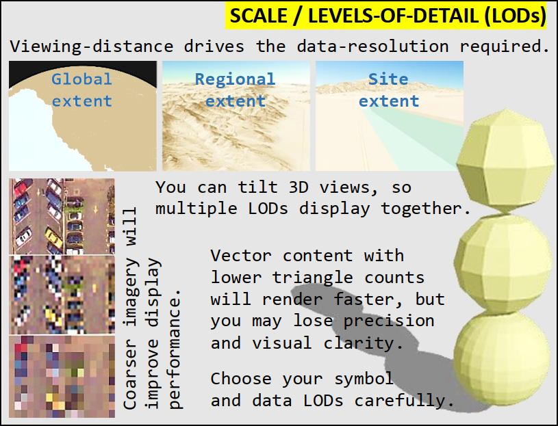
3D also has this nasty habit of showing continuous scales (aka levels-of-detail / LODs) throughout the view…
You WILL need to think about how scales change off into the distance, as well as choosing the “just-right” LOD for the features you’re showing.
-4/12
You WILL need to think about how scales change off into the distance, as well as choosing the “just-right” LOD for the features you’re showing.
-4/12
Got data with no Z’s? No problem – give them a place to draw by creating an elevation surface. While ‘Ground’ is the most famous, you can also model surfaces to be: underground; in the air; or based on thematic values.
-5/12
-5/12
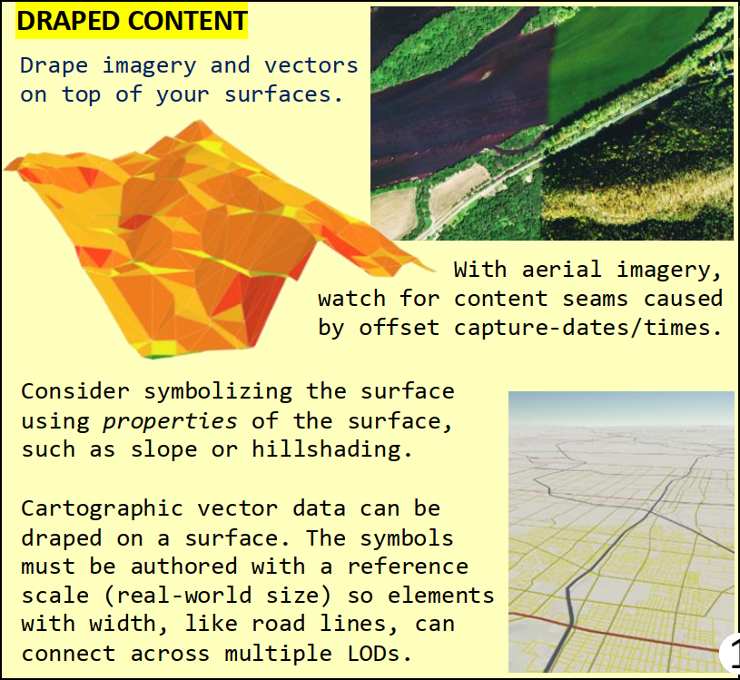
“Paint” your surfaces by draping them with imagery and cartographic content… but don’t forget about the whole continuous-scale thing.
-6/12
-6/12
Vector content are the “pretty boys” of 3D maps. They give the scene depth and things for people to click on. They can also be high maintenance, both in creation time and performance impact.
Use them wisely, and consistently, to avoid a scene that tries to do too much.
-7/12
Use them wisely, and consistently, to avoid a scene that tries to do too much.
-7/12
Vector objects come in all shapes and sizes. Think about how even a simple shape – rotated and resized into place – can communicate information to the user.
Everything does NOT* have to look “real”!
* (Full Disclosure: sometimes it does).
-8/12
Everything does NOT* have to look “real”!
* (Full Disclosure: sometimes it does).
-8/12
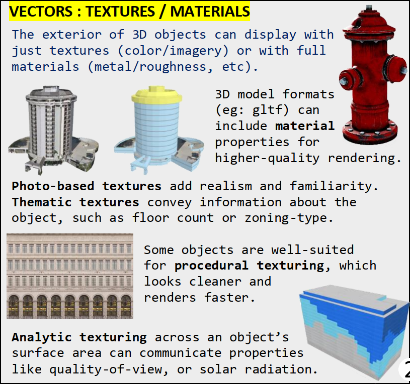
Much like the Ground surface, the exterior shell of vector objects can also be “painted”.
The source could be oblique imagery… or procedurally-placed windows and bricks… or even “material” properties that can make a surface appear to be iron or glass or wood.
-9/12
The source could be oblique imagery… or procedurally-placed windows and bricks… or even “material” properties that can make a surface appear to be iron or glass or wood.
-9/12
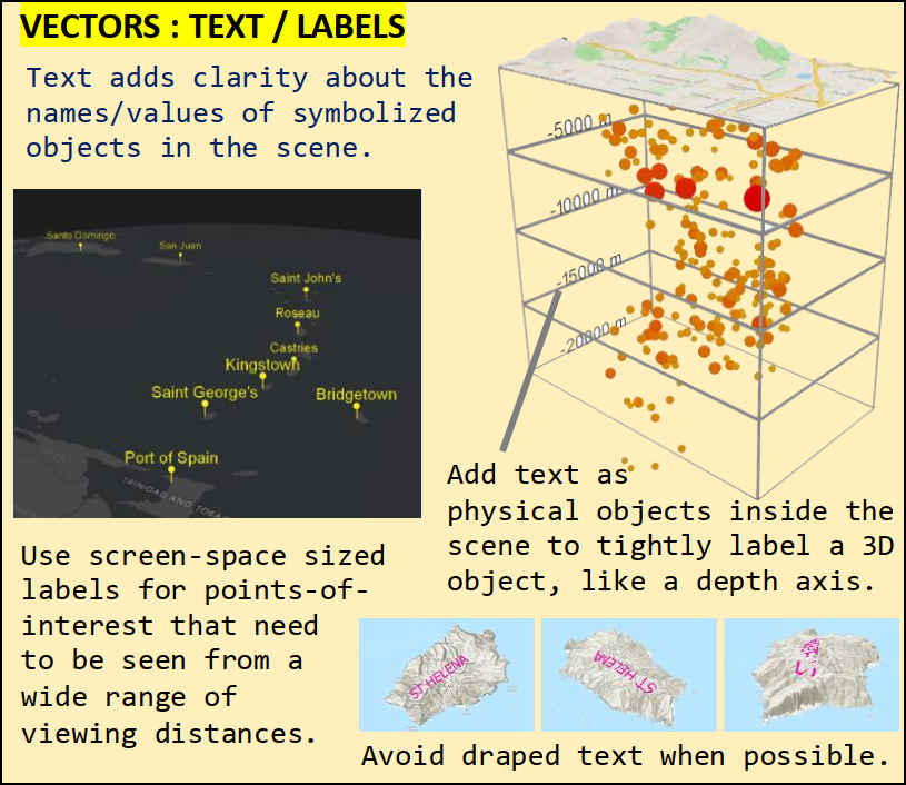
Text in a 3D view can label locations and reinforce the direction a feature is oriented. Make it 3D (where you can) and only drape it on the ground as a last resort… or when you have full camera control (eg: video).
-10/12
-10/12
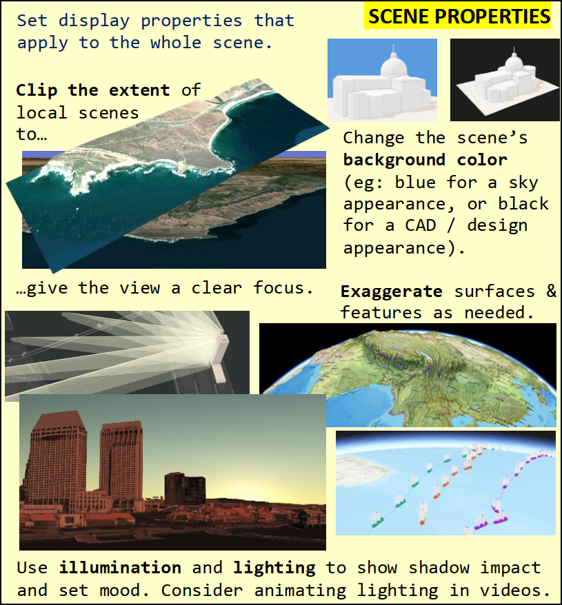
Once you’ve symbolized your layers, there's still more to do – you must also think about the scene as a whole!
A scene’s lighting changes the mood, exaggeration makes flat land interesting, and the background color is critical for the intended use of an exported image.
-11/12
A scene’s lighting changes the mood, exaggeration makes flat land interesting, and the background color is critical for the intended use of an exported image.
-11/12

 Read on Twitter
