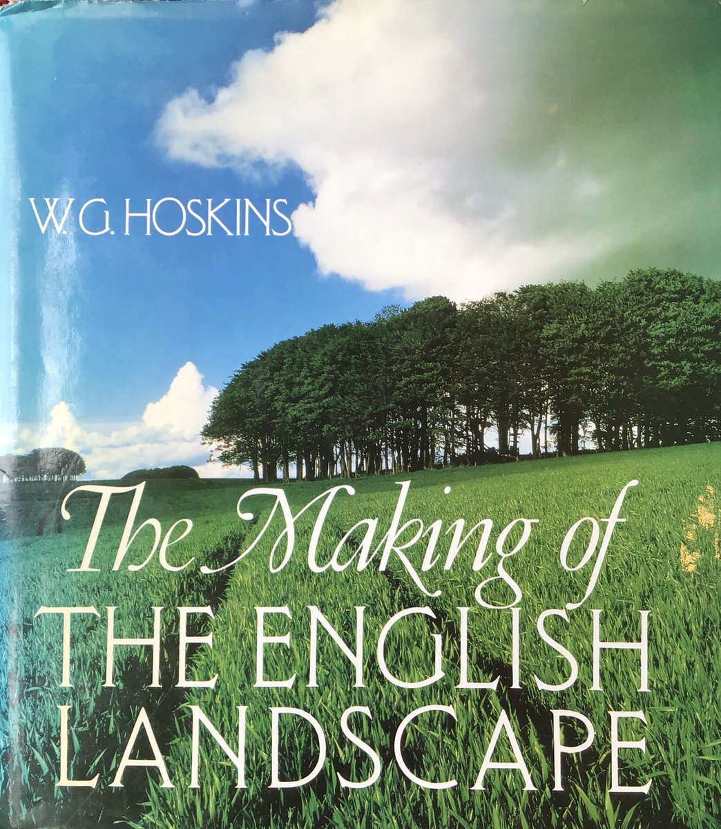
THREAD. The origins of English villages like Spaldwick, Hunts., so typical of the rural landscape, is a question that’s puzzled historians and archaeologists for generations. (Photo from Christopher Taylor’s masterfully annotated 1988 re-edition of Hoskins’ classic book.)
2. Most people in rural prehistoric and Roman Britain tended to live in farms and hamlets dispersed around the landscape (though for a qualification of this generalisation see Christopher Taylor’s 1983 Village & Farmstead). Take the archaeology of Doddington, Northants  ....
....
 ....
....
3. .. mapping the archaeological evidence (filled red circles) of Romano-British settlement at Doddington shows settlement scattered between a villa (bottom, R) & 3 farmsteads lying to its east (Source: https://www.british-history.ac.uk/rchme/northants/vol2/xxix-lxv). What about after 400 AD?
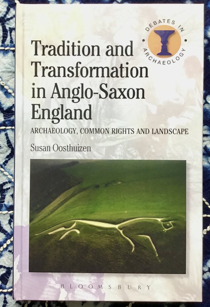
4. Until the 1960s historians generally agreed that ‘the English village’ was introduced into the landscape by colonists from NW Europe (Source: Tradition & Transformation in Anglo-Saxon England, Oosthuizen 2013, p. 97). But the archaeology began to show something different ..
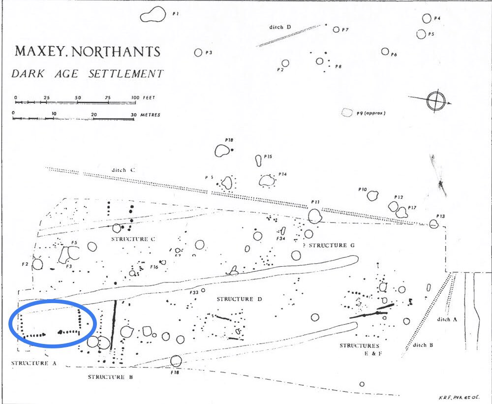
5. First, excavations at Maxey, Northants., revealed an early medieval hamlet of rectangular timber buildings (eg circled in blue), unplanned, & deserted by the ?mid to late 9thC.
The modern village appears to date from the 11thC.
What was going on?
( https://archaeologydataservice.ac.uk/archiveDS/archiveDownload?t=arch-769-1/dissemination/pdf/vol08/8_020_073.pdf)
The modern village appears to date from the 11thC.
What was going on?
( https://archaeologydataservice.ac.uk/archiveDS/archiveDownload?t=arch-769-1/dissemination/pdf/vol08/8_020_073.pdf)
6. Second, field walking at Doddington showed that early medieval settlement remained dispersed... (Taylor shows that settlements of all periods moved around the landscape so don’t worry about that. It’s not significant in the origins of villages.)
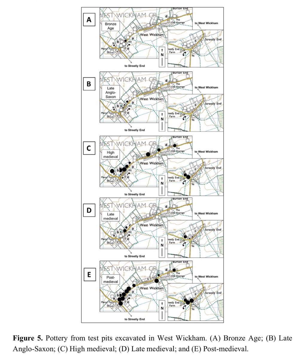
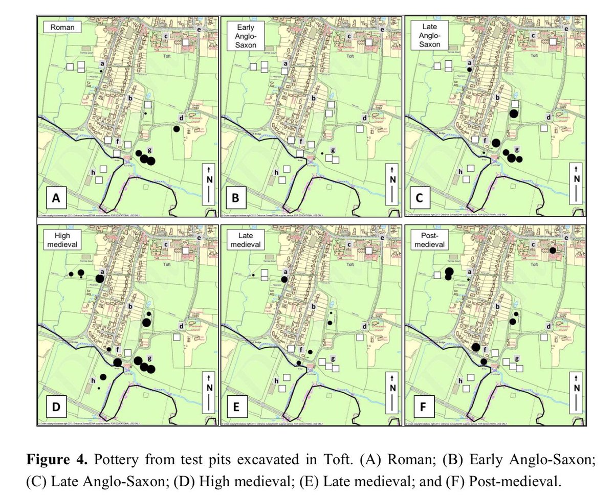
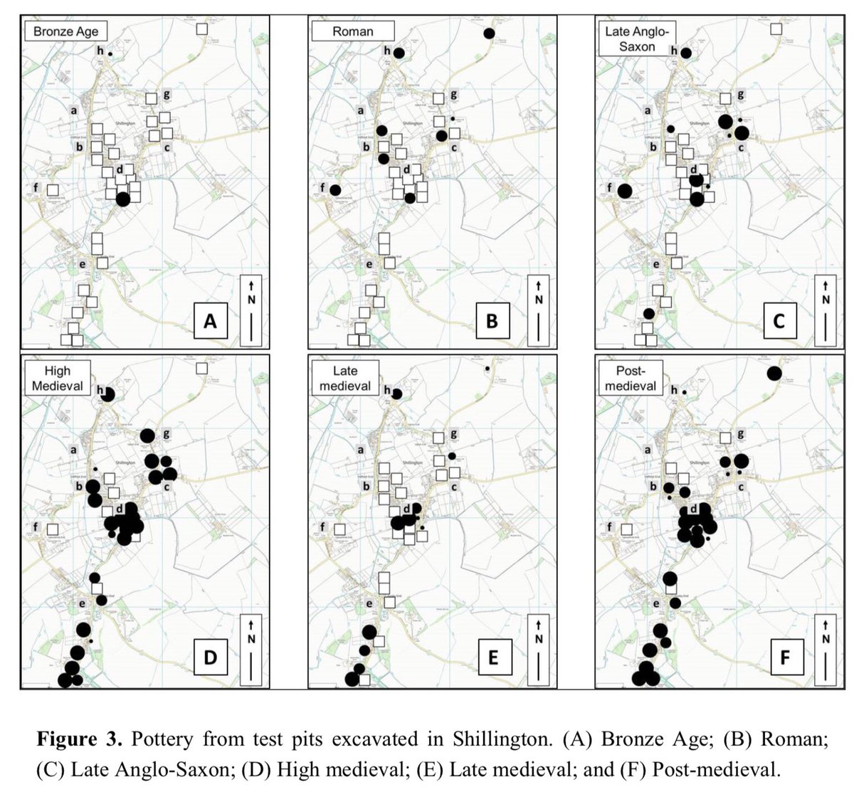
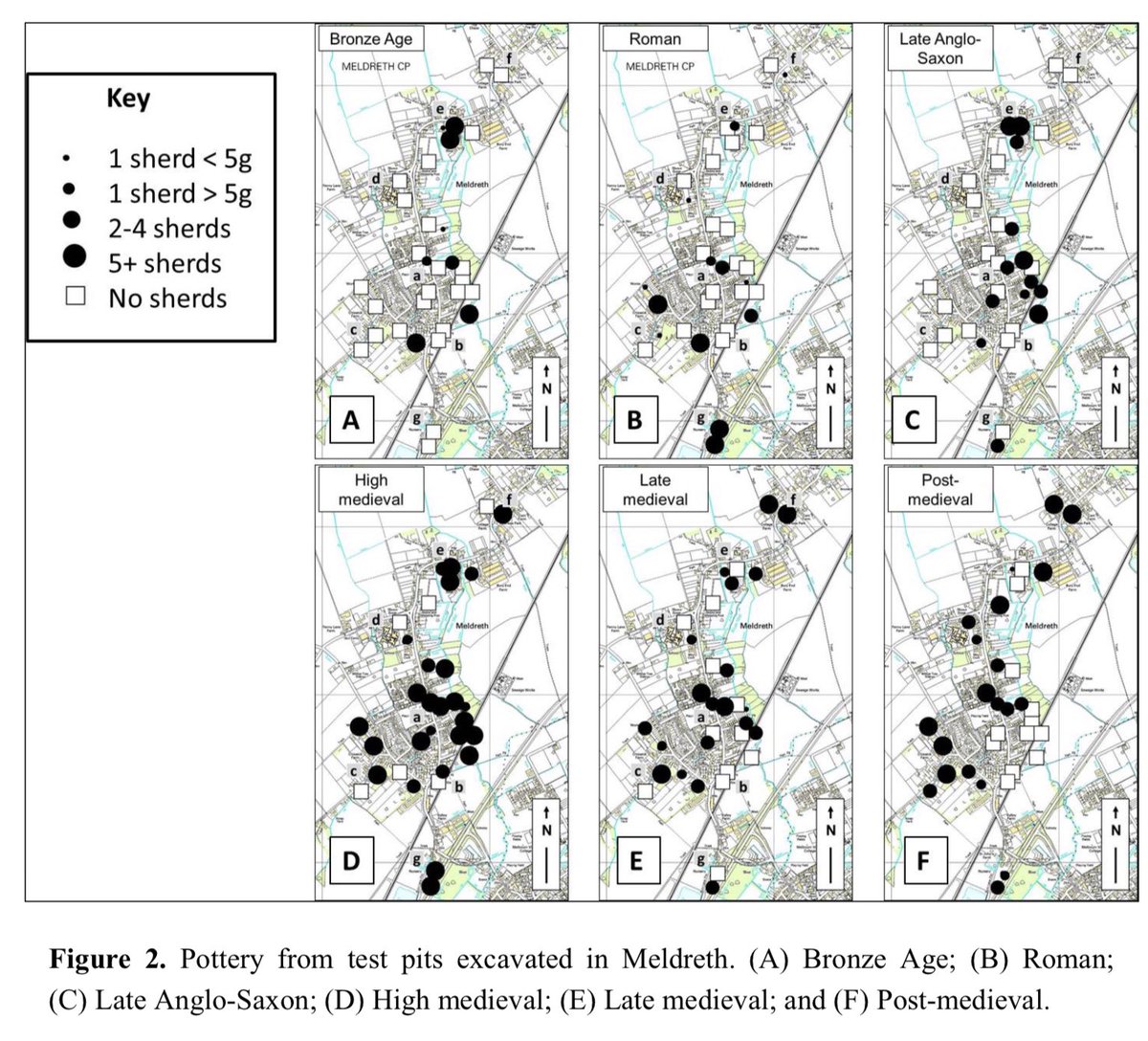
7. Third, @CarenzaLewis’ test pitting on the sites of modern, occupied villages confirms the work of many that village origins lie in the 10thC or later. ( https://www.academia.edu/16765989/Archaeological_Excavation_and_Deep_Mapping_in_Historic_Rural_Communities)
8. So do the origins of the English village lie in the centuries spanning the Norman Conquest? Clues to the answer to that question lie in a specific form of settlement which archaeologists call planned nucleations - here’s what they mean.
9. Back at Doddington again, as an example, all medieval settlement was focused on a single site - no longer dispersed.
10. So two quite different landscapes emerged : in the first, like this one also in Northants., almost all settlement remains focused in one place. But in other places
11. ..while settlement in other landscapes, like this one in Essex, remained dispersed (both maps reproduced at the same scale).
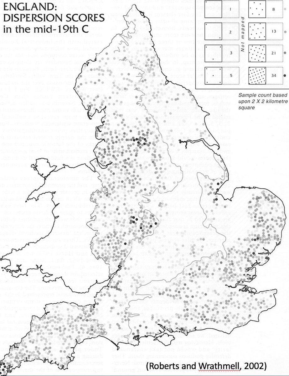
12. And when they’re mapped, nucleations tend to be found more often in a belt running across central England from SW to NE, while dispersed landscapes tend to be found beyond ( https://archaeologydataservice.ac.uk/archives/view/eh_monographs_2014/contents.cfm?mono=1089068).
13. And many of those nucleations show some evidence of having been planned - for more on how to recognise planning see  https://twitter.com/drsueoosthuizen/status/1270737937588801537?s=21 https://twitter.com/drsueoosthuizen/status/1270737937588801537
 https://twitter.com/drsueoosthuizen/status/1270737937588801537?s=21 https://twitter.com/drsueoosthuizen/status/1270737937588801537
14. Ha! I can hear you thinking: so the planned, uncleared English village has origins in the 10thC onwards. Not so fast. Because: small, planned nucleations were laid out c650-850 at the centres of large early medieval estates long before ‘the English village’ became widespread
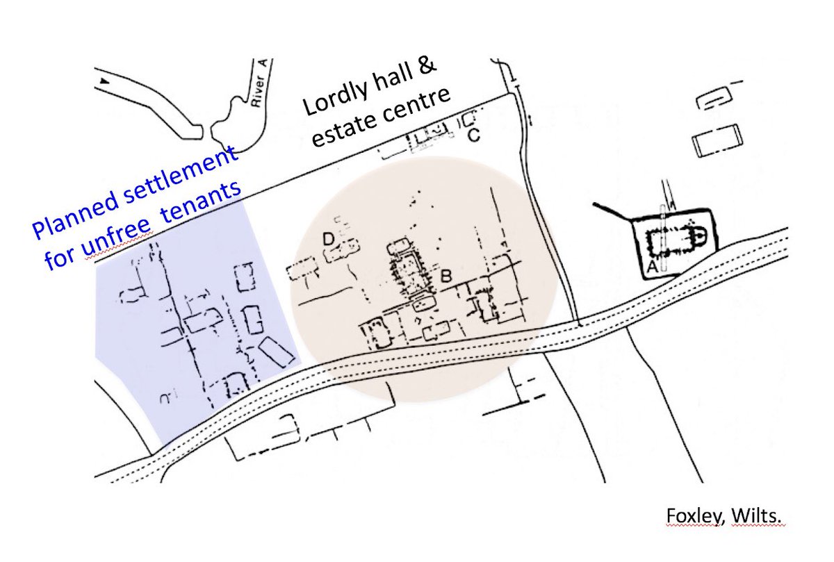
15. Here are some examples: a planned settlement appears to have been laid out for their unfree tenants alongside a high status hall fronted by a courtyard, on a 6th-7thC estate at Foxley, Wilts. https://www.tandfonline.com/doi/abs/10.1080/00665983.1986.11021134
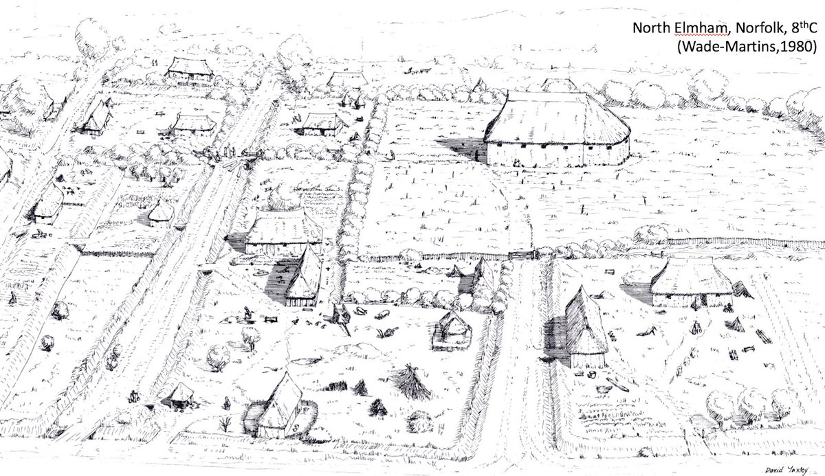
16. An early 8thC Bishop of East Anglia oversaw the creation of a large, planned settlement at N Elmham, Norf., which flourished between 720 and 830, & was replanned several times afterwards. Http://eaareports.org.uk/publication/report9/
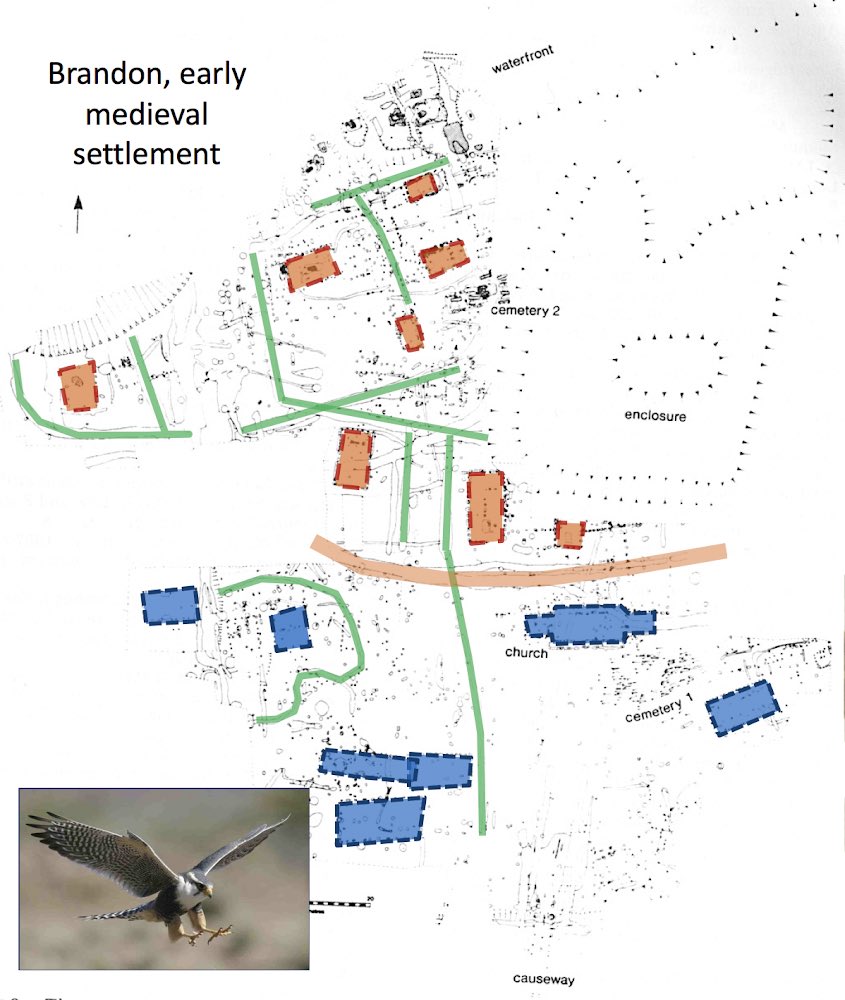
17. And the Abbey at Ely may have laid out a substantial planned settlement c650-850 at Brandon, Norf., divided by a large ditch between the monks who ran it (blue, to the S), & the cloth weavers & dyers that they managed (orange, to the N). https://www.cambridge.org/core/journals/antiquity/article/middlesaxon-settlement-at-staunch-meadow-brandon/C29D71CAB671CB06FFCBBE584C96F692
18. So what was going on? It seems that planned nucleations emerged into the English landscape in two, quite separate phases.
(1) in organising dependent labour on vast estates granted principally to the church between 650-850
(1) in organising dependent labour on vast estates granted principally to the church between 650-850
(2) and then again, once more in organising labour in the one or two centuries on either side of the Norman conquest. At Balsham, for instance, Ely Abbey may have laid out the planned elements of the village soon after it acquired the estate c1017-1035 https://twitter.com/drsueoosthuizen/status/1270743934600445952?s=21 https://twitter.com/drsueoosthuizen/status/1270743934600445952
20. At Kingston, Cambs., by contrast, the planned village may have been laid out in the later 12thC https://twitter.com/drsueoosthuizen/status/1225821220245057536?s=21 https://twitter.com/drsueoosthuizen/status/1225821220245057536
21. So the story of the English village is more convoluted than it once appeared. Beginning on large estates c650-850, then adopted more widely by lords expanding manorial control from the 10thC onwards -
For more see
…https://profsusanoosthuizen.files.wordpress.com/2020/06/oosthuizen-2010-in-higham.pdf, and
https://archaeologydataservice.ac.uk/archiveDS/archiveDownload?t=arch-1164-1/dissemination/pdf/Volume_28_2013/MSR28_96-98_Oosthuizen.pdf
For more see
…https://profsusanoosthuizen.files.wordpress.com/2020/06/oosthuizen-2010-in-higham.pdf, and
https://archaeologydataservice.ac.uk/archiveDS/archiveDownload?t=arch-1164-1/dissemination/pdf/Volume_28_2013/MSR28_96-98_Oosthuizen.pdf

 Read on Twitter
