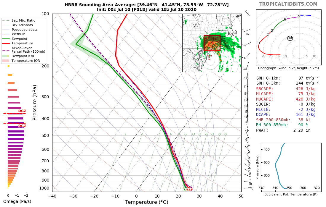
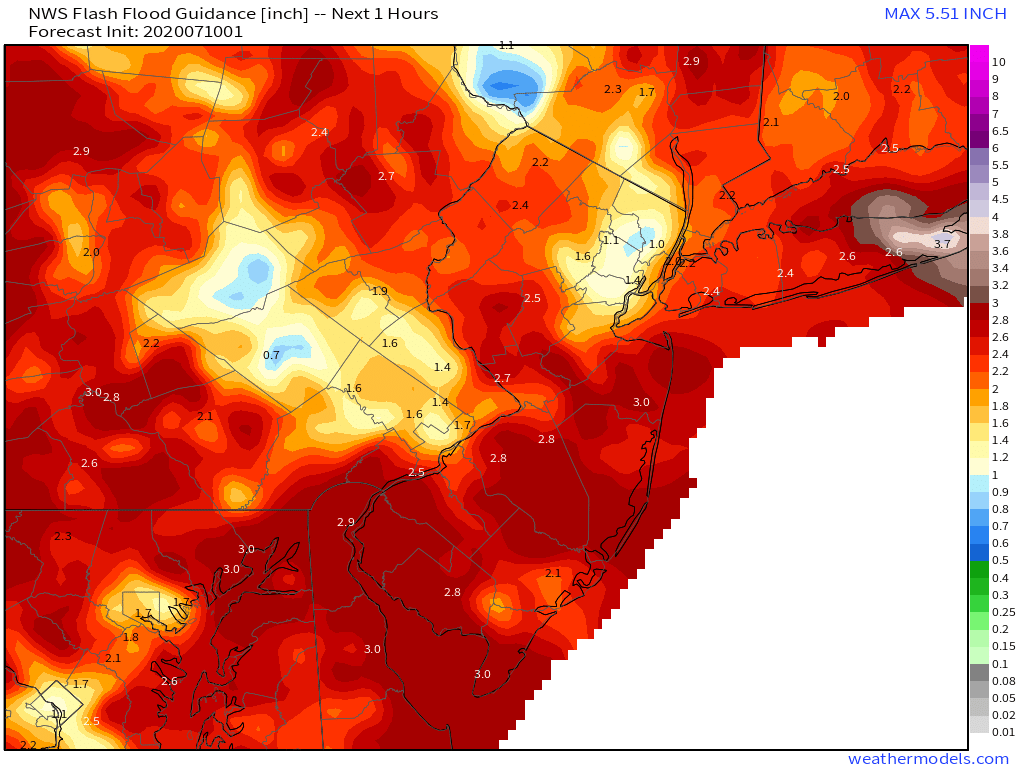
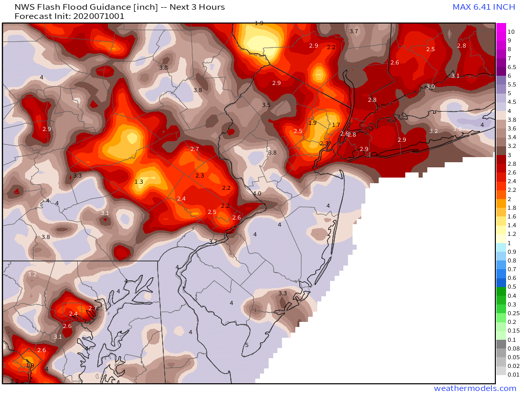
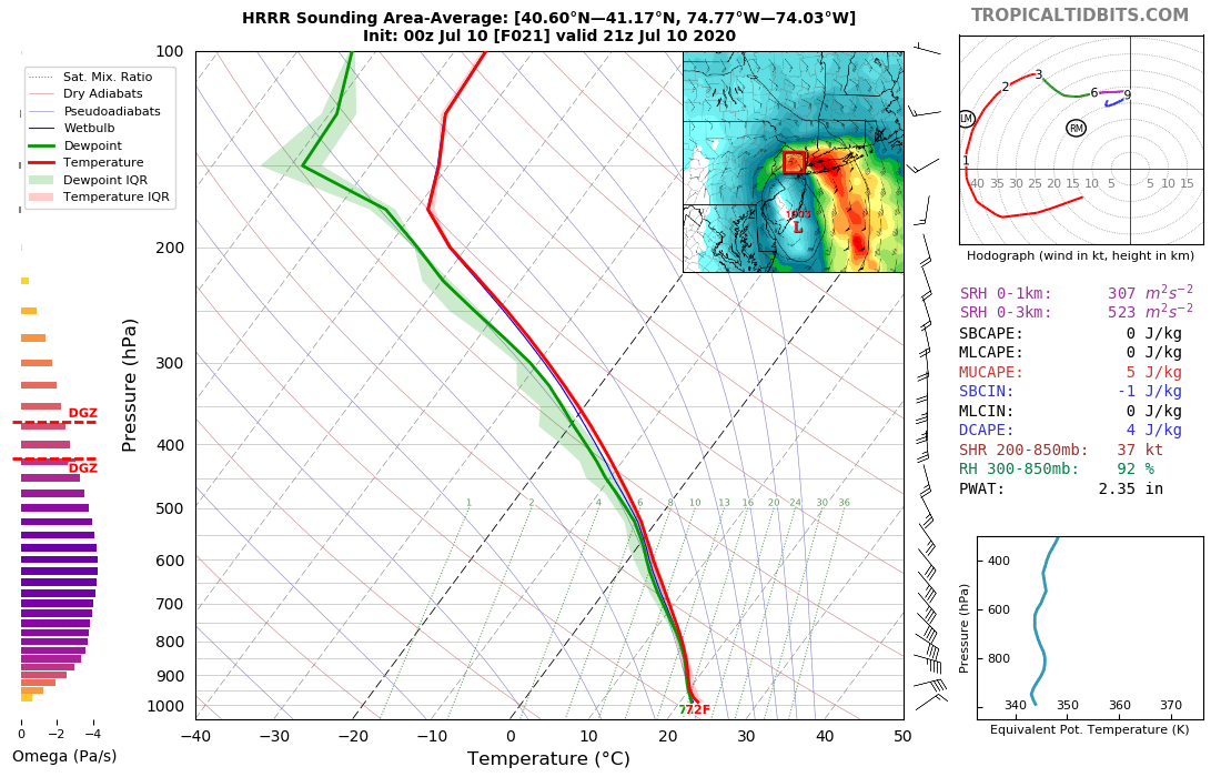
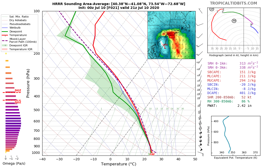
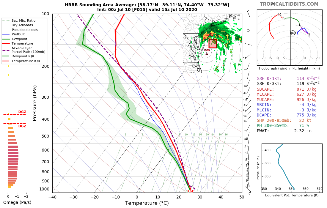
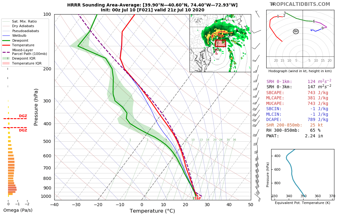
Fay...where to start. OK, rain. Unsurprisingly, the environment will be very favorable for heavy rain north/east of the center, with PWATs of 2-2.50", skinny CAPE, and warm cloud depth to above 600mb/around 14k ft. The drops will be warm/a bit small, but will be tons of them. 1/9
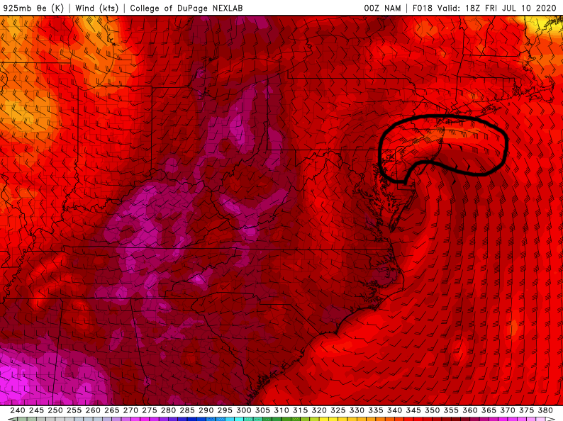
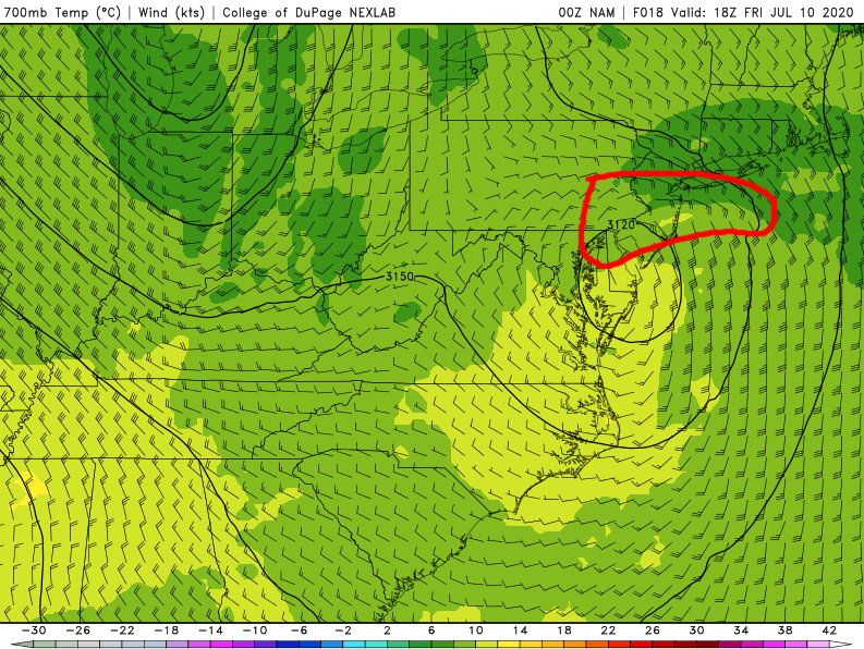
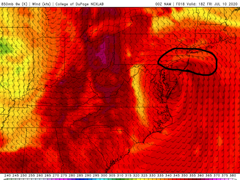
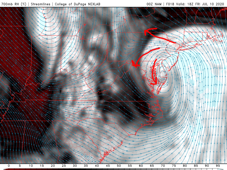
The heaviest rainfall will be driven by a band of deep fgen north/northeast of the low where the deep tropical air slams into the slightly less tropical airmass we "enjoyed" today. Could certainly see rates of 1-2"+ per hour in any embedded convective cores in this band. 2/9
In general, residence time of this band will only be 2-3 hours in any given spot from extreme eastern PA/NJ to LI and the HV/NY). However, 2-3 hours of heavy rain with embedded 1-2"+ per/hr rates can hit FFG in urban areas or areas that have recently seen heavy rain. 3/9
If this band is able to wrap around the western side of the circulation (where there may be some deformation), residence time in a narrow corridor could be a bit longer and allow for heavier totals. Some disagreement on if this occurs and placement (E PA, NJ, NYC/HV?) 4/9
In terms of wind, meh but a few interesting spots. Along the coast, probably some 40-50 MPH type gusts from NJ to Long Island/CT (it's a tropical storm after all)...maybe locally 50-60 if a convectively active mesovort smacks into land somewhere. 5/9
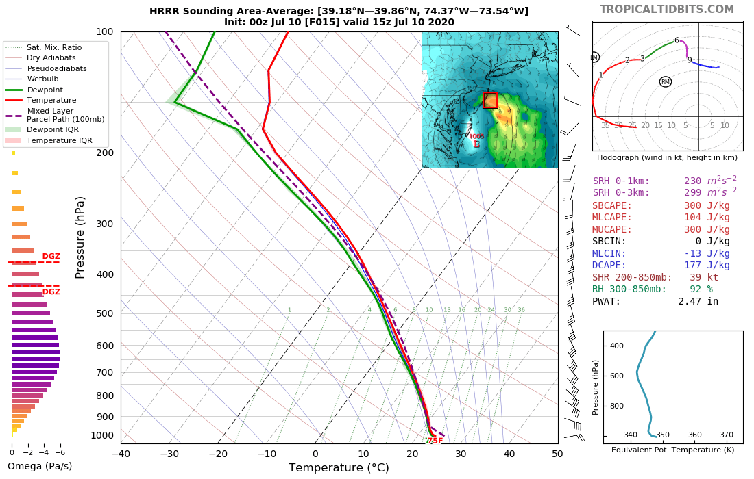
The LLJ that intensifies and tries wrapping around the low as it deepens is important not only for hvy rain, but also inland wind gusts and any tornado potential. The hodographs really enlarge as that LLJ ramps up, with very low LCLs and some weak instability. 6/9
While those soundings have very weak instability, it's worth noting that the environment immediately south of that rain band will feature a bit more CAPE (which will enhance updrafts some) and even some mid-lvl dry air/DCAPE. 7/9
Low LCLs and high SRH will give some tornado risk...especially near the coast, but could work inland. Rotating updrafts, decent low-level flow, and some DCAPE may otherwise enhance gustiness with any convection. With E/SE winds in NJ, 40-50 MPH gusts can cause some damage. 8/9
To sum up...
-Some flash flood risk (on top of typical urban stuff) DE/E PA/NJ/NY/W New Eng, though western extent ?
-Windy along the coast from NJ to CT
-Sporadic damage possible inland NJ, LI, lower HV/S CT with embedded convection
-A couple tornadoes possible NJ/SE NY/CT
9/9
-Some flash flood risk (on top of typical urban stuff) DE/E PA/NJ/NY/W New Eng, though western extent ?
-Windy along the coast from NJ to CT
-Sporadic damage possible inland NJ, LI, lower HV/S CT with embedded convection
-A couple tornadoes possible NJ/SE NY/CT
9/9

 Read on Twitter