May 2020 saw a significant severe weather and tornado drought. While severe weather reports were closer to normal in June, the tornado drought continued for another record breaking month. The following tweets will give a brief summary of severe weather in June 2020.
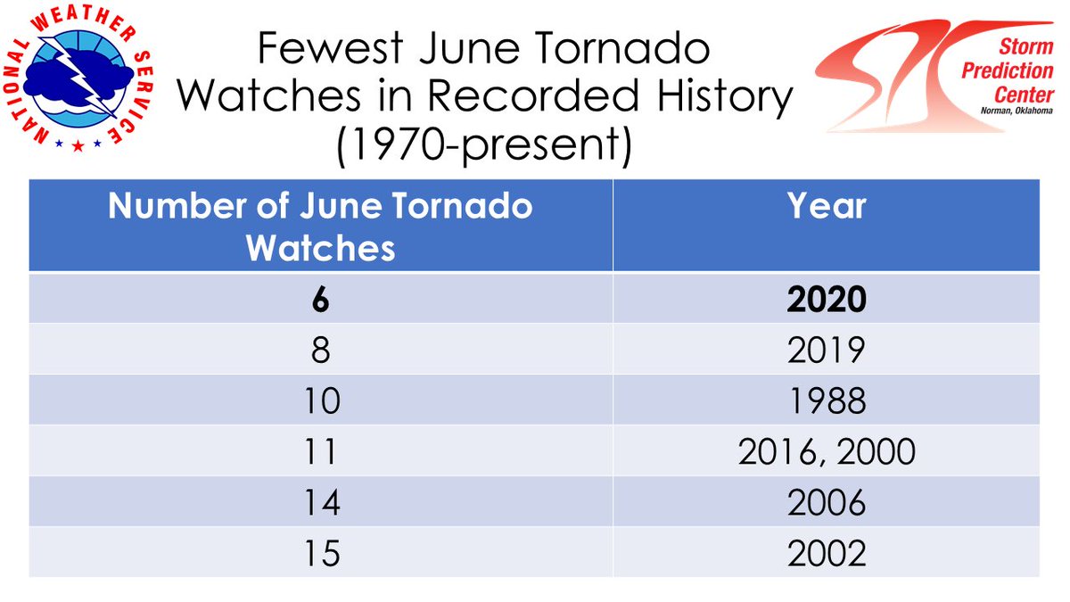
June 2020 had the fewest number of tornado watches in recorded history with 6. This beats the previous fewest of 8 from 2019. The combined number of May and June tornado watches was 16 which is 12 fewer than the previous lowest May/June total of 28 in 2018.
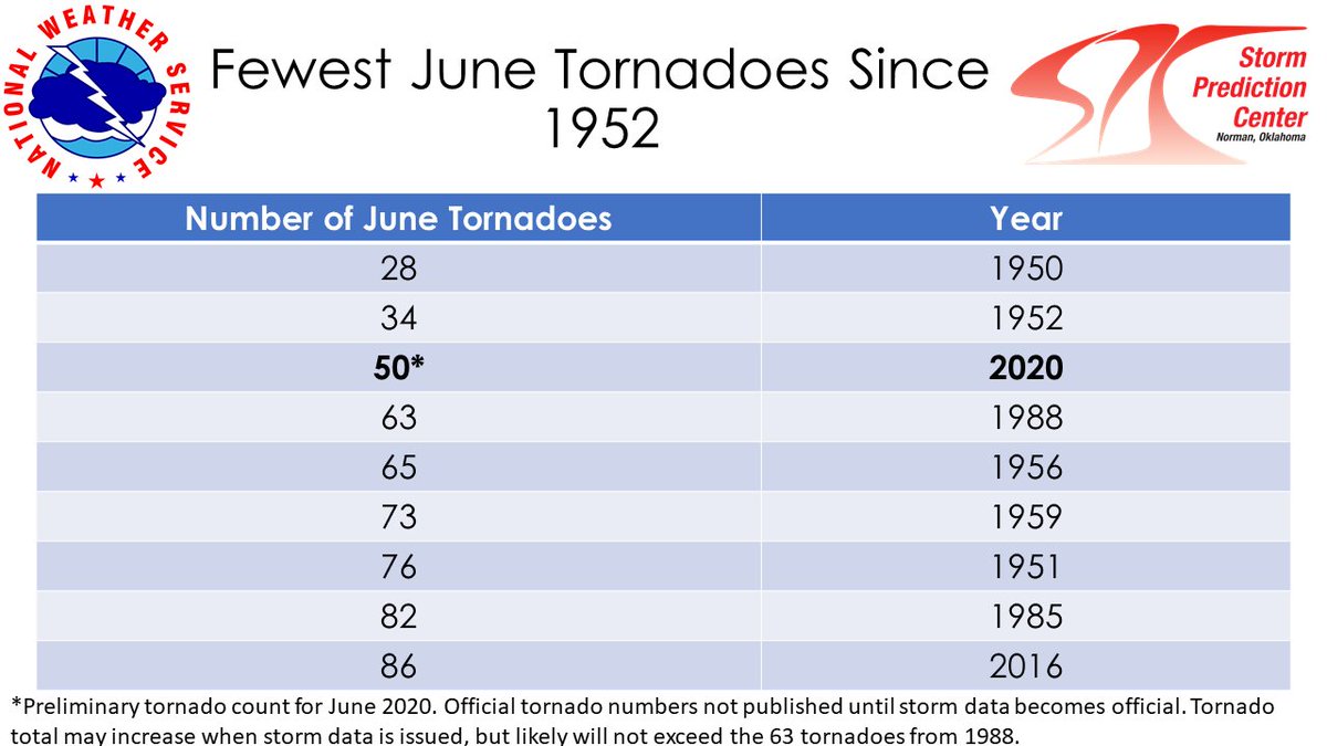
June saw the fewest number of preliminary June tornadoes (50) since 1952. This number could go up once official storm data is published, but it likely will not exceed the 63 total tornadoes from June 1988.
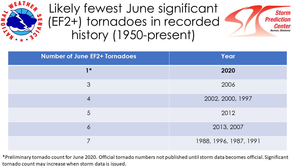
So far, there has only been one confirmed EF2+ tornado in June 2020. This is the fewest EF2+ tornadoes in June in recorded history (1950-present). The previous fewest was 3 in 2006.
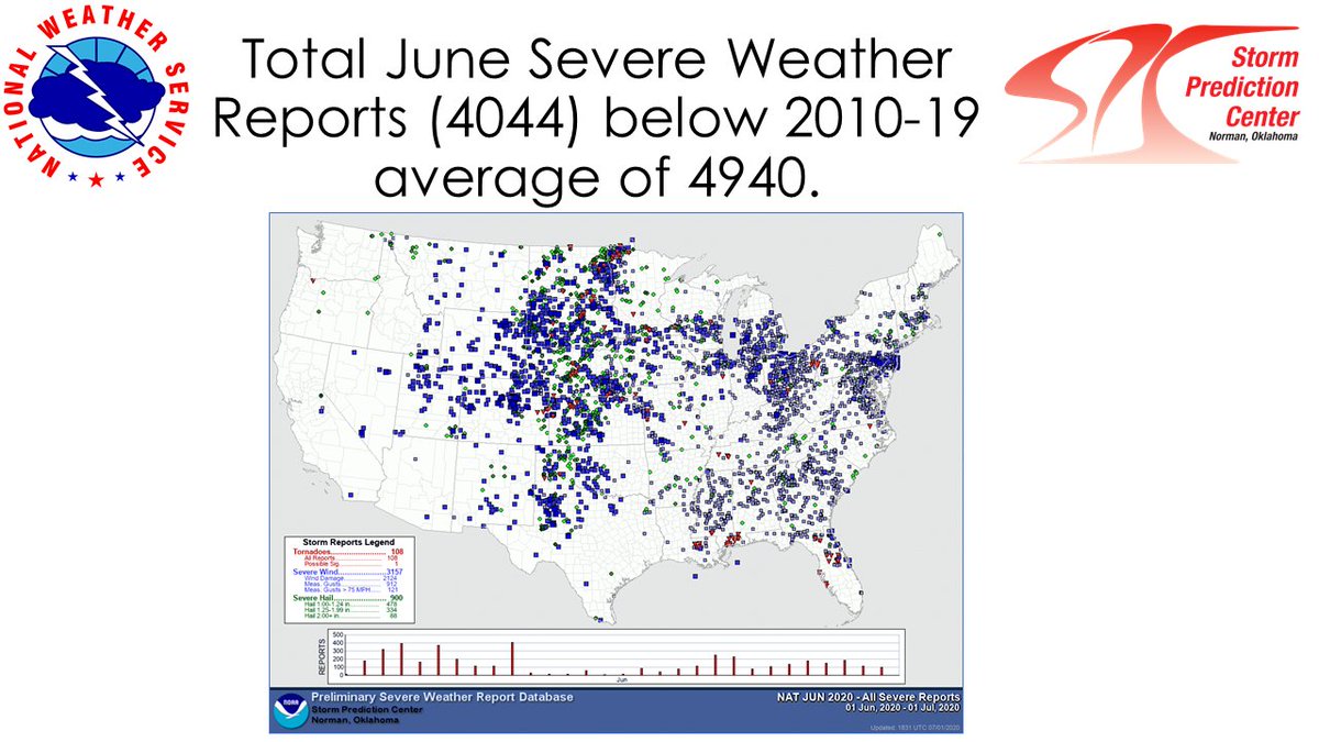
June 2020 saw 4044 total preliminary severe weather reports. This is below the 2010-2019 average of 4940 reports.

 Read on Twitter