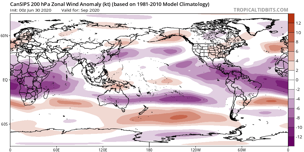
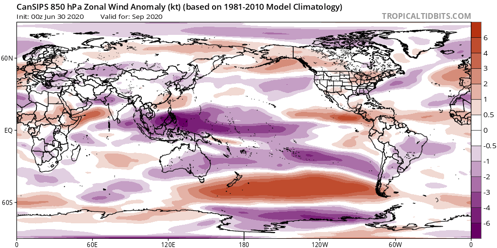
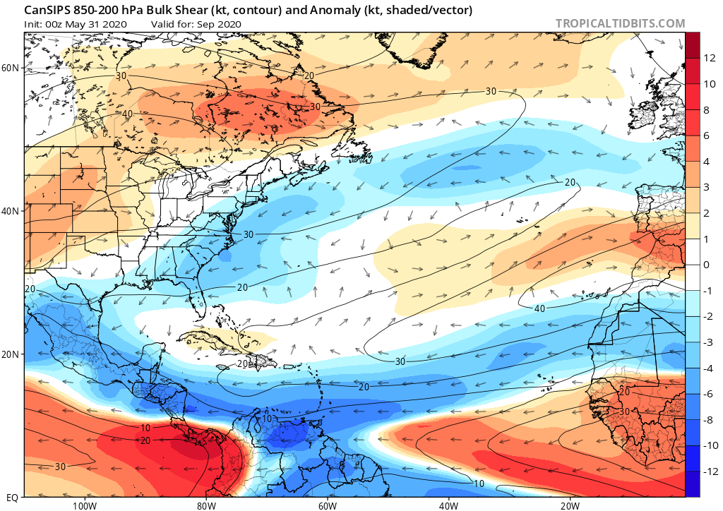
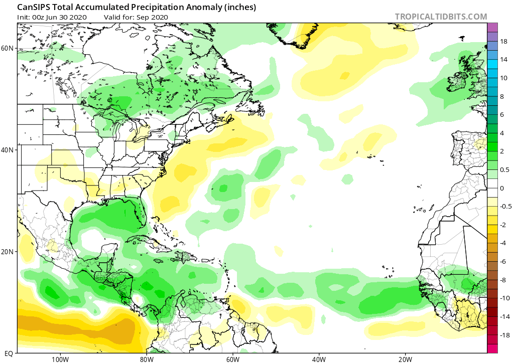
July #CanSIPS seasonal modeling out this morning continuing to show large scale ingredients continue to come together for an active Atlantic hurricane season - here we have a cool E Pacific SSTs with warmer than normal Atlantic Main Development Region
Reduced convection with the cool E Pacific reduces upper level westerly shear across the Atlantic (Purple 200mb) while the model also shows weaker trade winds (Red 850mb) across the tropical Atlantic typical of the active era -> lower wind shear across basin (blues in Bulk Shear)
Prior factors combine to drive the precipitation anomalies that suggest an active MDR - green shading (enhanced precipitation)
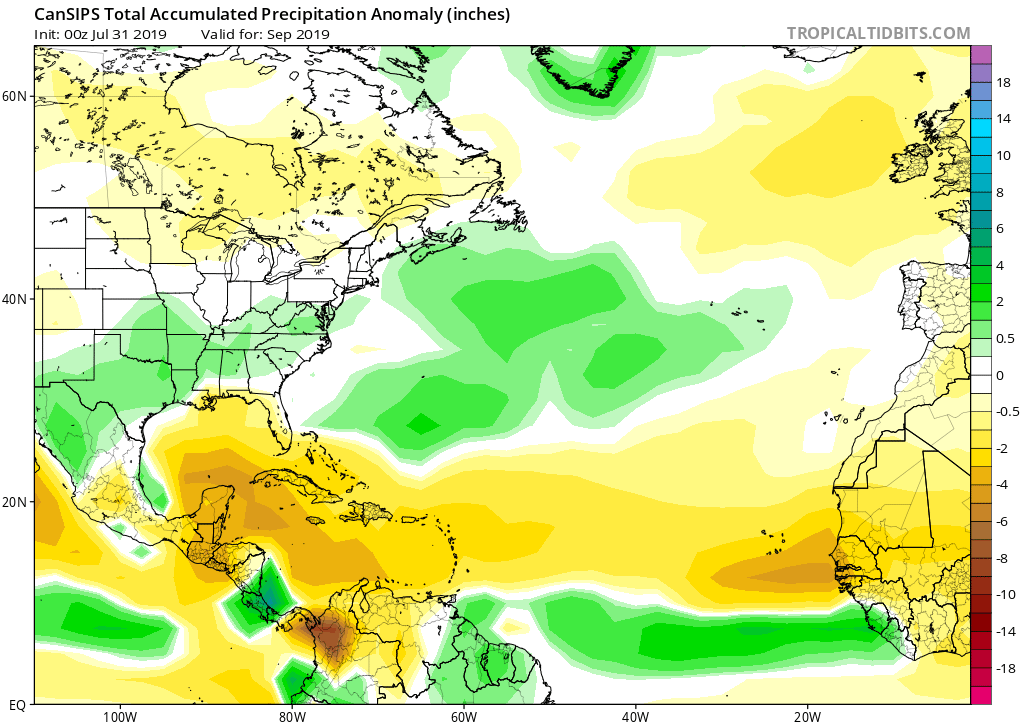
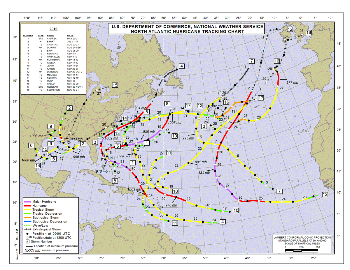
Contrast the 2020 forecast shown previously with the 2019 forecast shown here with below normal precip anomalies across the tropical Atlantic and Caribbean and how the 2019 season largely figured activity in the subtropical Atlantic
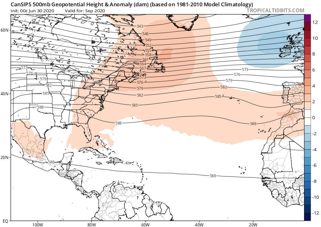
Consistent w/ a majority of last month's seasonal modeling, the July CanSIPS is hinting at anomalous ridging over E Canada which would lessen the likelihood of storms recurving and increase landfall threat. Of course I must emphasize the LARGE uncertainty with steering forecasts
Thanks to http://TropicalTidbits.com for all the great CanSIPS July forecast graphics and the NHC for the 2019 seasonal map!

 Read on Twitter
