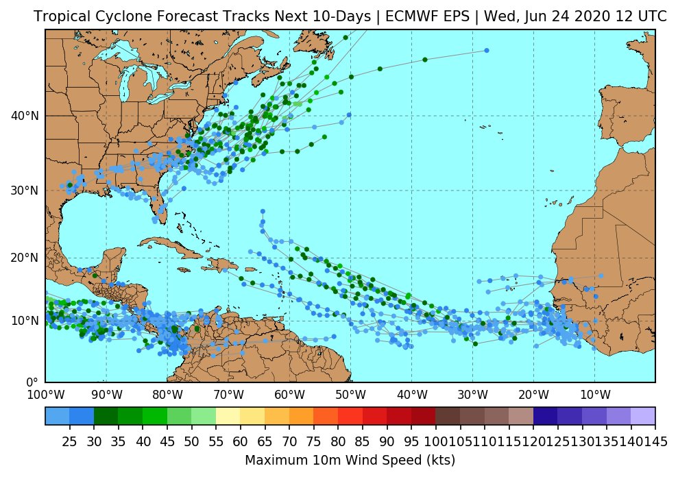
I'd keep an eye on the Atlantic's Main Development Region in the coming 10 days for the first MDR spawned Atlantic tropical cyclone. Yes, I feel this way even after seeing that colossal Saharan Air Layer (SAL) outbreak that dimmed the sky for the Antilles + PR.
Reasons to follow
Reasons to follow
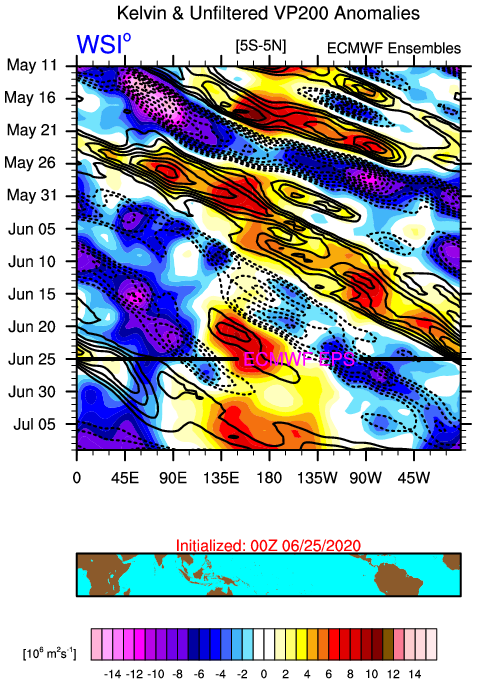
1. Strong convectively coupled Kelvin wave will be passing by. The SAL outbreak took place as the suppressed phase of this Kelvin wave passed by. Now we are tracking the active phase over the eastern Pacific and this will pass the Atlantic's MDR late June and early July
The suppressed phase of Kelvin waves notoriously shut down the Atlantic basin when passing by. There will be squakers on social media about how bad the Atlantic basin looks and this season is a bust, etc., when a suppressed Kelvin wave is passing by.
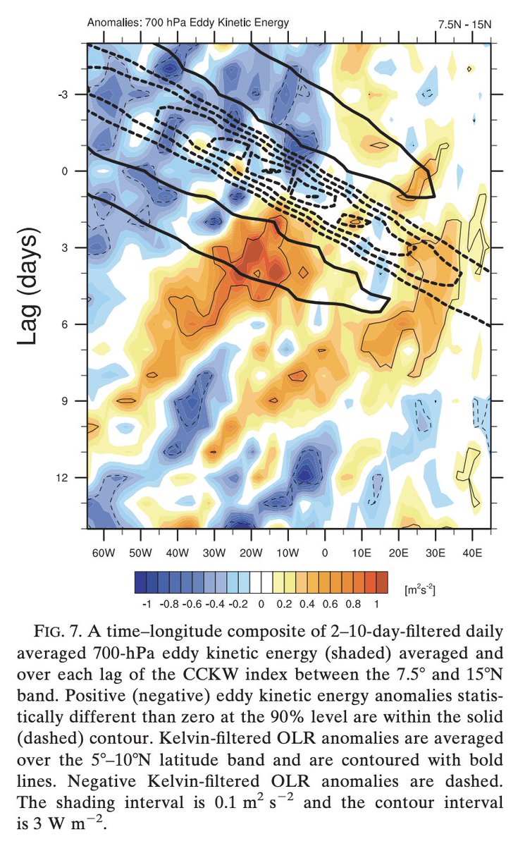
But the suppressed phase of the Kelvin wave actually primes the African easterly Jet (AEJ) in a sense, in which when the active phase begins to enter from stage left and convectively triggers African easterly waves, they can grow more barotropically against the AEJ.
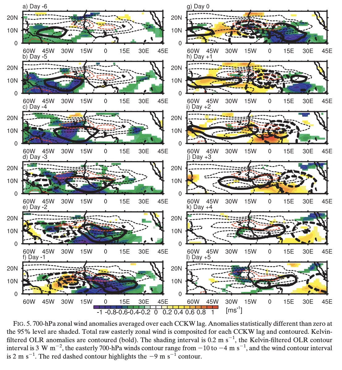
Chris Thorncroft ( @ChrisThorncrof1) and I looked into how CCKWs impact the West African Monsoon and African easterly wave frequency in one of our papers. This was one of my favorite papers we published. http://www.atmos.albany.edu/student/ventrice/documents/publications/Ventrice_Thorcroft_2013.pdf
The CCKW active phase to pass the MDR is going to change the environment to one that is more conducive for tropical cyclogenesis. I call these "windows of opportunity". The suppressed (active) Kelvin wave dries (moistens) the atmosphere and increases (reduces) vertical wind shear
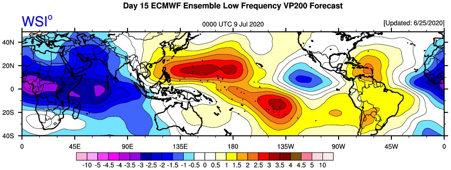
2. In the tropics, there's an evolving atmospheric standing wave over the Africa-Indian Ocean. You can see these standing waves by low-pass filtering 200mb velocity potential anomalies, where -CHI represents mass divergence aloft (analogous to rising air).
The standing wave over Africa-Indian will resonate once active Kelvin waves pass Africa. This is going to give a big boost to the amplitude of these Kelvin waves as they pass by, which will serve to put the West African Monsoon into overdrive on given weeks following a passage.
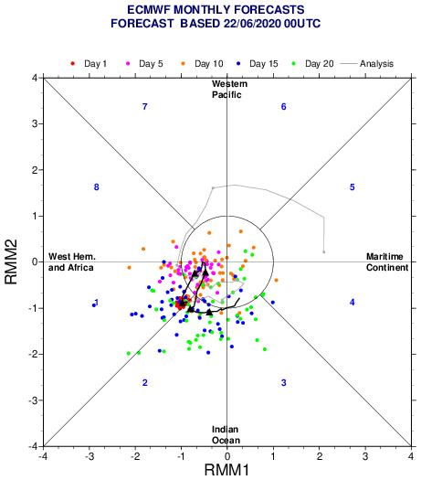
As a result, you're going to see EOF based Madden Julian Oscillation indices get stuck in RMM Phases 1-3, which by definition is Africa and the Indian Ocean. This is the index getting plagued by the low-frequency state, even though the index tries to remove this. You just can't.
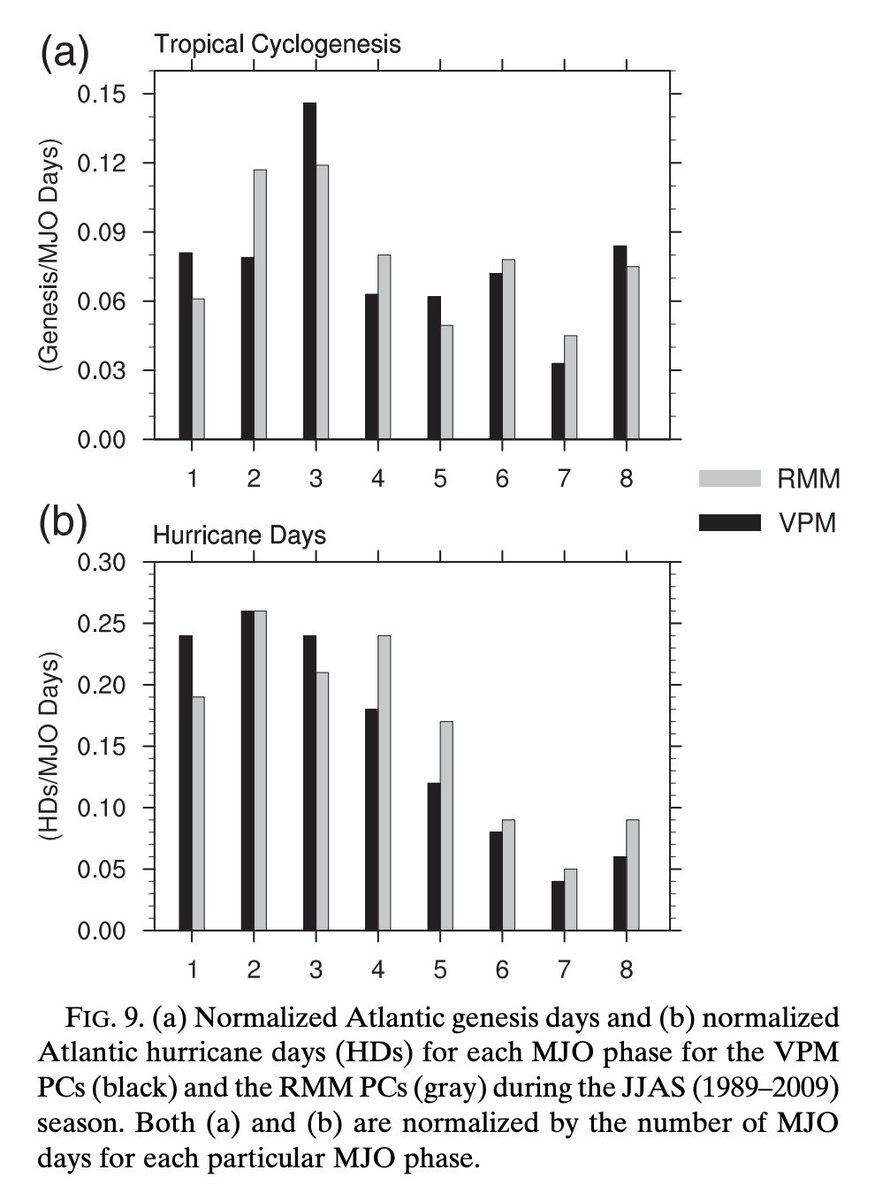
In Ventrice et al. 2013 (Modified MJO index using VP), we show that Phases 1-3 are the most favorable tropical state for Atlantic Hurricanes. This is the base state that we are in and WILL be in for the entire duration of the 2020 Atlantic Hurricane Season.
So every time the convectively active phase of a Kelvin wave passes the Atlantic-Africa region, it's going to create these windows of opportunity that will be prolonged by the constructive interference with this African-Indian Ocean standing wave.
I'm watching the MDR over the next two weeks as this process of a Kelvin wave ringing the Low-Frequency bell is about to take place. We are still early in the season though... just wait until we get into late August and September...  !
!
 !
!
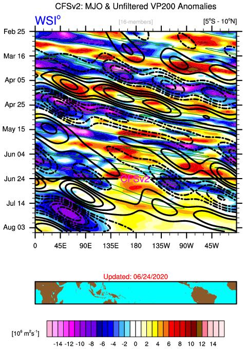
Just as a kicker, the CFSv2 absolute blows up this Kelvin wave into a full on MJO event during July once over the Indian Ocean. If correct, this would mean there's an Atlantic tropical cyclone outbreak looming late August-early September. Yeah, that's "Climo"... I know.

 Read on Twitter