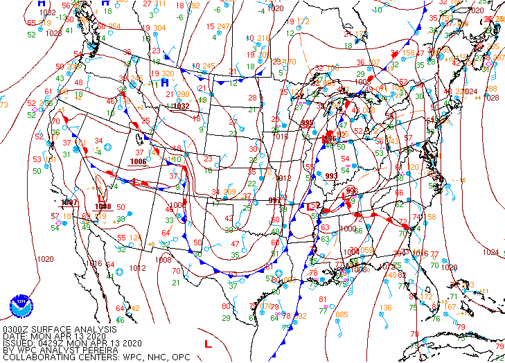
Looking over the data from last Sunday's tornado outbreak, it's another good reminder that it's often helpful to stand back and look at the base data. Derived parameters and indices are great, but they're just a reflection of base data. Take a look at the 03z surface analysis ->
At 03z, a surface warm front is near Chattanooga. Looking at the surface obs for that time, KCHA had a surface Td of 66°F and was likely right along the front. Obs further north had Td still in the 50s. Low-level shear is enhanced along frontal boundaries.
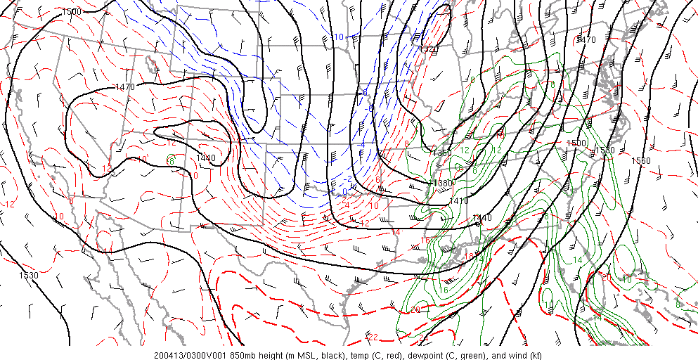
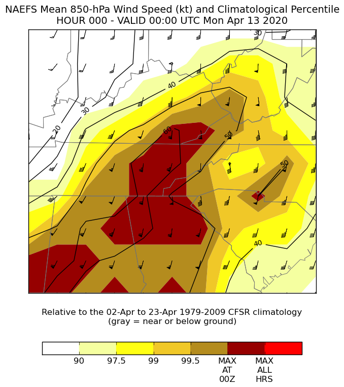
What was happening at the 850mb level at 03z? The extremely strong low-level jet axis was directly over NE AL, N GA, and SE TN. This low-level jet axis is a focal point for much of the tornado/wind severe weather threat as it maximizes low-level shear and SRH.
The 850mb winds were anomalously strong. Why is that important? Again, it enhances the environmental low-level shear and SRH to very high values. Plus, Chattanooga is in the vicinity of a warm front which will further locally enhance low-level shear and SRH!
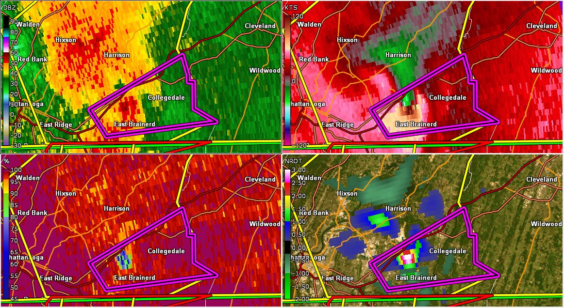
Surface based instability (albeit small) + warm front nearby + an anomalously strong low-level jet = strong tornado potential. At 0315z, the tornado began in GA and moved into TN between 0319-0320z. About 0326z is when the large TDS developed and Tornado Emergency issued.
Just by doing a simple surface analysis and knowing your synoptic features, you could pretty easily highlight the highest severe weather potential through central MS, central AL, and NE AL, N GA, and SE TN through the afternoon and evening.
This tornado setup is common. It's pretty rare to have a significant tornado outbreak in East Tennessee when MLCAPE is greater than about 500 J/Kg. In the TN Valley/Southern Appalachians, just be familiar with forecasting high shear/low surface CAPE severe weather environments.
To show how important low-level jet magnitude (generally 50+ kt) and location is to low-level shear, SRH, and overall tornado potential, just look at SPC tornado reports and where the 850mb jet is located (especially where it's near the warm front). It's pretty much spot on.

 Read on Twitter


