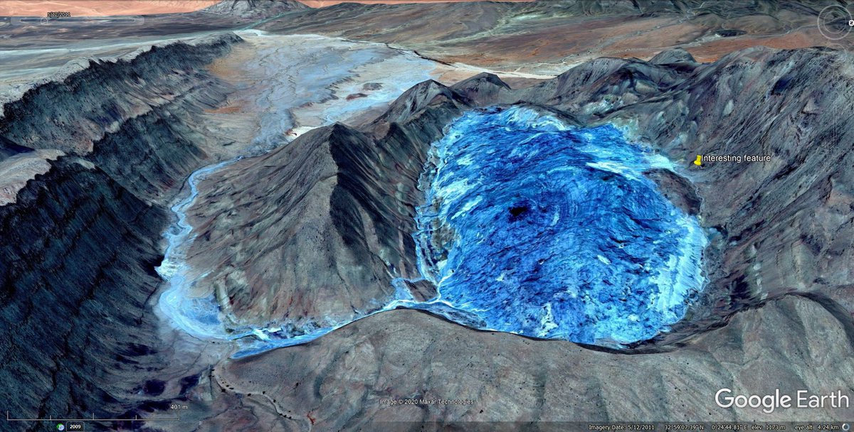
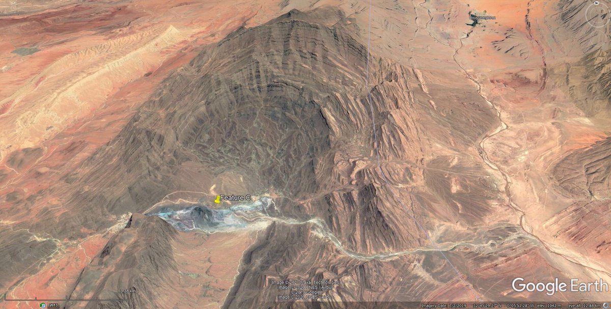
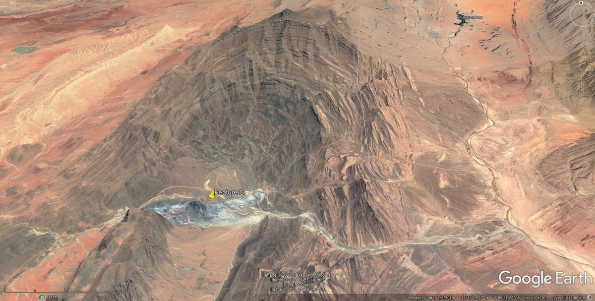
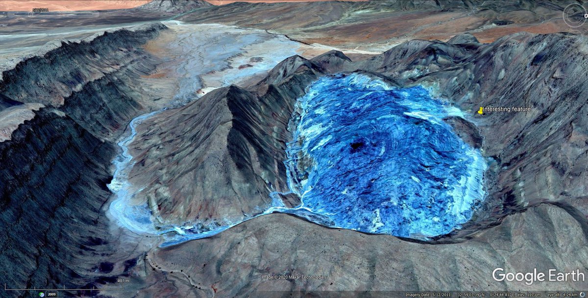
Came across this spectacular and interesting feature on @googleearth while admiring the lovely structures of the western Saharan Atlas Mountains of Algeria.
But what is it.... (thread)
But what is it.... (thread)
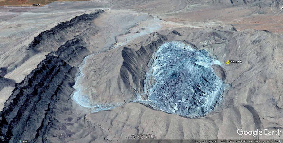
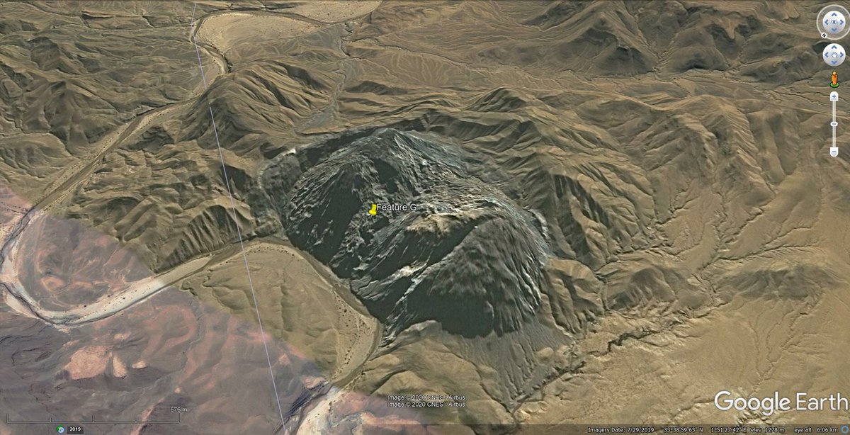
That first image is false colour (unusual on google earth), here’s a different image of the feature.
It’s located here:
https://goo.gl/maps/1CzXeauo2he5e25z7
It’s located here:
https://goo.gl/maps/1CzXeauo2he5e25z7
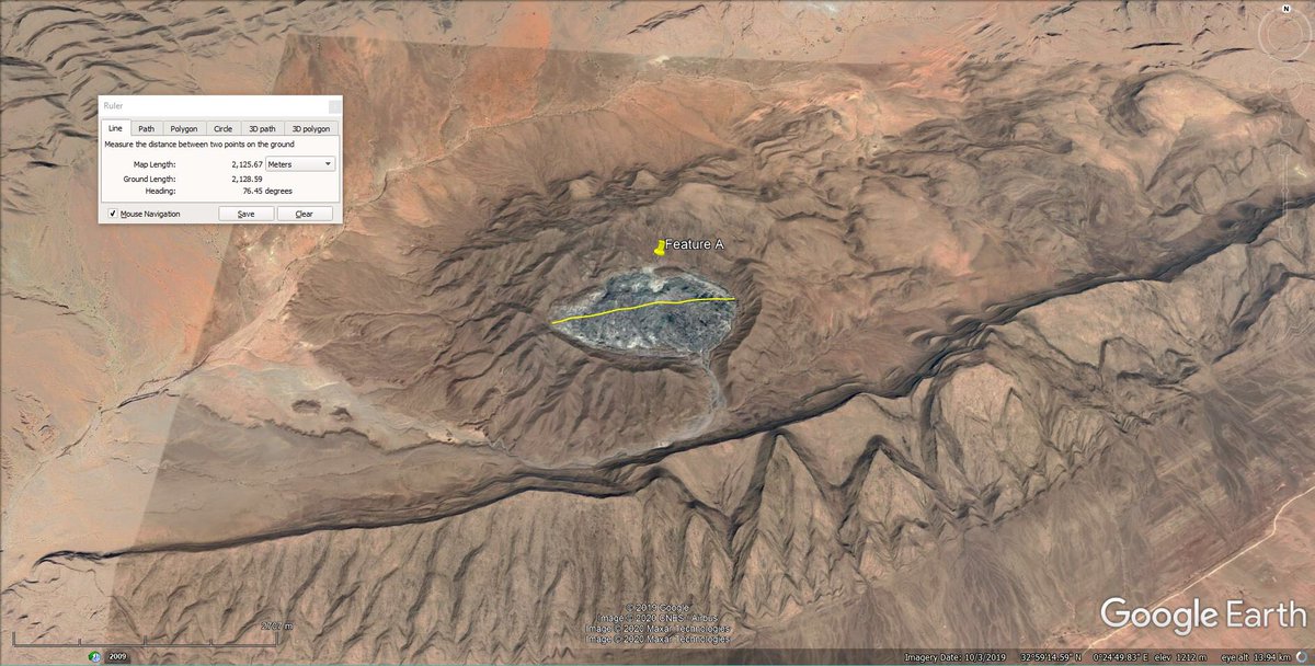
This gives an idea of scale. The feature is clearly in the core of an antiform.
But what is it?
From location, size, colour and texture, it might be a igneous feature, salt diapir, shale core or something else.
I’m not familiar with the regional geology...
But what is it?
From location, size, colour and texture, it might be a igneous feature, salt diapir, shale core or something else.
I’m not familiar with the regional geology...
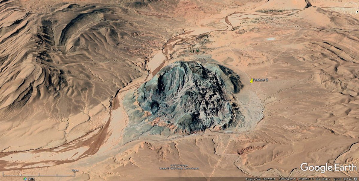
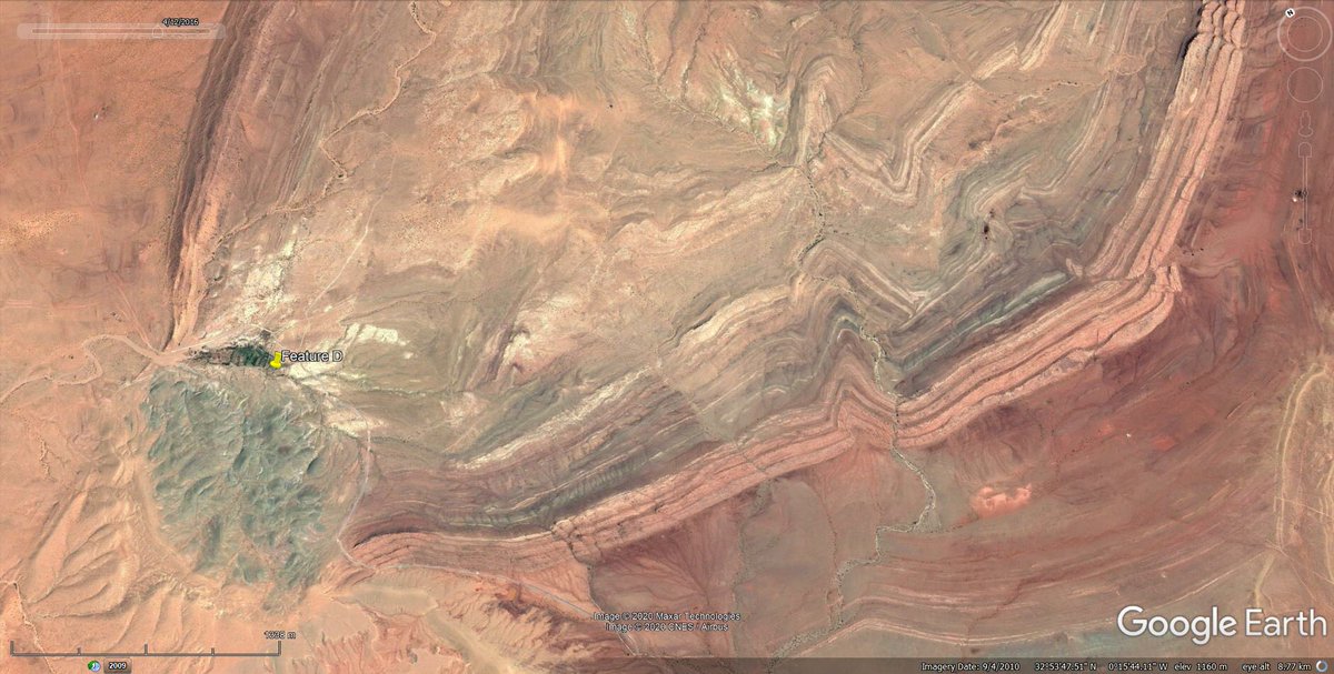
First, it’s not the only one. There’s a few other similar features in the area.
This one is a few km to the NE.
This one is a few km to the NE.
Here’s another, to the SW. They all have positive relief, similar smooth texture, and a distinctive greyish/blueish/greenish colour.
And they sit in some pretty stunning geology.
And they sit in some pretty stunning geology.
My leading guess is a salt diapir, but I’m not sure if there’s evaporites one that part of the Atlas.
So, I dug up some papers. Amri et al 2017 looks at satellite images for geology about 300km to the NE. https://link.springer.com/article/10.1007/s12517-017-2883-6
So, I dug up some papers. Amri et al 2017 looks at satellite images for geology about 300km to the NE. https://link.springer.com/article/10.1007/s12517-017-2883-6
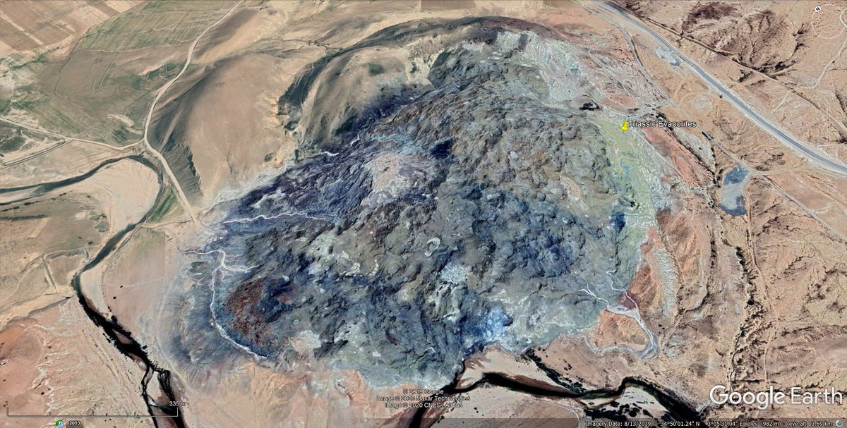
Amri et al 2017 states that there are Triassic evaporite diapirs in the central Saharan Atlas Mountains. It even describes this feature as one, which looks very similar in appearance, texture and colour to ‘my’ features.
So, it’s looking like salt diapirs! Yay!
So, it’s looking like salt diapirs! Yay!
Oooh! This study by Meddah et al 2017 focuses on the area of ‘my’ features. It also says there are evaporite diapirs through the area.
It even has mapped at Ain Ouarka, which seems to be my ‘Feature C’.
https://hal.archives-ouvertes.fr/hal-01548653/document
It even has mapped at Ain Ouarka, which seems to be my ‘Feature C’.
https://hal.archives-ouvertes.fr/hal-01548653/document
But wait, there’s more!
The Meddah et al study is on Central Altlantic Magmatic Province (CAMP) volcanism.
Turns out, this feature is a salt diapir interbedded with volcanic basalt flows - The easternmost end of CAMP volcanism.
The Meddah et al study is on Central Altlantic Magmatic Province (CAMP) volcanism.
Turns out, this feature is a salt diapir interbedded with volcanic basalt flows - The easternmost end of CAMP volcanism.
So, to wrap up, this speccy feature in Algeria is likely to be a fascinating combination of BOTH salt diapir and volcanic lava flows. Which, I have to say is pretty darn awesome!
Gotta love Google Earth!
/end
Gotta love Google Earth!
/end
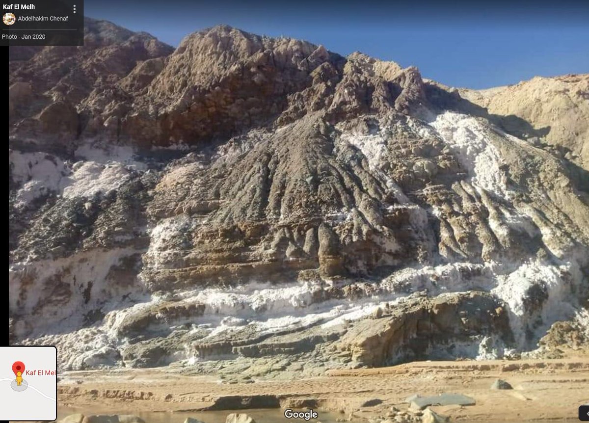
So, after posting the thread, I came across this similar feature about 153km to the NE.
https://goo.gl/maps/Co8j5iw295LrgpYT7
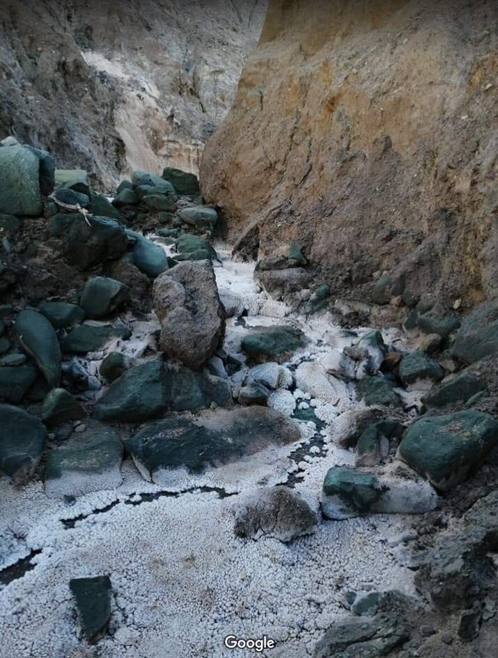
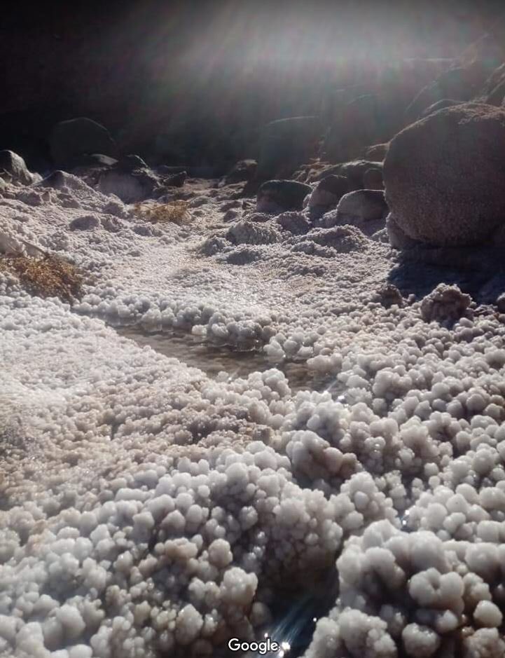
It’s called Kaf El Melh - and it has outcrop photos!
These make it pretty obvious the feature is a salt diapir, and there looks to be basalt blocks in there too!
https://goo.gl/maps/Co8j5iw295LrgpYT7
It’s called Kaf El Melh - and it has outcrop photos!
These make it pretty obvious the feature is a salt diapir, and there looks to be basalt blocks in there too!
Note that if anyone wants the google map links to all the features (A to G) they are in the thread or here:
https://twitter.com/criticalstress_/status/1224866780134330369?s=21 https://twitter.com/CriticalStress_/status/1224866780134330369
https://twitter.com/criticalstress_/status/1224866780134330369?s=21 https://twitter.com/CriticalStress_/status/1224866780134330369

 Read on Twitter